


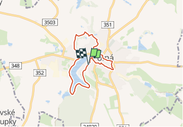

6.8 km | 8.4 km-effort
![Trail On foot Polná - [Z] Polná místní, okruh - Photo](https://media.geolcdn.com/t/1900/400/a7a51ed6-d0d0-4931-bc45-033d0de4dc94.jpeg&format=pjpeg&maxdim=2)

Tous les sentiers balisés d’Europe GUIDE+


FREE GPS app for hiking
 SityTrail
IGN / Geographical institutes
SityTrail World
The world is yours!
Trail On foot of 6 km to be discovered at Southeast, Kraj Vysočina, Polná. This trail is proposed by SityTrail - itinéraires balisés pédestres.
Trail created by cz:KČT.
![Trail On foot Polná - [Z] Polná místní, okruh - Photo 1](https://media.geolcdn.com/t/2048/auto/860c4bf9-a7bf-42ae-9618-4ae0ba1c466f.jpeg&format=jpg&maxdim=0 "Trail On foot Polná - [Z] Polná místní, okruh - Photo 1")
![Trail On foot Polná - [Z] Polná místní, okruh - Photo 2](https://media.geolcdn.com/t/2048/auto/72354331-c8f0-45cf-8e4e-efce1e37eba3.jpeg&format=jpg&maxdim=0 "Trail On foot Polná - [Z] Polná místní, okruh - Photo 2")
![Trail On foot Polná - [Z] Polná místní, okruh - Photo 3](https://media.geolcdn.com/t/2048/auto/df12848e-24ff-4e1d-bba9-8f4f362a42d9.jpeg&format=jpg&maxdim=0 "Trail On foot Polná - [Z] Polná místní, okruh - Photo 3")
![Trail On foot Polná - [Z] Polná místní, okruh - Photo 4](https://media.geolcdn.com/t/2048/auto/79d20afa-5040-4b04-8cb9-0d599df5b463.jpeg&format=jpg&maxdim=0 "Trail On foot Polná - [Z] Polná místní, okruh - Photo 4")
![Trail On foot Polná - [Z] Polná místní, okruh - Photo 5](https://media.geolcdn.com/t/2048/auto/17db4a05-64a4-4d90-8008-07dd48283a74.jpeg&format=jpg&maxdim=0 "Trail On foot Polná - [Z] Polná místní, okruh - Photo 5")
![Trail On foot Polná - [Z] Polná místní, okruh - Photo 6](https://media.geolcdn.com/t/2048/auto/b40530a5-7de8-48d0-9562-6df8104d34fb.jpeg&format=jpg&maxdim=0 "Trail On foot Polná - [Z] Polná místní, okruh - Photo 6")
![Trail On foot Polná - [Z] Polná místní, okruh - Photo 7](https://media.geolcdn.com/t/2048/auto/6b65193f-52e1-40f3-bd03-d38c46e6da08.jpeg&format=jpg&maxdim=0 "Trail On foot Polná - [Z] Polná místní, okruh - Photo 7")
![Trail On foot Polná - [Z] Polná místní, okruh - Photo 8](https://media.geolcdn.com/t/2048/auto/8fe39e32-5fa6-4a75-8bed-b535bd01e8ae.jpeg&format=jpg&maxdim=0 "Trail On foot Polná - [Z] Polná místní, okruh - Photo 8")
![Trail On foot Polná - [Z] Polná místní, okruh - Photo 9](https://media.geolcdn.com/t/2048/auto/2fec36bb-2da8-4238-87b2-ce1d1e8374d5.jpeg&format=jpg&maxdim=0 "Trail On foot Polná - [Z] Polná místní, okruh - Photo 9")
![Trail On foot Polná - [Z] Polná místní, okruh - Photo 10](https://media.geolcdn.com/t/2048/auto/a7a51ed6-d0d0-4931-bc45-033d0de4dc94.jpeg&format=jpg&maxdim=0 "Trail On foot Polná - [Z] Polná místní, okruh - Photo 10")
![Trail On foot Polná - [Ž] Polná - Kukle, okruh - Photo](https://media.geolcdn.com/t/375/260/51187ab0-28db-4a00-97ca-cb3c00db34d7.jpeg&format=jpg&maxdim=2)
On foot
![Trail On foot Polná - [Z] Přibyslav - Polná - Photo](https://media.geolcdn.com/t/375/260/075c8237-6652-4826-9aef-5f493afa6e41.jpeg&format=jpg&maxdim=2)
On foot