


4.5 km | 7 km-effort

Tous les sentiers balisés d’Europe GUIDE+


FREE GPS app for hiking
 SityTrail
IGN / Geographical institutes
SityTrail World
The world is yours!
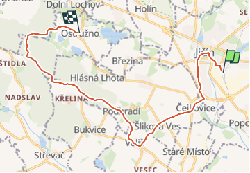
Trail On foot of 14.4 km to be discovered at Northeast, Královéhradecký kraj, Jičín. This trail is proposed by SityTrail - itinéraires balisés pédestres.
Trail created by cz:KČT.


![Trail On foot Železnice - [M] Klepanda - Železnice - Photo](https://media.geolcdn.com/t/375/260/832322d6-77e9-49e6-bca3-0a99f605ca60.jpeg&format=jpg&maxdim=2)
On foot
On foot
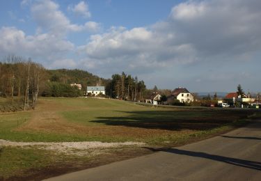
![Trail On foot Brada-Rybníček - [Z] Bradačka - Železnice - Photo](https://media.geolcdn.com/t/375/260/37505409-b0d1-440d-bf83-6e0ecd2445fd.jpeg&format=jpg&maxdim=2)
On foot