


14.5 km | 20 km-effort
![Trail On foot Děčín - [Ž] Děčín - Čertova voda - Photo](https://media.geolcdn.com/t/1900/400/0e874321-450b-4598-af3f-f7bf88704d7f.jpeg&format=pjpeg&maxdim=2)

Tous les sentiers balisés d’Europe GUIDE+


FREE GPS app for hiking
 SityTrail
IGN / Geographical institutes
SityTrail World
The world is yours!
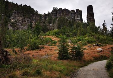
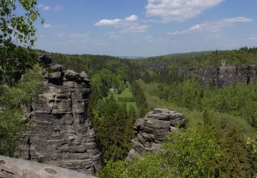
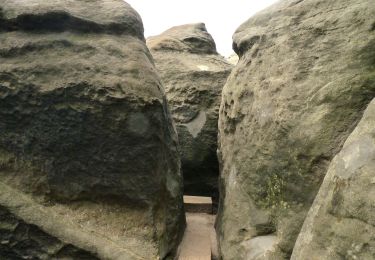
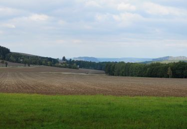
Trail On foot of 15.8 km to be discovered at Northwest, Ústecký kraj, Děčín. This trail is proposed by SityTrail - itinéraires balisés pédestres.
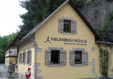
Trail created by cz:KČT.
![Trail On foot Děčín - [Ž] Děčín - Čertova voda - Photo 1](https://media.geolcdn.com/t/2048/auto/5c25547e-22ee-44e3-8014-21f2e4ab3374.jpeg&format=jpg&maxdim=0 "Trail On foot Děčín - [Ž] Děčín - Čertova voda - Photo 1")
![Trail On foot Děčín - [Ž] Děčín - Čertova voda - Photo 2](https://media.geolcdn.com/t/2048/auto/1c3a94ca-3558-4940-907f-9e08ba31a1c0.jpeg&format=jpg&maxdim=0 "Trail On foot Děčín - [Ž] Děčín - Čertova voda - Photo 2")
![Trail On foot Děčín - [Ž] Děčín - Čertova voda - Photo 3](https://media.geolcdn.com/t/2048/auto/72a1b1ab-c6c7-44a5-b980-dfb7f5622974.jpeg&format=jpg&maxdim=0 "Trail On foot Děčín - [Ž] Děčín - Čertova voda - Photo 3")
![Trail On foot Děčín - [Ž] Děčín - Čertova voda - Photo 4](https://media.geolcdn.com/t/2048/auto/12270deb-2e11-4c3c-ae19-a515f15fe285.jpeg&format=jpg&maxdim=0 "Trail On foot Děčín - [Ž] Děčín - Čertova voda - Photo 4")
![Trail On foot Děčín - [Ž] Děčín - Čertova voda - Photo 5](https://media.geolcdn.com/t/2048/auto/6d98da09-c056-4816-a055-522451f8e6cb.jpeg&format=jpg&maxdim=0 "Trail On foot Děčín - [Ž] Děčín - Čertova voda - Photo 5")
![Trail On foot Děčín - [Ž] Děčín - Čertova voda - Photo 6](https://media.geolcdn.com/t/2048/auto/6f080095-8b9f-4055-82cf-2cc6f154a4b7.jpeg&format=jpg&maxdim=0 "Trail On foot Děčín - [Ž] Děčín - Čertova voda - Photo 6")
![Trail On foot Děčín - [Ž] Děčín - Čertova voda - Photo 7](https://media.geolcdn.com/t/2048/auto/c6ccc709-bbeb-4bf7-a8cd-5ff6e9089e64.jpeg&format=jpg&maxdim=0 "Trail On foot Děčín - [Ž] Děčín - Čertova voda - Photo 7")
![Trail On foot Děčín - [Ž] Děčín - Čertova voda - Photo 8](https://media.geolcdn.com/t/2048/auto/411d6cfc-050d-48a5-8a76-9e8128c2e7f8.jpeg&format=jpg&maxdim=0 "Trail On foot Děčín - [Ž] Děčín - Čertova voda - Photo 8")
![Trail On foot Děčín - [Ž] Děčín - Čertova voda - Photo 9](https://media.geolcdn.com/t/2048/auto/ba490946-90b8-4068-aeae-9002cbe6125d.jpeg&format=jpg&maxdim=0 "Trail On foot Děčín - [Ž] Děčín - Čertova voda - Photo 9")
![Trail On foot Děčín - [Ž] Děčín - Čertova voda - Photo 10](https://media.geolcdn.com/t/2048/auto/0e874321-450b-4598-af3f-f7bf88704d7f.jpeg&format=jpg&maxdim=0 "Trail On foot Děčín - [Ž] Děčín - Čertova voda - Photo 10")
On foot
On foot
On foot
On foot
On foot
On foot
On foot
On foot
On foot