


3.5 km | 4.6 km-effort
![Trail On foot Čerčany - [Z] Čerčany - Poříčí n. S. - Photo](https://media.geolcdn.com/t/1900/400/ede0169c-97fd-4e44-b5a1-bce727974295.jpeg&format=pjpeg&maxdim=2)

Tous les sentiers balisés d’Europe GUIDE+


FREE GPS app for hiking
 SityTrail
IGN / Geographical institutes
SityTrail World
The world is yours!
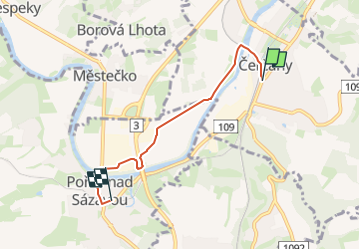
Trail On foot of 3.9 km to be discovered at Central Bohemia, Unknown, Čerčany. This trail is proposed by SityTrail - itinéraires balisés pédestres.
Trail created by cz:KČT.
![Trail On foot Čerčany - [Z] Čerčany - Poříčí n. S. - Photo 1](https://media.geolcdn.com/t/2048/auto/1b6b8f9b-6b08-4ab5-9a59-f0f3a84239a9.jpeg&format=jpg&maxdim=0 "Trail On foot Čerčany - [Z] Čerčany - Poříčí n. S. - Photo 1")
![Trail On foot Čerčany - [Z] Čerčany - Poříčí n. S. - Photo 2](https://media.geolcdn.com/t/2048/auto/3cd427ec-857b-486b-b316-0aba3ec23e40.jpeg&format=jpg&maxdim=0 "Trail On foot Čerčany - [Z] Čerčany - Poříčí n. S. - Photo 2")
![Trail On foot Čerčany - [Z] Čerčany - Poříčí n. S. - Photo 3](https://media.geolcdn.com/t/2048/auto/3c7f50cf-a7b3-4c3b-94cd-6fc2fbe381bf.jpeg&format=jpg&maxdim=0 "Trail On foot Čerčany - [Z] Čerčany - Poříčí n. S. - Photo 3")
![Trail On foot Čerčany - [Z] Čerčany - Poříčí n. S. - Photo 4](https://media.geolcdn.com/t/2048/auto/5f57d1fb-3fcf-4df6-8377-3910c0997297.jpeg&format=jpg&maxdim=0 "Trail On foot Čerčany - [Z] Čerčany - Poříčí n. S. - Photo 4")
![Trail On foot Čerčany - [Z] Čerčany - Poříčí n. S. - Photo 5](https://media.geolcdn.com/t/2048/auto/8ca83b94-6275-490e-b58c-12a86562de0d.jpeg&format=jpg&maxdim=0 "Trail On foot Čerčany - [Z] Čerčany - Poříčí n. S. - Photo 5")
![Trail On foot Čerčany - [Z] Čerčany - Poříčí n. S. - Photo 6](https://media.geolcdn.com/t/2048/auto/dd07dd36-65bc-4623-b027-d2d292bac742.jpeg&format=jpg&maxdim=0 "Trail On foot Čerčany - [Z] Čerčany - Poříčí n. S. - Photo 6")
![Trail On foot Čerčany - [Z] Čerčany - Poříčí n. S. - Photo 7](https://media.geolcdn.com/t/2048/auto/1f722e5b-0e03-45fc-8de0-26a1459e2dc5.jpeg&format=jpg&maxdim=0 "Trail On foot Čerčany - [Z] Čerčany - Poříčí n. S. - Photo 7")
![Trail On foot Čerčany - [Z] Čerčany - Poříčí n. S. - Photo 8](https://media.geolcdn.com/t/2048/auto/44f95003-8341-450c-8e35-fcd99257943a.jpeg&format=jpg&maxdim=0 "Trail On foot Čerčany - [Z] Čerčany - Poříčí n. S. - Photo 8")
![Trail On foot Čerčany - [Z] Čerčany - Poříčí n. S. - Photo 9](https://media.geolcdn.com/t/2048/auto/04865be7-d4d2-4cbd-9436-ce459eb246cc.jpeg&format=jpg&maxdim=0 "Trail On foot Čerčany - [Z] Čerčany - Poříčí n. S. - Photo 9")
![Trail On foot Čerčany - [Z] Čerčany - Poříčí n. S. - Photo 10](https://media.geolcdn.com/t/2048/auto/ede0169c-97fd-4e44-b5a1-bce727974295.jpeg&format=jpg&maxdim=0 "Trail On foot Čerčany - [Z] Čerčany - Poříčí n. S. - Photo 10")
![Trail On foot Pyšely - [M] Pyšely žst - Pyšely Loreta - Photo](https://media.geolcdn.com/t/375/260/67976ba2-0958-47e5-97b5-e8131ae8a420.jpeg&format=jpg&maxdim=2)
On foot
![Trail On foot Poříčí nad Sázavou - [M] Týnec n. S. - Poříčí n. S. - Photo](https://media.geolcdn.com/t/375/260/a945f703-f7b0-46ec-baf8-bf941e8d859d.jpeg&format=jpg&maxdim=2)
On foot
![Trail On foot Poříčí nad Sázavou - [Č] Poříčí n. S. - Benešov - Photo](https://media.geolcdn.com/t/375/260/fd2d8f48-a91f-479c-bf66-87184c69822c.jpeg&format=jpg&maxdim=2)
On foot