![](/images/other/stat-length.png)
![Trail On foot District of Ružomberok - Náučný chodník Čierny kameň - Photo](https://media.geolcdn.com/t/1900/400/37bb9b4f-68fe-4e1f-8ff6-e050106b6a96.jpeg&format=pjpeg&maxdim=2)
Náučný chodník Čierny kameň
SityTrail - itinéraires balisés pédestres
Tous les sentiers balisés d’Europe GUIDE+
![Length](/images/other/stat-length.png)
Length
5.4 km
![Max alt](https://static1.geolcdn.com/siteimages/upload/files/1508320355ic_sort_altitude_max_24dp.png)
Max alt
1395 m
![Uphill gradient](https://static1.geolcdn.com/siteimages/upload/files/1508320355ic_sort_den_pos_24dp.png)
Uphill gradient
684 m
![Km-Effort](/images/other/stat-length.png)
Km-Effort
12.3 km
![Min alt](https://static1.geolcdn.com/siteimages/upload/files/1508320355ic_sort_altitude_min_24dp.png)
Min alt
718 m
![Downhill gradient](https://static1.geolcdn.com/siteimages/upload/files/1508320355ic_sort_den_neg_24dp.png)
Downhill gradient
10 m
![Boucle](https://static1.geolcdn.com/siteimages/upload/files/16400158638029165_repeat_loop_refresh_sync_direction_icon.png)
Boucle
No
Signpost
Creation date :
2025-02-06 15:18:42.679
Updated on :
2025-02-06 15:18:42.679
![On foot](https://static1.geolcdn.com/sitytour/trail-icons/100.png)
2h47
Difficulty : Easy
![Scan this QR Code to open this trail in the SityTrail application](https://capi.geolives.com/qq0zvz2zws4bq2lad0pu/sitytour/trails/4343378/qr.png?size=200)
FREE GPS app for hiking
About
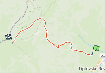
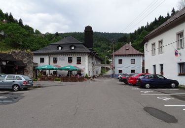
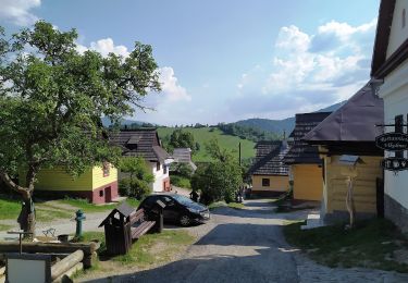
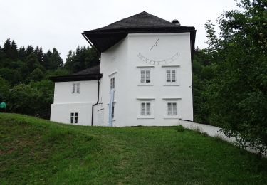
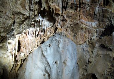
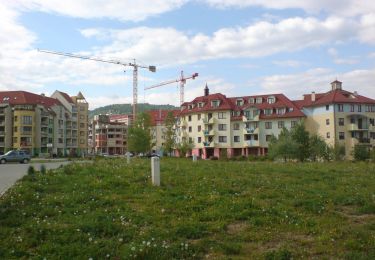
Trail On foot of 5.4 km to be discovered at Region of Žilina, Unknown, District of Ružomberok. This trail is proposed by SityTrail - itinéraires balisés pédestres.
Description
Trail created by Združenie na podporu a rozvoj cestovného ruchu v obci Liptovské Revúce.
Symbol: education
Positioning
Country:
Slovakia
Region :
Region of Žilina
Department/Province :
Unknown
Municipality :
District of Ružomberok
Location:
Liptovské Revúce
Start:(Dec)
Start:(UTM)
366505 ; 5420828 (34U) N.
Comments
Trails nearby
![Trail Walking District of Banská Bystrica - Slovaquie Jour 4 - Photo](https://media.geolcdn.com/t/375/260/ext.jpg?maxdim=2&url=https%3A%2F%2Fstatic1.geolcdn.com%2Fsiteimages%2Fupload%2Ffiles%2F1553511878bg_sport_marche.png)
![Walking Walking](https://static1.geolcdn.com/sitytour/trail-icons/101.png)
Slovaquie Jour 4
Walking
Very difficult
District of Banská Bystrica,
Region of Banská Bystrica,
Unknown,
Slovakia
![](/images/other/stat-length.png)
20 km | 31 km-effort
8h 38min
![](https://static1.geolcdn.com/siteimages/upload/files/16400158638029165_repeat_loop_refresh_sync_direction_icon.png)
No
![Trail Walking District of Martin - Slovaquie jour 3 - Photo](https://media.geolcdn.com/t/375/260/ext.jpg?maxdim=2&url=https%3A%2F%2Fstatic1.geolcdn.com%2Fsiteimages%2Fupload%2Ffiles%2F1553511878bg_sport_marche.png)
![Walking Walking](https://static1.geolcdn.com/sitytour/trail-icons/101.png)
Slovaquie jour 3
Walking
Very difficult
District of Martin,
Region of Žilina,
Unknown,
Slovakia
![](/images/other/stat-length.png)
13.6 km | 23 km-effort
7h 24min
![](https://static1.geolcdn.com/siteimages/upload/files/16400158638029165_repeat_loop_refresh_sync_direction_icon.png)
No
![Trail Walking District of Ružomberok - Slovaquie Jour 2 - Photo](https://media.geolcdn.com/t/375/260/ext.jpg?maxdim=2&url=https%3A%2F%2Fstatic1.geolcdn.com%2Fsiteimages%2Fupload%2Ffiles%2F1553511878bg_sport_marche.png)
![Walking Walking](https://static1.geolcdn.com/sitytour/trail-icons/101.png)
Slovaquie Jour 2
Walking
Difficult
District of Ružomberok,
Region of Žilina,
Unknown,
Slovakia
![](/images/other/stat-length.png)
14.2 km | 25 km-effort
9h 39min
![](https://static1.geolcdn.com/siteimages/upload/files/16400158638029165_repeat_loop_refresh_sync_direction_icon.png)
No
![Trail On foot District of Banská Bystrica - Banskobystrickeho Permona - Photo](https://media.geolcdn.com/t/375/260/6fd1cec4-1cc2-4f84-993c-f010de7a4fc9.jpeg&format=jpg&maxdim=2)
![On foot On foot](https://static1.geolcdn.com/sitytour/trail-icons/100.png)
Banskobystrickeho Permona
On foot
Easy
District of Banská Bystrica,
Region of Banská Bystrica,
Unknown,
Slovakia
![](/images/other/stat-length.png)
11.1 km | 17.3 km-effort
3h 55min
![](https://static1.geolcdn.com/siteimages/upload/files/16400158638029165_repeat_loop_refresh_sync_direction_icon.png)
No
![Trail On foot District of Ružomberok - Medvedia cesta - Photo](https://media.geolcdn.com/t/375/260/08526067-6b0c-4dcb-ad67-6c959ad07983.jpeg&format=jpg&maxdim=2)
![On foot On foot](https://static1.geolcdn.com/sitytour/trail-icons/100.png)
Medvedia cesta
On foot
Easy
District of Ružomberok,
Region of Žilina,
Unknown,
Slovakia
![](/images/other/stat-length.png)
3.8 km | 4.9 km-effort
1h 6min
![](https://static1.geolcdn.com/siteimages/upload/files/16400158638029165_repeat_loop_refresh_sync_direction_icon.png)
No
![Trail On foot District of Banská Bystrica - Malý banský okruh - Photo](https://media.geolcdn.com/t/375/260/b6068df5-d91c-4c21-9250-0613289efe32.jpeg&format=jpg&maxdim=2)
![On foot On foot](https://static1.geolcdn.com/sitytour/trail-icons/100.png)
Malý banský okruh
On foot
Easy
District of Banská Bystrica,
Region of Banská Bystrica,
Unknown,
Slovakia
![](/images/other/stat-length.png)
3.8 km | 5.9 km-effort
1h 21min
![](https://static1.geolcdn.com/siteimages/upload/files/16400158638029165_repeat_loop_refresh_sync_direction_icon.png)
Yes
![Trail On foot District of Turčianske Teplice - SK-8436M - Photo](https://media.geolcdn.com/t/375/260/8bdfee72-d54f-42e2-bd79-cfa012a54233.jpeg&format=jpg&maxdim=2)
![On foot On foot](https://static1.geolcdn.com/sitytour/trail-icons/100.png)
SK-8436M
On foot
Easy
District of Turčianske Teplice,
Region of Žilina,
Unknown,
Slovakia
![](/images/other/stat-length.png)
6.4 km | 8 km-effort
1h 49min
![](https://static1.geolcdn.com/siteimages/upload/files/16400158638029165_repeat_loop_refresh_sync_direction_icon.png)
No
![Trail On foot District of Banská Bystrica - SK-0895M - Photo](https://media.geolcdn.com/t/375/260/71233ea3-126f-4275-8675-09bb89dcfd81.jpeg&format=jpg&maxdim=2)
![On foot On foot](https://static1.geolcdn.com/sitytour/trail-icons/100.png)
SK-0895M
On foot
Easy
District of Banská Bystrica,
Region of Banská Bystrica,
Unknown,
Slovakia
![](/images/other/stat-length.png)
9.2 km | 12.5 km-effort
2h 51min
![](https://static1.geolcdn.com/siteimages/upload/files/16400158638029165_repeat_loop_refresh_sync_direction_icon.png)
No
![Trail On foot District of Banská Bystrica - SK-2796M - Photo](https://media.geolcdn.com/t/375/260/b9ed9259-3fc8-4a81-a649-88e0c0a9035d.jpeg&format=jpg&maxdim=2)
![On foot On foot](https://static1.geolcdn.com/sitytour/trail-icons/100.png)
SK-2796M
On foot
Easy
District of Banská Bystrica,
Region of Banská Bystrica,
Unknown,
Slovakia
![](/images/other/stat-length.png)
11.1 km | 17.3 km-effort
3h 56min
![](https://static1.geolcdn.com/siteimages/upload/files/16400158638029165_repeat_loop_refresh_sync_direction_icon.png)
No