![](/images/other/stat-length.png)
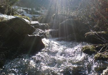
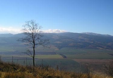
![Trail On foot District of Spišská Nová Ves - Náučný chodník Prielom Hornádu - Photo](https://media.geolcdn.com/t/1900/400/0ae550aa-5974-4602-a9f7-4c3c4eb86e93.jpeg&format=pjpeg&maxdim=2)
Náučný chodník Prielom Hornádu
SityTrail - itinéraires balisés pédestres
Tous les sentiers balisés d’Europe GUIDE+
![Length](/images/other/stat-length.png)
Length
10.3 km
![Max alt](https://static1.geolcdn.com/siteimages/upload/files/1508320355ic_sort_altitude_max_24dp.png)
Max alt
665 m
![Uphill gradient](https://static1.geolcdn.com/siteimages/upload/files/1508320355ic_sort_den_pos_24dp.png)
Uphill gradient
342 m
![Km-Effort](/images/other/stat-length.png)
Km-Effort
14.8 km
![Min alt](https://static1.geolcdn.com/siteimages/upload/files/1508320355ic_sort_altitude_min_24dp.png)
Min alt
501 m
![Downhill gradient](https://static1.geolcdn.com/siteimages/upload/files/1508320355ic_sort_den_neg_24dp.png)
Downhill gradient
332 m
![Boucle](https://static1.geolcdn.com/siteimages/upload/files/16400158638029165_repeat_loop_refresh_sync_direction_icon.png)
Boucle
Yes
Signpost
Creation date :
2025-02-06 14:11:01.654
Updated on :
2025-02-06 14:11:01.654
![On foot](https://static1.geolcdn.com/sitytour/trail-icons/100.png)
3h22
Difficulty : Easy
![Scan this QR Code to open this trail in the SityTrail application](https://capi.geolives.com/qq0zvz2zws4bq2lad0pu/sitytour/trails/4343094/qr.png?size=200)
FREE GPS app for hiking
About
Trail On foot of 10.3 km to be discovered at Region of Košice, Unknown, District of Spišská Nová Ves. This trail is proposed by SityTrail - itinéraires balisés pédestres.
Description
Symbol: education
Positioning
Country:
Slovakia
Region :
Region of Košice
Department/Province :
Unknown
Municipality :
District of Spišská Nová Ves
Location:
Spišské Tomášovce
Start:(Dec)
Start:(UTM)
461719 ; 5421624 (34U) N.
Comments
Trails nearby
![Trail On foot District of Poprad - Baba - Photo](https://media.geolcdn.com/t/375/260/d19dcb59-9448-4bc0-8359-c9bb20e1f018.jpeg&format=jpg&maxdim=2)
![On foot On foot](https://static1.geolcdn.com/sitytour/trail-icons/100.png)
Baba
On foot
Easy
District of Poprad,
Region of Prešov,
Unknown,
Slovakia
![](/images/other/stat-length.png)
4.7 km | 8.1 km-effort
1h 50min
![](https://static1.geolcdn.com/siteimages/upload/files/16400158638029165_repeat_loop_refresh_sync_direction_icon.png)
No
![Trail On foot District of Spišská Nová Ves - Banícky náučný chodník - Photo](https://media.geolcdn.com/t/375/260/03f12c3d-aa78-45aa-aeab-5b310866a84e.jpeg&format=jpg&maxdim=2)
![On foot On foot](https://static1.geolcdn.com/sitytour/trail-icons/100.png)
Banícky náučný chodník
On foot
Easy
District of Spišská Nová Ves,
Region of Košice,
Unknown,
Slovakia
![](/images/other/stat-length.png)
3.3 km | 5.3 km-effort
1h 11min
![](https://static1.geolcdn.com/siteimages/upload/files/16400158638029165_repeat_loop_refresh_sync_direction_icon.png)
No
![Trail On foot District of Spišská Nová Ves - Banícky náučný chodník - Photo](https://media.geolcdn.com/t/375/260/97f1be49-920f-4179-9988-d5e6055726f1.jpeg&format=jpg&maxdim=2)
![On foot On foot](https://static1.geolcdn.com/sitytour/trail-icons/100.png)
Banícky náučný chodník
On foot
Medium
District of Spišská Nová Ves,
Region of Košice,
Unknown,
Slovakia
![](/images/other/stat-length.png)
14.7 km | 20 km-effort
4h 34min
![](https://static1.geolcdn.com/siteimages/upload/files/16400158638029165_repeat_loop_refresh_sync_direction_icon.png)
No
![Trail On foot District of Levoča - Sivá Brada - Dreveník - Photo](https://media.geolcdn.com/t/375/260/fce95c01-1cc6-460d-92aa-678a9394ee36.jpeg&format=jpg&maxdim=2)
![On foot On foot](https://static1.geolcdn.com/sitytour/trail-icons/100.png)
Sivá Brada - Dreveník
On foot
Easy
District of Levoča,
Region of Prešov,
Unknown,
Slovakia
![](/images/other/stat-length.png)
10 km | 14.6 km-effort
3h 19min
![](https://static1.geolcdn.com/siteimages/upload/files/16400158638029165_repeat_loop_refresh_sync_direction_icon.png)
No
![Trail On foot District of Rožňava - Náučný chodník Slovenský raj - juh - Photo](https://media.geolcdn.com/t/375/260/0ac25558-3292-40ce-8686-d6a7bce3d734.jpeg&format=jpg&maxdim=2)
![On foot On foot](https://static1.geolcdn.com/sitytour/trail-icons/100.png)
Náučný chodník Slovenský raj - juh
On foot
Easy
District of Rožňava,
Region of Košice,
Unknown,
Slovakia
![](/images/other/stat-length.png)
10.2 km | 16.5 km-effort
3h 44min
![](https://static1.geolcdn.com/siteimages/upload/files/16400158638029165_repeat_loop_refresh_sync_direction_icon.png)
No
![Trail On foot District of Poprad - Kvetnica - Zámčisko - Kvetnica - Photo](https://media.geolcdn.com/t/375/260/c94c38a5-0564-4489-8ead-f97c8759f4d2.jpeg&format=jpg&maxdim=2)
![On foot On foot](https://static1.geolcdn.com/sitytour/trail-icons/100.png)
Kvetnica - Zámčisko - Kvetnica
On foot
Medium
District of Poprad,
Region of Prešov,
Unknown,
Slovakia
![](/images/other/stat-length.png)
13.2 km | 22 km-effort
4h 55min
![](https://static1.geolcdn.com/siteimages/upload/files/16400158638029165_repeat_loop_refresh_sync_direction_icon.png)
Yes
![Trail On foot District of Poprad - Okruh zdravia - Photo](https://media.geolcdn.com/t/375/260/37c021fc-ca3b-479c-9971-ac7ca503ea20.jpeg&format=jpg&maxdim=2)
![On foot On foot](https://static1.geolcdn.com/sitytour/trail-icons/100.png)
Okruh zdravia
On foot
Easy
District of Poprad,
Region of Prešov,
Unknown,
Slovakia
![](/images/other/stat-length.png)
4 km | 6.7 km-effort
1h 31min
![](https://static1.geolcdn.com/siteimages/upload/files/16400158638029165_repeat_loop_refresh_sync_direction_icon.png)
Yes
![Trail On foot District of Spišská Nová Ves - Náučný chodník históriou baníctva v Hnilčíku - Photo](https://media.geolcdn.com/t/375/260/ext.jpg?maxdim=2&url=https%3A%2F%2Fstatic1.geolcdn.com%2Fsiteimages%2Fupload%2Ffiles%2F1545311037marcheuse_200dpi.jpg)
![On foot On foot](https://static1.geolcdn.com/sitytour/trail-icons/100.png)
Náučný chodník históriou baníctva v Hnilčíku
On foot
Easy
District of Spišská Nová Ves,
Region of Košice,
Unknown,
Slovakia
![](/images/other/stat-length.png)
4.3 km | 6.3 km-effort
1h 25min
![](https://static1.geolcdn.com/siteimages/upload/files/16400158638029165_repeat_loop_refresh_sync_direction_icon.png)
Yes
![Trail On foot District of Spišská Nová Ves - SK-0902M - Photo](https://media.geolcdn.com/t/375/260/ext.jpg?maxdim=2&url=https%3A%2F%2Fstatic1.geolcdn.com%2Fsiteimages%2Fupload%2Ffiles%2F1545311037marcheuse_200dpi.jpg)
![On foot On foot](https://static1.geolcdn.com/sitytour/trail-icons/100.png)
SK-0902M
On foot
Easy
District of Spišská Nová Ves,
Region of Košice,
Unknown,
Slovakia
![](/images/other/stat-length.png)
4.6 km | 7.5 km-effort
1h 42min
![](https://static1.geolcdn.com/siteimages/upload/files/16400158638029165_repeat_loop_refresh_sync_direction_icon.png)
No