


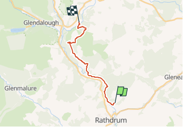

9.2 km | 14.6 km-effort


Tous les sentiers balisés d’Europe GUIDE+


FREE GPS app for hiking
 SityTrail
IGN / Geographical institutes
SityTrail World
The world is yours!
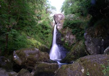
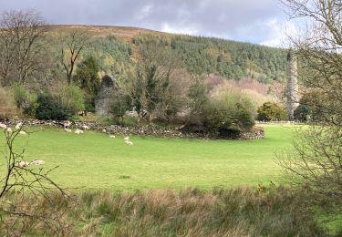
Trail On foot of 12.9 km to be discovered at Unknown, County Wicklow, The Municipal District of Arklow. This trail is proposed by SityTrail - itinéraires balisés pédestres.
Trail created by Wicklow Uplands Council.
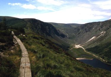
Symbol: yellow hiker on black
Website: http://www.irishtrails.ie/Trail/Avonmore-Way/905/


On foot
On foot
On foot
On foot
Walking

Walking

Other activity
Walking
Walking