Trail Walking Pontaix - Portail - Photo
© OpenStreetMap contributors
Length
Length
16.6 km
Max alt
Max alt
620 m
Uphill gradient
Uphill gradient
501 m
Km-Effort
Km-Effort  
23 km
Min alt
Min alt
329 m
Downhill gradient
Downhill gradient
492 m
Boucle
Boucle
No
Creation date :
2025-02-05 08:38:39.984
Updated on :
2025-02-05 15:06:22.038

(0 Reviews)

Walking
Walking
5h30
Difficulty : Medium

Scan this QR Code to open this trail in the SityTrail application

FREE GPS app for hiking

Logo SityTrail SityTrail

IGN / Geographical institutes

Download SityTrail from the App Store Download SityTrail from Google Play

Logo SityTrail SityTrail World

The world is yours!

Download SityTrail from the App Store Download SityTrail from Google Play Download SityTrail on Huawei AppGallery

About

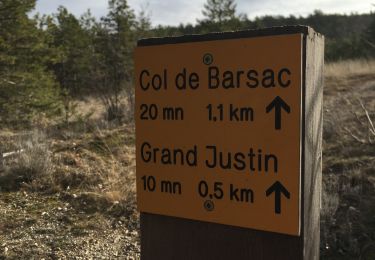
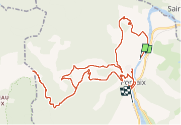
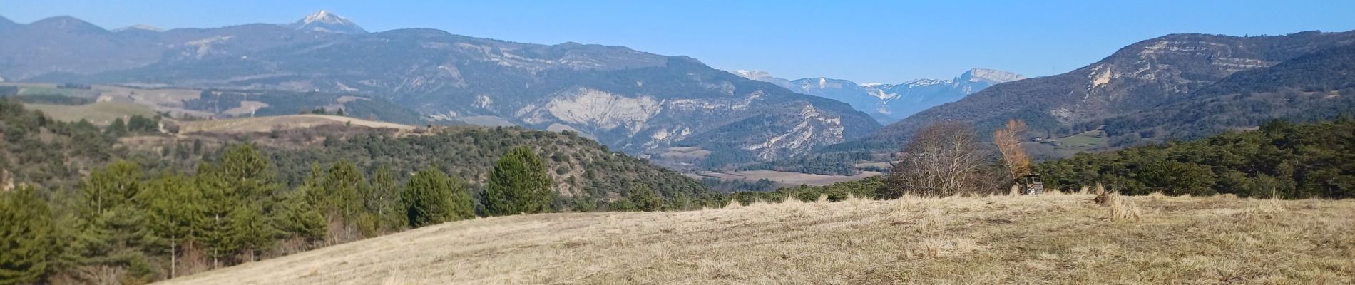
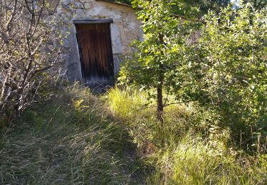
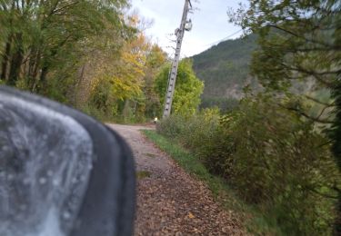
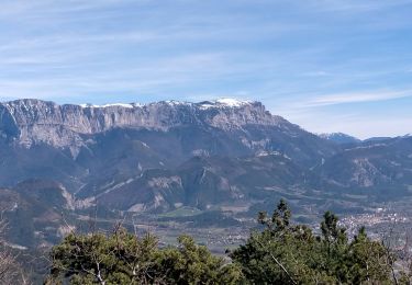
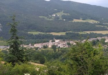
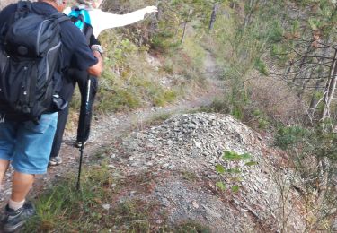
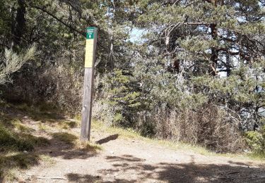
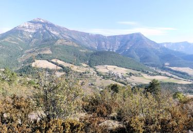
Trail Walking of 16.6 km to be discovered at Auvergne-Rhône-Alpes, Drôme, Pontaix. This trail is proposed by godemel@9online.fr.

Description

Pontaix- Veronne
16 km - 480 m déniv

Elevation profile

Photos

Positioning

Country:
France
Region :
Auvergne-Rhône-Alpes
Department/Province :
Drôme
Municipality :
Pontaix
Location:
Unknown
Start:(UTM)
679383 ; 4958368 (31T) N.

Trails nearby

Trail Nordic walking Ponet-et-Saint-Auban - 20/12/2015 Pierre plats  - Photo
Nordic walking
fiorano

Nordic walking

Easy
(1)
Ponet-et-Saint-Auban, Auvergne-Rhône-Alpes, Drôme, France
6.9 km | 11.1 km-effort
1h 46min
Yes
Trail Walking Pontaix - 26 pontaix gaudichard HS danger - Photo
Walking
GUIDE
randodyssée

Walking

Medium
Pontaix, Auvergne-Rhône-Alpes, Drôme, France
16.2 km | 28 km-effort
7h 18min
Yes
Trail Road bike Pontaix - 26 eygluy st julien en Q Marignac velo - Photo
Road bike
GUIDE
randodyssée

Road bike

Medium
Pontaix, Auvergne-Rhône-Alpes, Drôme, France
77 km | 99 km-effort
6h 20min
Yes
Trail Walking Sainte-Croix - 26 Sainte Croix Crêtes de Ramiat - Photo
Walking
Maryma

Walking

Very difficult
Sainte-Croix, Auvergne-Rhône-Alpes, Drôme, France
17.5 km | 30 km-effort
6h 42min
Yes
Trail Walking Sainte-Croix - 26 ste croix zel 22 . 06. 23 - Photo
Walking
GUIDE
randodyssée

Walking

Medium
Sainte-Croix, Auvergne-Rhône-Alpes, Drôme, France
11.6 km | 20 km-effort
6h 3min
Yes
Trail Walking Die - La belle justine - Photo
Walking
AIGUIER

Walking

Medium
Die, Auvergne-Rhône-Alpes, Drôme, France
13.7 km | 21 km-effort
3h 1min
Yes
Trail Walking Marignac-en-Diois - la montagne de Desses - Photo
Walking
GILOU440

Walking

Easy
Marignac-en-Diois, Auvergne-Rhône-Alpes, Drôme, France
6.5 km | 11.8 km-effort
3h 21min
No
Trail Walking Ponet-et-Saint-Auban - Ponet-et-St-Auban - Montagne de Desse - Marignac - Photo
Walking
Philindy26

Walking

Medium
Ponet-et-Saint-Auban, Auvergne-Rhône-Alpes, Drôme, France
11.6 km | 21 km-effort
3h 30min
Yes
Trail Walking Die - Chapiat_deb - Photo
Walking
ajd26

Walking

Easy
Die, Auvergne-Rhône-Alpes, Drôme, France
3.2 km | 4.4 km-effort
1h 0min
No


Close
My subscriptions