![](/images/other/stat-length.png)
![Trail On foot Amber Valley - Broxtowe Country Trail - Photo](https://media.geolcdn.com/t/1900/400/23e0ad2a-6ecf-4e98-b667-9d2f9d110d34.jpeg&format=pjpeg&maxdim=2)
Broxtowe Country Trail
SityTrail - itinéraires balisés pédestres
Tous les sentiers balisés d’Europe GUIDE+
![Length](/images/other/stat-length.png)
Length
46 km
![Max alt](https://static1.geolcdn.com/siteimages/upload/files/1508320355ic_sort_altitude_max_24dp.png)
Max alt
152 m
![Uphill gradient](https://static1.geolcdn.com/siteimages/upload/files/1508320355ic_sort_den_pos_24dp.png)
Uphill gradient
427 m
![Km-Effort](/images/other/stat-length.png)
Km-Effort
51 km
![Min alt](https://static1.geolcdn.com/siteimages/upload/files/1508320355ic_sort_altitude_min_24dp.png)
Min alt
24 m
![Downhill gradient](https://static1.geolcdn.com/siteimages/upload/files/1508320355ic_sort_den_neg_24dp.png)
Downhill gradient
460 m
![Boucle](https://static1.geolcdn.com/siteimages/upload/files/16400158638029165_repeat_loop_refresh_sync_direction_icon.png)
Boucle
No
Signpost
Creation date :
2025-02-05 11:55:16.955
Updated on :
2025-02-05 11:55:16.955
![On foot](https://static1.geolcdn.com/sitytour/trail-icons/100.png)
11h41
Difficulty : Very difficult
![Scan this QR Code to open this trail in the SityTrail application](https://capi.geolives.com/qq0zvz2zws4bq2lad0pu/sitytour/trails/4341384/qr.png?size=200)
FREE GPS app for hiking
About
Trail On foot of 46 km to be discovered at England, Derbyshire, Amber Valley. This trail is proposed by SityTrail - itinéraires balisés pédestres.
Description
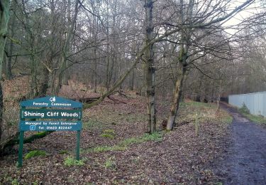
Signage in the centre of Kimberley is confusing. Route appears to split depending on direction of travel due to oneway streets. Needs confirming.
Positioning
Country:
United Kingdom
Region :
England
Department/Province :
Derbyshire
Municipality :
Amber Valley
Location:
Unknown
Start:(Dec)
Start:(UTM)
612387 ; 5875776 (30U) N.
Comments
Trails nearby
![Trail On foot Rushcliffe - Yellow - Photo](https://media.geolcdn.com/t/375/260/f9c1cb7d-deb0-4a1b-a905-2b51fe7d6d3f.jpeg&format=jpg&maxdim=2)
![On foot On foot](https://static1.geolcdn.com/sitytour/trail-icons/100.png)
Yellow
On foot
Easy
Rushcliffe,
England,
Nottinghamshire,
United Kingdom
![](/images/other/stat-length.png)
4 km | 4.4 km-effort
59min
![](https://static1.geolcdn.com/siteimages/upload/files/16400158638029165_repeat_loop_refresh_sync_direction_icon.png)
Yes
![Trail On foot Rushcliffe - Gotham Heritage Trail - Photo](https://media.geolcdn.com/t/375/260/a5275286-787b-4140-809c-10f37c98a475.jpeg&format=jpg&maxdim=2)
![On foot On foot](https://static1.geolcdn.com/sitytour/trail-icons/100.png)
Gotham Heritage Trail
On foot
Easy
Rushcliffe,
England,
Nottinghamshire,
United Kingdom
![](/images/other/stat-length.png)
4.3 km | 5.3 km-effort
1h 11min
![](https://static1.geolcdn.com/siteimages/upload/files/16400158638029165_repeat_loop_refresh_sync_direction_icon.png)
No
![Trail On foot Amber Valley - Amber Valley Routeways Walk 12 - Photo](https://media.geolcdn.com/t/375/260/880d3f46-7b6b-4c8f-90d3-8e588259fcd1.jpeg&format=jpg&maxdim=2)
![On foot On foot](https://static1.geolcdn.com/sitytour/trail-icons/100.png)
Amber Valley Routeways Walk 12
On foot
Easy
Amber Valley,
England,
Derbyshire,
United Kingdom
![](/images/other/stat-length.png)
4.8 km | 6.9 km-effort
1h 33min
![](https://static1.geolcdn.com/siteimages/upload/files/16400158638029165_repeat_loop_refresh_sync_direction_icon.png)
No
![Trail On foot Amber Valley - Amber Valley Routeway Walk 1 - Photo](https://media.geolcdn.com/t/375/260/ef974cbb-8e9d-41c6-8fcd-d1aa8706949c.jpeg&format=jpg&maxdim=2)
![On foot On foot](https://static1.geolcdn.com/sitytour/trail-icons/100.png)
Amber Valley Routeway Walk 1
On foot
Easy
Amber Valley,
England,
Derbyshire,
United Kingdom
![](/images/other/stat-length.png)
8.2 km | 10.1 km-effort
2h 17min
![](https://static1.geolcdn.com/siteimages/upload/files/16400158638029165_repeat_loop_refresh_sync_direction_icon.png)
Yes
![Trail On foot North East Derbyshire - North Wingfield Walk - Photo](https://media.geolcdn.com/t/375/260/5d83c5f8-1942-46e6-ac5f-27b706052c45.jpeg&format=jpg&maxdim=2)
![On foot On foot](https://static1.geolcdn.com/sitytour/trail-icons/100.png)
North Wingfield Walk
On foot
Easy
North East Derbyshire,
England,
Derbyshire,
United Kingdom
![](/images/other/stat-length.png)
4.6 km | 5.4 km-effort
1h 14min
![](https://static1.geolcdn.com/siteimages/upload/files/16400158638029165_repeat_loop_refresh_sync_direction_icon.png)
Yes
![Trail On foot North East Derbyshire - Pilsley Walk - Photo](https://media.geolcdn.com/t/375/260/731c70a8-8797-485f-af62-14cae3ced22f.jpeg&format=jpg&maxdim=2)
![On foot On foot](https://static1.geolcdn.com/sitytour/trail-icons/100.png)
Pilsley Walk
On foot
Easy
North East Derbyshire,
England,
Derbyshire,
United Kingdom
![](/images/other/stat-length.png)
5 km | 5.9 km-effort
1h 20min
![](https://static1.geolcdn.com/siteimages/upload/files/16400158638029165_repeat_loop_refresh_sync_direction_icon.png)
Yes
![Trail On foot Bolsover - Astwith Walk - Photo](https://media.geolcdn.com/t/375/260/f1e78084-3de2-439b-940a-de35a2a44a52.jpeg&format=jpg&maxdim=2)
![On foot On foot](https://static1.geolcdn.com/sitytour/trail-icons/100.png)
Astwith Walk
On foot
Easy
Bolsover,
England,
Derbyshire,
United Kingdom
![](/images/other/stat-length.png)
7.6 km | 9.1 km-effort
2h 4min
![](https://static1.geolcdn.com/siteimages/upload/files/16400158638029165_repeat_loop_refresh_sync_direction_icon.png)
Yes
![Trail On foot Bolsover - Tibshelf Walk - Photo](https://media.geolcdn.com/t/375/260/8a9fc3e4-7360-4aab-9f4c-452ed8f26e11.jpeg&format=jpg&maxdim=2)
![On foot On foot](https://static1.geolcdn.com/sitytour/trail-icons/100.png)
Tibshelf Walk
On foot
Easy
Bolsover,
England,
Derbyshire,
United Kingdom
![](/images/other/stat-length.png)
4.6 km | 5.7 km-effort
1h 17min
![](https://static1.geolcdn.com/siteimages/upload/files/16400158638029165_repeat_loop_refresh_sync_direction_icon.png)
Yes
![Trail On foot Rushcliffe - Rushcliffe Country Park 10km Course - Photo](https://media.geolcdn.com/t/375/260/cb475d07-5f20-4b62-bdf3-f9eff93f3952.jpeg&format=jpg&maxdim=2)
![On foot On foot](https://static1.geolcdn.com/sitytour/trail-icons/100.png)
Rushcliffe Country Park 10km Course
On foot
Easy
Rushcliffe,
England,
Nottinghamshire,
United Kingdom
![](/images/other/stat-length.png)
9.9 km | 10.8 km-effort
2h 27min
![](https://static1.geolcdn.com/siteimages/upload/files/16400158638029165_repeat_loop_refresh_sync_direction_icon.png)
Yes