Trail On foot Hinckley and Bosworth - Footpath T54 - Photo

Tous les sentiers balisés d’Europe GUIDE+

© OpenStreetMap contributors
Length
Length
6 km
Max alt
Max alt
100 m
Uphill gradient
Uphill gradient
27 m
Km-Effort
Km-Effort  
6.4 km
Min alt
Min alt
92 m
Downhill gradient
Downhill gradient
27 m
Boucle
Boucle
No
Signpost
Signpost
Creation date :
2025-02-05 10:40:45.924
Updated on :
2025-02-05 10:40:45.924

(0 Reviews)

On foot
On foot
1h26
Difficulty : Easy

Scan this QR Code to open this trail in the SityTrail application

FREE GPS app for hiking

Logo SityTrail SityTrail

IGN / Geographical institutes

Download SityTrail from the App Store Download SityTrail from Google Play

Logo SityTrail SityTrail World

The world is yours!

Download SityTrail from the App Store Download SityTrail from Google Play Download SityTrail on Huawei AppGallery

About

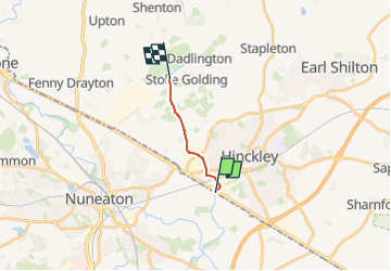
Trail On foot of 6 km to be discovered at England, Leicestershire, Hinckley and Bosworth. This trail is proposed by SityTrail - itinéraires balisés pédestres.

Description

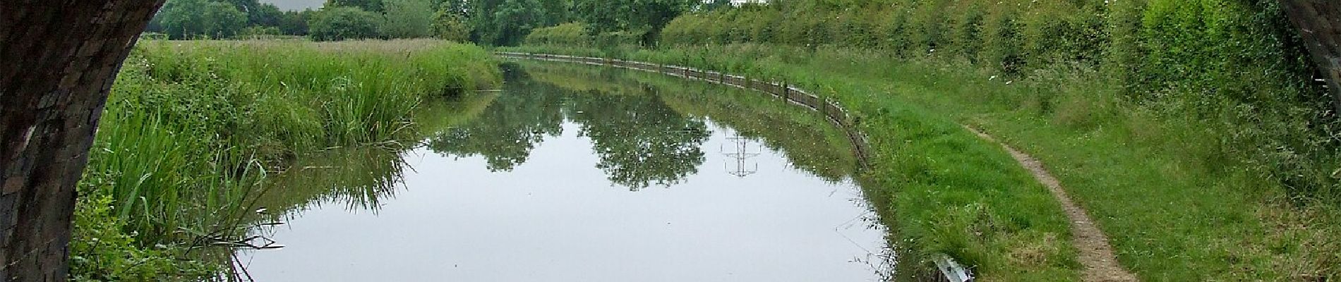
From Stoke Golding Wharf, along western bank of canal to Lime Kiln Bridge at Watling Street, Hinckley, and to the County Boundary with Warwickshire

Elevation profile

Photos

Positioning

Country:
United Kingdom
Region :
England
Department/Province :
Leicestershire
Municipality :
Hinckley and Bosworth
Location:
Unknown
Start:(UTM)
608883 ; 5820866 (30U) N.

Trails nearby

Trail On foot Hinckley and Bosworth - Footpath T53 - Photo
On foot
GUIDE+

On foot

Easy
Hinckley and Bosworth, England, Leicestershire, United Kingdom
3 km | 3.3 km-effort
44min
No


Close
My subscriptions