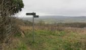

Wychavon Way (old)
SityTrail - itinéraires balisés pédestres
Tous les sentiers balisés d’Europe GUIDE+

Length
13.1 km

Max alt
245 m

Uphill gradient
328 m

Km-Effort
17.3 km

Min alt
41 m

Downhill gradient
285 m
Boucle
No
Signpost
Creation date :
2025-02-05 10:18:53.853
Updated on :
2025-02-05 10:18:53.853
3h56
Difficulty : Easy

FREE GPS app for hiking
About
Trail On foot of 13.1 km to be discovered at England, Worcestershire, Wychavon. This trail is proposed by SityTrail - itinéraires balisés pédestres.
Description
Original route pre 2012 revision
Positioning
Country:
United Kingdom
Region :
England
Department/Province :
Worcestershire
Municipality :
Wychavon
Location:
Unknown
Start:(Dec)
Start:(UTM)
568255 ; 5765698 (30U) N.
Comments
Trails nearby
Wychavon Way (old)


On foot
Easy
Wychavon,
England,
Worcestershire,
United Kingdom

11 km | 14.4 km-effort
3h 15min
No
Pershore Bridges Circular Walk


On foot
Easy
Wychavon,
England,
Worcestershire,
United Kingdom

6.6 km | 7.7 km-effort
1h 45min
No
Eckington Wharf Circular Walk


On foot
Easy
Wychavon,
England,
Worcestershire,
United Kingdom

5.5 km | 5.8 km-effort
1h 19min
Yes
Warden's Way


On foot
Easy
Tewkesbury,
England,
Gloucestershire,
United Kingdom

7.7 km | 10.9 km-effort
2h 28min
No

Windrush Way


On foot
Medium
Tewkesbury,
England,
Gloucestershire,
United Kingdom

22 km | 26 km-effort
5h 58min
No
costwold way


Walking
Easy
Wychavon,
England,
Worcestershire,
United Kingdom

8.9 km | 11.8 km-effort
2h 49min
No

w-engeland-cotswold-way


Walking
Very easy
Cotswold,
England,
Gloucestershire,
United Kingdom

165 km | 220 km-effort
Unknown
No

J5 Stow-on-the-world - Bourton on the water


Walking
Difficult
Cotswold,
England,
Gloucestershire,
United Kingdom

12 km | 13 km-effort
2h 57min
No

j4 Mickelton - Hidcote - Chippen Campden


Walking
Difficult
Cotswold,
England,
Gloucestershire,
United Kingdom

15.2 km | 19.2 km-effort
2h 18min
No


 SityTrail


