


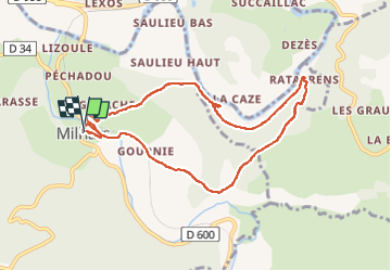

9.6 km | 12.8 km-effort


User


FREE GPS app for hiking
 SityTrail
IGN / Geographical institutes
SityTrail World
The world is yours!
Trail Walking of 8.7 km to be discovered at Occitania, Tarn, Milhars. This trail is proposed by christian425.
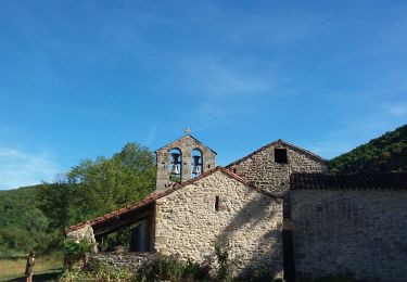
vue sur la vallée de l'Aveyron et halte à l'église de Larroque
Milhars : fête de l'osier le second dimanche de Février
Walking
Walking

On foot
Walking

Walking
Walking
Walking


sport