Trail Walking Belvédère - Mercantour 4 jours v1 - Photo
 MCARY
MCARY

User

© OpenStreetMap contributors
Length
Length
37 km
Max alt
Max alt
2826 m
Uphill gradient
Uphill gradient
3186 m
Km-Effort
Km-Effort  
79 km
Min alt
Min alt
1506 m
Downhill gradient
Downhill gradient
3185 m
Boucle
Boucle
Yes
Creation date :
2025-02-01 16:53:17.642
Updated on :
2025-02-01 16:53:20.002

(0 Reviews)

Walking
Walking
18h01
Difficulty : Medium

Scan this QR Code to open this trail in the SityTrail application

FREE GPS app for hiking

Logo SityTrail SityTrail

IGN / Geographical institutes

Download SityTrail from the App Store Download SityTrail from Google Play

Logo SityTrail SityTrail World

The world is yours!

Download SityTrail from the App Store Download SityTrail from Google Play Download SityTrail on Huawei AppGallery

About

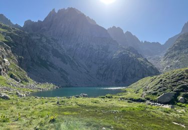
Trail Walking of 37 km to be discovered at Provence-Alpes-Côte d'Azur, Maritime Alps, Belvédère. This trail is proposed by MCARY.

Elevation profile

Positioning

Country:
France
Region :
Provence-Alpes-Côte d'Azur
Department/Province :
Maritime Alps
Municipality :
Belvédère
Location:
Unknown
Start:(UTM)
370880 ; 4879358 (32T) N.

Comments

Please log in to post a review or rate the element


Ça m'a l'air bien Mais je ne peux pas voir le détail de chaque journée On passe par la vallée des merveilles ?


Trails nearby

Trail On foot Saint-Martin-Vésubie - SityTrail - Lacs de Prals - Photo
On foot
GUIDE
toutankhcarton

On foot

Easy
(1)
Saint-Martin-Vésubie, Provence-Alpes-Côte d'Azur, Maritime Alps, France
6.7 km | 13.6 km-effort
3h 5min
Yes
Trail Walking Saint-Martin-Vésubie - Boucle Les lacs de Prals par la cime de la Vallette - Photo
Walking
GUIDE
donda

Walking

Very difficult
Saint-Martin-Vésubie, Provence-Alpes-Côte d'Azur, Maritime Alps, France
13.2 km | 24 km-effort
4h 50min
Yes
Trail On foot Belvédère - Les Merveilles par la Gordolasque - Photo
On foot
GUIDE+

On foot

Medium
Belvédère, Provence-Alpes-Côte d'Azur, Maritime Alps, France
13 km | 29 km-effort
6h 35min
Yes
Trail On foot Saint-Martin-Vésubie - Circuit de Fenestre - Photo
On foot
GUIDE+

On foot

Easy
Saint-Martin-Vésubie, Provence-Alpes-Côte d'Azur, Maritime Alps, France
8.1 km | 16.4 km-effort
3h 44min
Yes
Trail Walking Belvédère - SityTrail - Refuge de Nice et Les Lacs   - Photo
Walking
GUIDE
donda

Walking

Very difficult
Belvédère, Provence-Alpes-Côte d'Azur, Maritime Alps, France
13 km | 25 km-effort
5h 4min
Yes
Trail Walking Belvédère - Pont du Countet refuge de Nice et Lacs du Mont Clapier - Photo
Walking
GUIDE
donda

Walking

Difficult
Belvédère, Provence-Alpes-Côte d'Azur, Maritime Alps, France
8.1 km | 18.1 km-effort
4h 1min
No
Trail Walking Saint-Martin-Vésubie - Lacs de Prals - Photo
Walking
michlie

Walking

Easy
(1)
Saint-Martin-Vésubie, Provence-Alpes-Côte d'Azur, Maritime Alps, France
6.7 km | 13.5 km-effort
2h 48min
Yes
Trail Other activity Saint-Martin-Vésubie - gr 52 merveilles - Photo
Other activity
legris

Other activity

Very easy
(1)
Saint-Martin-Vésubie, Provence-Alpes-Côte d'Azur, Maritime Alps, France
27 km | 53 km-effort
Unknown
No
Trail Walking Belvédère - Tête Nord du Basto  - Photo
Walking
bozo1970

Walking

Very difficult
Belvédère, Provence-Alpes-Côte d'Azur, Maritime Alps, France
10.4 km | 25 km-effort
5h 42min
Yes


Close
My subscriptions