


STONEHENGE

dudu42
User GUIDE
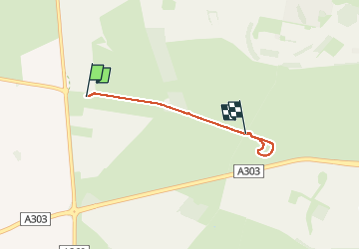

Length
3.2 km

Max alt
115 m

Uphill gradient
29 m
Km-Effort
3.5 km

Min alt
93 m

Downhill gradient
28 m
Boucle
No
Creation date :
2025-01-30 10:30:32.301
Updated on :
2025-01-30 11:15:34.164
41m
Difficulty : Very easy

FREE GPS app for hiking
 SityTrail
IGN / Geographical institutes
SityTrail World
The world is yours!
About
Trail Walking of 3.2 km to be discovered at England, Wiltshire. This trail is proposed by dudu42.
Description
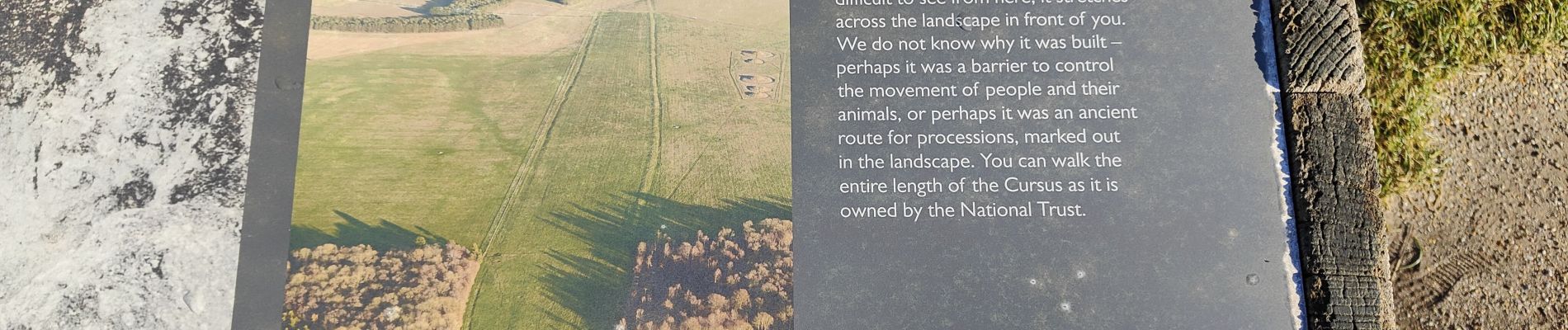
Visite du site de Stonehenge.
Dommage qu'il n'y ait pas de plateforme en hauteur ( esthétique obligé)
Photos


Positioning
Country:
United Kingdom
Region :
England
Department/Province :
Wiltshire
Municipality :
Unknown
Location:
Unknown
Start:(Dec)
Start:(UTM)
579892 ; 5670950 (30U) N.
Comments
Trails nearby