Trail Walking Bouvron - Chemin de la Charmotte  - Photo

Chemin de la Charmotte

 kikkko
kikkko

User

© OpenStreetMap contributors
Length
Length
8.1 km
Max alt
Max alt
231 m
Uphill gradient
Uphill gradient
68 m
Km-Effort
Km-Effort  
9 km
Min alt
Min alt
209 m
Downhill gradient
Downhill gradient
68 m
Boucle
Boucle
Yes
Creation date :
2025-01-20 13:01:42.549
Updated on :
2025-01-20 15:22:34.49

(0 Reviews)

Walking
Walking
1h56
Difficulty : Medium

Scan this QR Code to open this trail in the SityTrail application

FREE GPS app for hiking

Logo SityTrail SityTrail

IGN / Geographical institutes

Download SityTrail from the App Store Download SityTrail from Google Play

Logo SityTrail SityTrail World

The world is yours!

Download SityTrail from the App Store Download SityTrail from Google Play Download SityTrail on Huawei AppGallery

About

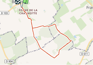
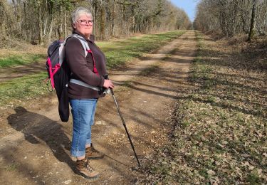
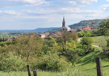
Trail Walking of 8.1 km to be discovered at Grand Est, Meurthe-et-Moselle, Bouvron. This trail is proposed by kikkko.

Description

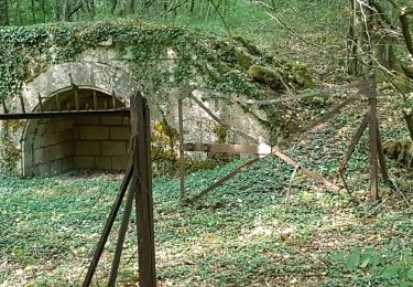
balisé rond bleu par les baliseurs de la Linotte
merci à eux

Elevation profile

Positioning

Country:
France
Region :
Grand Est
Department/Province :
Meurthe-et-Moselle
Municipality :
Bouvron
Location:
Unknown
Start:(UTM)
711949 ; 5402550 (31U) N.

Trails nearby

Trail On foot Ménil-la-Tour - Boucle du Terrouin - Photo
On foot
GUIDE+

On foot

Medium
Ménil-la-Tour, Grand Est, Meurthe-et-Moselle, France
25 km | 28 km-effort
6h 22min
Yes
Trail On foot Bruley - Circuit de la Petite Linotte - Photo
On foot
GUIDE+

On foot

Easy
Bruley, Grand Est, Meurthe-et-Moselle, France
9.2 km | 12 km-effort
2h 43min
No
Trail On foot Lucey - Circuit des Vignes - Photo
On foot
GUIDE+

On foot

Easy
Lucey, Grand Est, Meurthe-et-Moselle, France
4.2 km | 5.2 km-effort
1h 11min
Yes
Trail On foot Lagney - Circuit des Forts - Photo
On foot
GUIDE+

On foot

Easy
Lagney, Grand Est, Meurthe-et-Moselle, France
8.3 km | 10.6 km-effort
2h 24min
No
Trail Walking Bruley - Bruley Lucey - Photo
Walking
papounet56

Walking

Easy
Bruley, Grand Est, Meurthe-et-Moselle, France
10.2 km | 13.2 km-effort
3h 41min
Yes
Trail Walking Toul - TOUL - LA CROIX D'ARGENT - Photo
Walking
jean-marie.parachini

Walking

Very easy
Toul, Grand Est, Meurthe-et-Moselle, France
13 km | 14.5 km-effort
3h 22min
Yes
Trail Other activity Lagney - Le circuit des forts - Photo
Other activity
ericsnoopy

Other activity

Medium
(1)
Lagney, Grand Est, Meurthe-et-Moselle, France
7.6 km | 9.8 km-effort
30min
Yes
Trail Walking Bruley - Bruley Lucey par les vignes et la forêt  - Photo
Walking
jean-marie.parachini

Walking

Medium
Bruley, Grand Est, Meurthe-et-Moselle, France
10.6 km | 13.6 km-effort
4h 59min
Yes
Trail Horseback riding Francheville - Chez pat à l’étang toul Tivio  - Photo
Horseback riding
ACPL

Horseback riding

Easy
Francheville, Grand Est, Meurthe-et-Moselle, France
13.7 km | 15.2 km-effort
2h 0min
Yes


Close
My subscriptions