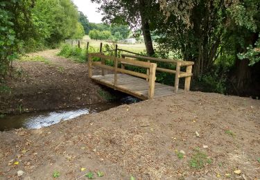
Trail Walking Villaines-la-Gonais - le brame des cerfs - Photo
 darkpapa
darkpapa

User

© OpenStreetMap contributors
Length
Length
9.1 km
Max alt
Max alt
127 m
Uphill gradient
Uphill gradient
151 m
Km-Effort
Km-Effort  
11.1 km
Min alt
Min alt
82 m
Downhill gradient
Downhill gradient
151 m
Boucle
Boucle
Yes
Creation date :
2025-01-10 16:09:40.257
Updated on :
2025-01-14 19:15:37.478

(0 Reviews)

Walking
Walking
2h30
Difficulty : Easy

Scan this QR Code to open this trail in the SityTrail application

FREE GPS app for hiking

Logo SityTrail SityTrail

IGN / Geographical institutes

Download SityTrail from the App Store Download SityTrail from Google Play

Logo SityTrail SityTrail World

The world is yours!

Download SityTrail from the App Store Download SityTrail from Google Play Download SityTrail on Huawei AppGallery

About

Trail Walking of 9.1 km to be discovered at Pays de la Loire, Sarthe, Villaines-la-Gonais. This trail is proposed by darkpapa.

Description

départ salle polyvalente , quelques zones humide mais contournable , charmant village , élevage de cerfs cote autoroute , si on est matinal on peut croiser des animaux sauvage ;chevreuils sangliers
il existe un autre parcours référencé le brame des cerfs de 4km qui ne passe pas par les cerfs( Perche sarthois )

Elevation profile

Positioning

Country:
France
Region :
Pays de la Loire
Department/Province :
Sarthe
Municipality :
Villaines-la-Gonais
Location:
Unknown
Start:(UTM)
321706 ; 5334039 (31U) N.

Trails nearby

Trail On foot Saint-Aubin-des-Coudrais - St Aubin PR-9 long - Photo
On foot
darkpapa

On foot

Medium
Saint-Aubin-des-Coudrais, Pays de la Loire, Sarthe, France
13.6 km | 16.4 km-effort
3h 42min
Yes
Trail Walking Saint-Maixent - Saint Maixent - L'eau vive - Photo
Walking
tracegps

Walking

Medium
Saint-Maixent, Pays de la Loire, Sarthe, France
8.7 km | 10.2 km-effort
2h 15min
Yes
Trail Walking Saint-Maixent - autour de la butte de montbauge - Photo
Walking
darkpapa

Walking

Difficult
Saint-Maixent, Pays de la Loire, Sarthe, France
11.8 km | 14 km-effort
3h 11min
Yes
Trail On foot Saint-Aubin-des-Coudrais - de bois gars a la lande - Photo
On foot
darkpapa

On foot

Easy
Saint-Aubin-des-Coudrais, Pays de la Loire, Sarthe, France
12.3 km | 14.3 km-effort
3h 14min
Yes
Trail Walking Boëssé-le-Sec - Autour de Boesse - Photo
Walking
darkpapa

Walking

Easy
Boëssé-le-Sec, Pays de la Loire, Sarthe, France
10.3 km | 12.7 km-effort
2h 53min
Yes
Trail Walking Saint-Aubin-des-Coudrais - rando 15 km 2024 - Photo
Walking
darkpapa

Walking

Difficult
Saint-Aubin-des-Coudrais, Pays de la Loire, Sarthe, France
14.5 km | 17.5 km-effort
3h 58min
Yes
Trail Walking Saint-Aubin-des-Coudrais - rando 9 km 2024 - Photo
Walking
darkpapa

Walking

Medium
Saint-Aubin-des-Coudrais, Pays de la Loire, Sarthe, France
8.2 km | 9.9 km-effort
2h 14min
Yes
Trail On foot Tuffé Val de la Chéronne - Saint-Hilaire le lierru - Photo
On foot
darkpapa

On foot

Easy
Tuffé Val de la Chéronne, Pays de la Loire, Sarthe, France
10.3 km | 11.9 km-effort
2h 42min
Yes
Trail Walking Saint-Aubin-des-Coudrais -  la Mare de la lande - Photo
Walking
darkpapa

Walking

Easy
Saint-Aubin-des-Coudrais, Pays de la Loire, Sarthe, France
8.6 km | 9.9 km-effort
2h 15min
Yes


Close
My subscriptions