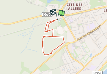
10.7 km | 12 km-effort
Circuit Bord de forêt de Blois
caillé
User
Length
3 km
Max alt
145 m
Uphill gradient
53 m
Km-Effort
3.8 km
Min alt
115 m
Downhill gradient
54 m
Boucle
Yes
Creation date :
2025-01-04 16:49:04.743
Updated on :
2025-01-04 16:52:36.418
51m
Difficulty : Easy
FREE GPS app for hiking
About
Trail Walking of 3 km to be discovered at Centre-Loire Valley, Loir-et-Cher, Blois. This trail is proposed by caillé.
Description
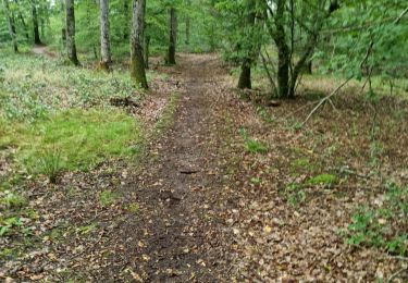
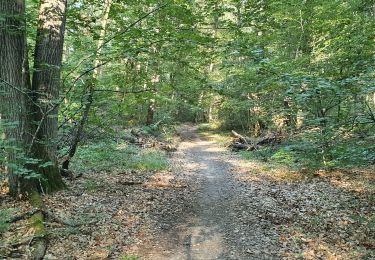
Facile, accessible à tous
Positioning
Country:
France
Region :
Centre-Loire Valley
Department/Province :
Loir-et-Cher
Municipality :
Blois
Location:
Unknown
Start:(Dec)
Start:(UTM)
371964 ; 5271150 (31T) N.
Comments
Trails nearby
BBR 2025-02-01 Valentine de Milan 10km
Walking
Medium
(1)
Valencisse,
Centre-Loire Valley,
Loir-et-Cher,
France
1h 35min
Yes
Saint-Gervais-la-Forêt - Chailles
Walking
Easy
Saint-Gervais-la-Forêt,
Centre-Loire Valley,
Loir-et-Cher,
France
9.1 km | 11.4 km-effort
2h 43min
Yes
Saint-Sulpice-de-Pommeray
Walking
Medium
Saint-Sulpice-de-Pommeray,
Centre-Loire Valley,
Loir-et-Cher,
France
24 km | 29 km-effort
8h 41min
Yes
Blois Chambord et retour
Hybrid bike
Easy
(1)
Blois,
Centre-Loire Valley,
Loir-et-Cher,
France
49 km | 54 km-effort
5h 13min
Yes
blois
Walking
Medium
Blois,
Centre-Loire Valley,
Loir-et-Cher,
France
5.6 km | 6.4 km-effort
4h 10min
No
La Chaussée St Victor
Walking
Very easy
Saint-Gervais-la-Forêt,
Centre-Loire Valley,
Loir-et-Cher,
France
13.5 km | 15.7 km-effort
2h 44min
Yes
sortie école N Mandeia 6/2/25
Walking
Easy
Saint-Sulpice-de-Pommeray,
Centre-Loire Valley,
Loir-et-Cher,
France
5 km | 5.7 km-effort
1h 3min
No
N Mandela , gare de Blois
Walking
Easy
(1)
Blois,
Centre-Loire Valley,
Loir-et-Cher,
France
5.2 km | 5.9 km-effort
1h 20min
Yes
Randonnée Ecole N Mandela 2
Walking
Easy
Blois,
Centre-Loire Valley,
Loir-et-Cher,
France
4.1 km | 4.6 km-effort
1h 2min
Yes