


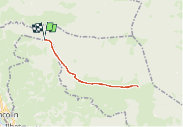

4.4 km | 5.9 km-effort


FREE GPS app for hiking
 SityTrail
IGN / Geographical institutes
SityTrail World
The world is yours!
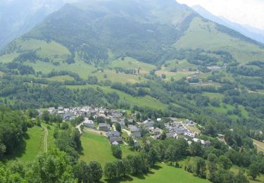
Trail Walking of 7.6 km to be discovered at Occitania, Hautespyrenees, Sarrancolin. This trail is proposed by damerenvielle@gmail.com.
A Sarrancolin prendre la route du Tous et continuer jusqu' au début de la piste non accidentée, puis jusqu'au début du sentier qui monte dans la forêt.
Walking
Walking
Walking
Mountain bike
Walking
Running

Walking
Walking
Walking