Trail Walking Kranenburg - GR Kranenburg Kleve 070615 - Photo
 riny
riny

User

© OpenStreetMap contributors
Length
Length
18.2 km
Max alt
Max alt
108 m
Uphill gradient
Uphill gradient
240 m
Km-Effort
Km-Effort  
21 km
Min alt
Min alt
11 m
Downhill gradient
Downhill gradient
235 m
Boucle
Boucle
No
Creation date :
2015-06-07 00:00:00.0
Updated on :
2015-06-07 00:00:00.0

(0 Reviews)

Walking
Walking
3h43
Difficulty : Easy

Scan this QR Code to open this trail in the SityTrail application

FREE GPS app for hiking

Logo SityTrail SityTrail

IGN / Geographical institutes

Download SityTrail from the App Store Download SityTrail from Google Play

Logo SityTrail SityTrail World

The world is yours!

Download SityTrail from the App Store Download SityTrail from Google Play Download SityTrail on Huawei AppGallery

About

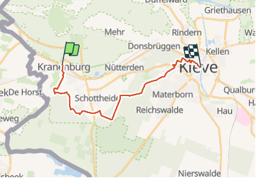
Trail Walking of 18.2 km to be discovered at North Rhine-Westphalia, Kreis Kleve, Kranenburg. This trail is proposed by riny.

Elevation profile

Positioning

Country:
Germany
Region :
North Rhine-Westphalia
Department/Province :
Kreis Kleve
Municipality :
Kranenburg
Location:
Unknown
Start:(UTM)
293552 ; 5741939 (32U) N.

Trails nearby

Trail Mountain bike Kranenburg - Gelderland - De Klever Reichswaldtour 2004 - Photo
Mountain bike
gpstracks

Mountain bike

Very easy
Kranenburg, North Rhine-Westphalia, Kreis Kleve, Germany
46 km | 53 km-effort
Unknown
Yes
Trail Walking Berg en Dal - w-gelderland-groesbeek-kranenburg - Photo
Walking
gpstracks

Walking

Very easy
Berg en Dal, Gelderland, Unknown, Netherlands
14.5 km | 16 km-effort
Unknown
Yes
Trail Walking Berg en Dal - w-gelderland-glooiend-groesbeek - Photo
Walking
gpstracks

Walking

Very easy
Berg en Dal, Gelderland, Unknown, Netherlands
13.9 km | 15.3 km-effort
Unknown
Yes


Close
My subscriptions