![](/images/other/stat-length.png)
![Trail Walking Berrias-et-Casteljau - 80-lestong--garigue-de-berrias-version-2 - Photo](https://media.geolcdn.com/t/1900/400/ext.pjpeg?maxdim=2&url=https%3A%2F%2Fstatic1.geolcdn.com%2Fsiteimages%2Fupload%2Ffiles%2F1553511878bg_sport_marche.png)
80-lestong--garigue-de-berrias-version-2
ganinette
User
![Length](/images/other/stat-length.png)
Length
7.6 km
![Boucle](https://static1.geolcdn.com/siteimages/upload/files/16400158638029165_repeat_loop_refresh_sync_direction_icon.png)
Boucle
Yes
Creation date :
2024-12-18 08:11:13.042
Updated on :
2024-12-18 08:11:13.042
![Walking](https://static1.geolcdn.com/sitytour/trail-icons/101.png)
--
Difficulty : Unknown
![Scan this QR Code to open this trail in the SityTrail application](https://capi.geolives.com/qq0zvz2zws4bq2lad0pu/sitytour/trails/4298715/qr.png?size=200)
FREE GPS app for hiking
About
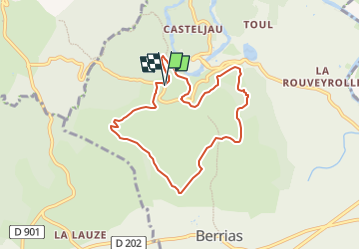
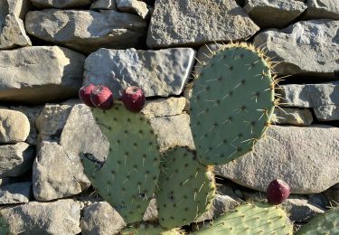
Trail Walking of 7.6 km to be discovered at Auvergne-Rhône-Alpes, Ardèche, Berrias-et-Casteljau. This trail is proposed by ganinette.
Description
ballade tranquille .belle vue sur le plan d'eau.
a faire hors chaleur car très peu d'ombre.
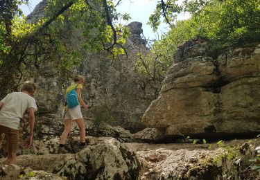
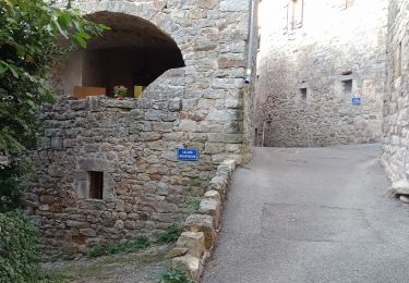
retour par l'entrée des gorges.
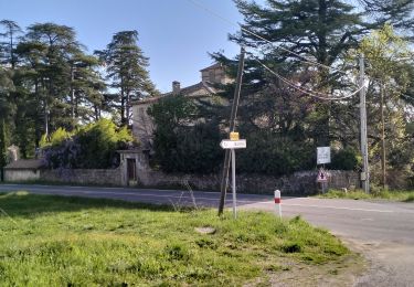
version1.dénivele 109m
version2.dénivelé 127m belle vue sur l'entrée des gorges .
Positioning
Country:
France
Region :
Auvergne-Rhône-Alpes
Department/Province :
Ardèche
Municipality :
Berrias-et-Casteljau
Location:
Casteljau
Start:(Dec)
Start:(UTM)
594904 ; 4916263 (31T) N.
Comments
Trails nearby
![Trail Walking Berrias-et-Casteljau - ARDÈCHE. BERRIAS. GORGES DE CHASSEZAC O - Photo](https://media.geolcdn.com/t/375/260/57afbf73-5c77-4144-bf42-14d64b3b569f.jpg&format=jpg&maxdim=2)
![Walking Walking](https://static1.geolcdn.com/sitytour/trail-icons/101.png)
ARDÈCHE. BERRIAS. GORGES DE CHASSEZAC O
Walking
Easy
Berrias-et-Casteljau,
Auvergne-Rhône-Alpes,
Ardèche,
France
![](/images/other/stat-length.png)
12.5 km | 15.3 km-effort
4h 14min
![](https://static1.geolcdn.com/siteimages/upload/files/16400158638029165_repeat_loop_refresh_sync_direction_icon.png)
Yes
![Trail Walking Banne - Autour de Banne - Photo](https://media.geolcdn.com/t/375/260/0d756104-e1b5-4f2e-b3d0-c252da0f965f.jpg&format=jpg&maxdim=2)
![Walking Walking](https://static1.geolcdn.com/sitytour/trail-icons/101.png)
Autour de Banne
Walking
Difficult
Banne,
Auvergne-Rhône-Alpes,
Ardèche,
France
![](/images/other/stat-length.png)
19.8 km | 28 km-effort
5h 46min
![](https://static1.geolcdn.com/siteimages/upload/files/16400158638029165_repeat_loop_refresh_sync_direction_icon.png)
Yes
![Trail Walking Berrias-et-Casteljau - Wikiloc Bois de Paiolive (PVDB) - Photo](https://media.geolcdn.com/t/375/260/045714af-a6fd-44e6-8871-35194bcde521.jpg&format=jpg&maxdim=2)
![Walking Walking](https://static1.geolcdn.com/sitytour/trail-icons/101.png)
Wikiloc Bois de Paiolive (PVDB)
Walking
Medium
Berrias-et-Casteljau,
Auvergne-Rhône-Alpes,
Ardèche,
France
![](/images/other/stat-length.png)
9.9 km | 12.3 km-effort
4h 24min
![](https://static1.geolcdn.com/siteimages/upload/files/16400158638029165_repeat_loop_refresh_sync_direction_icon.png)
Yes
![Trail Walking Les Vans - Bois de Païolive - Photo](https://media.geolcdn.com/t/375/260/ext.jpg?maxdim=2&url=https%3A%2F%2Fservices.sitytrail.com%2FGeolivesWS%2FDownloadMedia.ashx%3FTrailID%3D372613%26Media%3Dfix__20141226114045.jpg)
![Walking Walking](https://static1.geolcdn.com/sitytour/trail-icons/101.png)
Bois de Païolive
Walking
Medium
(1)
Les Vans,
Auvergne-Rhône-Alpes,
Ardèche,
France
![](/images/other/stat-length.png)
2.9 km | 3.3 km-effort
1h 33min
![](https://static1.geolcdn.com/siteimages/upload/files/16400158638029165_repeat_loop_refresh_sync_direction_icon.png)
Yes
![Trail Walking Berrias-et-Casteljau - paiolive - Photo](https://media.geolcdn.com/t/375/260/ext.jpg?maxdim=2&url=https%3A%2F%2Fstatic1.geolcdn.com%2Fsiteimages%2Fupload%2Ffiles%2F1553511878bg_sport_marche.png)
![Walking Walking](https://static1.geolcdn.com/sitytour/trail-icons/101.png)
paiolive
Walking
Very easy
(1)
Berrias-et-Casteljau,
Auvergne-Rhône-Alpes,
Ardèche,
France
![](/images/other/stat-length.png)
5.6 km | 6.7 km-effort
2h 16min
![](https://static1.geolcdn.com/siteimages/upload/files/16400158638029165_repeat_loop_refresh_sync_direction_icon.png)
Yes
![Trail Mountain bike Berrias-et-Casteljau - Berias et environ - Photo](https://media.geolcdn.com/t/375/260/ext.jpg?maxdim=2&url=https%3A%2F%2Fstatic1.geolcdn.com%2Fsiteimages%2Fupload%2Ffiles%2F1524743154velo.jpg)
![Mountain bike Mountain bike](https://static1.geolcdn.com/sitytour/trail-icons/202.png)
Berias et environ
Mountain bike
Difficult
(1)
Berrias-et-Casteljau,
Auvergne-Rhône-Alpes,
Ardèche,
France
![](/images/other/stat-length.png)
23 km | 27 km-effort
1h 41min
![](https://static1.geolcdn.com/siteimages/upload/files/16400158638029165_repeat_loop_refresh_sync_direction_icon.png)
Yes
![Trail Walking Les Vans - Granzon petit tour - Photo](https://media.geolcdn.com/t/375/260/f2b62cf6-814d-43d1-9d14-ffc0ac06b0e6.jpg&format=jpg&maxdim=2)
![Walking Walking](https://static1.geolcdn.com/sitytour/trail-icons/101.png)
Granzon petit tour
Walking
Very easy
Les Vans,
Auvergne-Rhône-Alpes,
Ardèche,
France
![](/images/other/stat-length.png)
4.8 km | 6.3 km-effort
1h 14min
![](https://static1.geolcdn.com/siteimages/upload/files/16400158638029165_repeat_loop_refresh_sync_direction_icon.png)
Yes
![Trail Walking Les Vans - Chabiscol du 26/08/2024 - Photo](https://media.geolcdn.com/t/375/260/b153c81c-81a0-4828-8297-c29e9496a4e0.jpg&format=jpg&maxdim=2)
![Walking Walking](https://static1.geolcdn.com/sitytour/trail-icons/101.png)
Chabiscol du 26/08/2024
Walking
Difficult
Les Vans,
Auvergne-Rhône-Alpes,
Ardèche,
France
![](/images/other/stat-length.png)
9.9 km | 13.3 km-effort
2h 46min
![](https://static1.geolcdn.com/siteimages/upload/files/16400158638029165_repeat_loop_refresh_sync_direction_icon.png)
Yes
![Trail Walking Banne - 07_Banne_8km290m - Photo](https://media.geolcdn.com/t/375/260/cc4349b5-bd6c-4fd5-b4f7-03cbd86b8a3c.jpg&format=jpg&maxdim=2)
![Walking Walking](https://static1.geolcdn.com/sitytour/trail-icons/101.png)
07_Banne_8km290m
Walking
Easy
Banne,
Auvergne-Rhône-Alpes,
Ardèche,
France
![](/images/other/stat-length.png)
8 km | 11.9 km-effort
2h 36min
![](https://static1.geolcdn.com/siteimages/upload/files/16400158638029165_repeat_loop_refresh_sync_direction_icon.png)
Yes