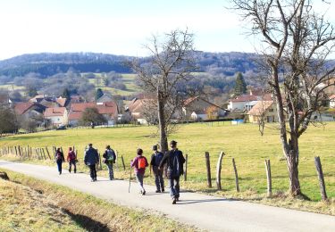

Lanthenans le rocher du Chatelard

Jean-Pierre Retail
User

Length
11.3 km

Max alt
591 m

Uphill gradient
377 m

Km-Effort
16.4 km

Min alt
365 m

Downhill gradient
376 m
Boucle
Yes
Creation date :
2024-11-20 13:06:57.075
Updated on :
2024-12-08 16:49:31.318
2h29
Difficulty : Medium

FREE GPS app for hiking
About
Trail Walking of 11.3 km to be discovered at Bourgogne-Franche-Comté, Doubs, Lanthenans. This trail is proposed by Jean-Pierre Retail .
Description
Depart cimetière de Lanthenans, vers Hyemondans, montée vers le Rocher du Chatelard, descente sur Sourans, le Rochet et retour
Positioning
Country:
France
Region :
Bourgogne-Franche-Comté
Department/Province :
Doubs
Municipality :
Lanthenans
Location:
Unknown
Start:(Dec)
Start:(UTM)
320959 ; 5251972 (32T) N.
Comments
Trails nearby

Goux-les-Dambelin


Walking
Easy
Goux-lès-Dambelin,
Bourgogne-Franche-Comté,
Doubs,
France

12.7 km | 18.1 km-effort
3h 49min
Yes

TRACES_VISIBLES


Walking
Difficult
Dambelin,
Bourgogne-Franche-Comté,
Doubs,
France

22 km | 31 km-effort
6h 33min
Yes

❤️


Walking
Very easy
L'Isle-sur-le-Doubs,
Bourgogne-Franche-Comté,
Doubs,
France

4.7 km | 5.2 km-effort
1h 6min
Yes

20200421


Walking
Very easy
L'Isle-sur-le-Doubs,
Bourgogne-Franche-Comté,
Doubs,
France

4 km | 4.7 km-effort
54min
Yes

les oiseaux colombier fontaine


Walking
Easy
Saint-Maurice-Colombier,
Bourgogne-Franche-Comté,
Doubs,
France

8.4 km | 12 km-effort
2h 7min
No

Lomont (La ferme du) - Mont Solemont - Eoliennes


Walking
Medium
Vyt-lès-Belvoir,
Bourgogne-Franche-Comté,
Doubs,
France

18.4 km | 24 km-effort
4h 10min
Yes

Colombier-Chatelot


Walking
Medium
Saint-Maurice-Colombier,
Bourgogne-Franche-Comté,
Doubs,
France

6.8 km | 8.2 km-effort
2h 11min
Yes

Les 40 km de Vallone-PM


Walking
Very difficult
Valonne,
Bourgogne-Franche-Comté,
Doubs,
France

17.2 km | 27 km-effort
6h 1min
Yes

40 km de Valonne-matin


Walking
Very difficult
Valonne,
Bourgogne-Franche-Comté,
Doubs,
France

23 km | 33 km-effort
7h 29min
Yes


 SityTrail


