marcilly le hayer SityTrail > Trails > Outdoor > France > Grand Est > Aube > Marcilly-le-Hayer SityTrail > Trails > Outdoor > France > Grand Est > Aube > Marcilly-le-Hayer marcilly le hayer Cvd89 User 3D © OpenStreetMap contributors Length 16.8 km Max alt 200 m Uphill gradient 220 m Km-Effort 19.7 km Min alt 114 m Downhill gradient 220 m Boucle Yes Creation date : 2024-12-01 08:50:13.459 Updated on : 2024-12-01 14:11:12.268 (0 Reviews) Walking 5h20 Difficulty : Very difficult FREE GPS app for hiking SityTrail IGN / Geographical institutes SityTrail World The world is yours! About 
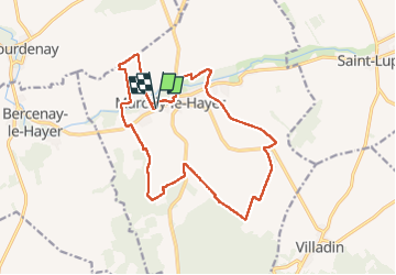
Trail Walking of 16.8 km to be discovered at Grand Est, Aube, Marcilly-le-Hayer. This trail is proposed by Cvd89. Legends | More details (PDF) Elevation profile Legends > 15% 15% - 10% 10% - 5% flat 5% - 10% 10% - 15% 15% - 30% > 30% Photos 
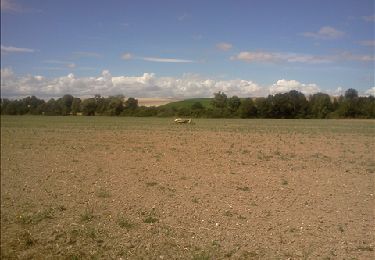
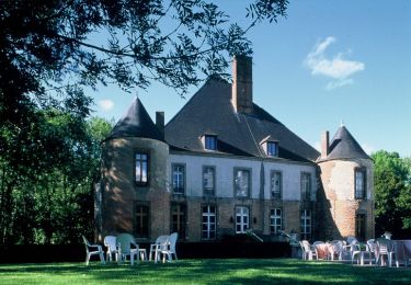
22 photos in total. Please click on a photo to see them all in the gallery. Positioning Country: France Region : Grand Est Department/Province : Aube Municipality : Marcilly-le-Hayer Location: Unknown Start:(Dec) 48.3458594 / 3.6292036 Start:(UTM) 546621 ; 5354933 (31U) N. Comments Please log in to post a review or rate the element Trails nearby Daneel-89 Marcilly le Hayer (Dolmens) Walking Very easy Marcilly-le-Hayer, Grand Est, Aube, France 11.9 km | 13 km-effort 3h 0min Yes tracegps Circuit des dolmens et polissoirs - Marcilly le Hayer Cycle Difficult Marcilly-le-Hayer, Grand Est, Aube, France 83 km | 96 km-effort 4h 0min Yes Alain Picard Villadin On foot Medium Villadin, Grand Est, Aube, France 12.7 km | 16 km-effort Unknown Yes bougnaou Villadin 07.24 Walking Easy Villadin, Grand Est, Aube, France 10.7 km | 13.2 km-effort 2h 47min Yes Tollard Viladin 17.3.24 Mountain bike Difficult Villadin, Grand Est, Aube, France 26 km | 35 km-effort 3h 5min No genndor vallée de l'orvin On foot Medium Marcilly-le-Hayer, Grand Est, Aube, France 26 km | 29 km-effort Unknown Yes genndor vallée de l'orvin On foot Medium Marcilly-le-Hayer, Grand Est, Aube, France 26 km | 29 km-effort Unknown Yes