Trail Walking Urcuit - Barthes d Ardanavy - Photo
 Papamoju
Papamoju

User

© OpenStreetMap contributors
Length
Length
13.1 km
Max alt
Max alt
31 m
Uphill gradient
Uphill gradient
99 m
Km-Effort
Km-Effort  
14.4 km
Min alt
Min alt
-1 m
Downhill gradient
Downhill gradient
100 m
Boucle
Boucle
Yes
Creation date :
2015-05-31 00:00:00.0
Updated on :
2015-05-31 00:00:00.0

(1 Reviews)

Walking
Walking
3h06
Difficulty : Easy

Scan this QR Code to open this trail in the SityTrail application

FREE GPS app for hiking

Logo SityTrail SityTrail

IGN / Geographical institutes

Download SityTrail from the App Store Download SityTrail from Google Play

Logo SityTrail SityTrail World

The world is yours!

Download SityTrail from the App Store Download SityTrail from Google Play Download SityTrail on Huawei AppGallery

About

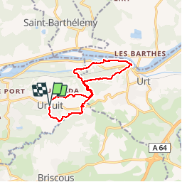
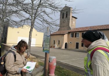
Trail Walking of 13.1 km to be discovered at New Aquitaine, Pyrénées-Atlantiques, Urcuit. This trail is proposed by Papamoju.

Elevation profile

Positioning

Country:
France
Region :
New Aquitaine
Department/Province :
Pyrénées-Atlantiques
Municipality :
Urcuit
Location:
Unknown
Start:(UTM)
634507 ; 4816080 (30T) N.

Comments

Please log in to post a review or rate the element


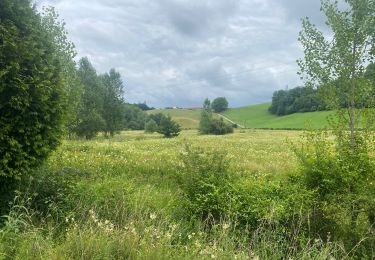
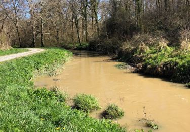
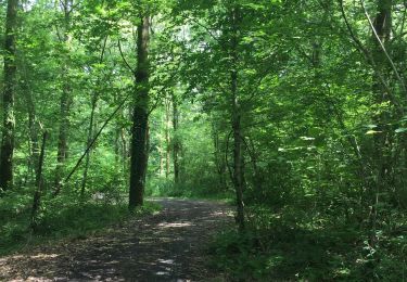
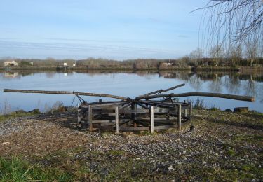
Yrès agréable par grosse chaleur: ombre + eau + pas de côte


Trails nearby

Trail Walking Urt - Les Barthes d'Etchepette - Photo
Walking
tracegps

Walking

Easy
(3)
Urt, New Aquitaine, Pyrénées-Atlantiques, France
5.3 km | 5.8 km-effort
1h 40min
Yes
Trail sport Urcuit - Urcuit les barrages de Ardanavy - Photo
sport
erjot60

sport

Very easy
Urcuit, New Aquitaine, Pyrénées-Atlantiques, France
7.8 km | 8.7 km-effort
Unknown
Yes
Trail Walking Urcuit - Section GR8 Urcuit / Lahonce en A/R - Photo
Walking
jaja64

Walking

Easy
Urcuit, New Aquitaine, Pyrénées-Atlantiques, France
5.2 km | 5.8 km-effort
1h 55min
Yes
Trail On foot Saint-Martin-de-Seignanx - Riston - Photo
On foot
GUIDE+

On foot

Easy
Saint-Martin-de-Seignanx, New Aquitaine, Landes, France
8.6 km | 10.4 km-effort
2h 21min
Yes
Trail Walking Urt - Barthes Échelepette; Ardanavy - Photo
Walking
jaja64

Walking

Easy
(1)
Urt, New Aquitaine, Pyrénées-Atlantiques, France
8.8 km | 9.7 km-effort
2h 19min
Yes
Trail Walking Lahonce - LAHONCE sentier de labaye formation balisage miden
Walking
GUIDE
marmotte65

Walking

Easy
Lahonce, New Aquitaine, Pyrénées-Atlantiques, France
2.3 km | 3.1 km-effort
1h 30min
Yes
Trail Mountain bike Lahonce - Rando mitounico - Photo
Mountain bike
Anthony Sol

Mountain bike

Medium
Lahonce, New Aquitaine, Pyrénées-Atlantiques, France
23 km | 25 km-effort
3h 4min
Yes
Trail Walking Briscous - Briscous  - Photo
Walking
jaja64

Walking

Easy
Briscous, New Aquitaine, Pyrénées-Atlantiques, France
10.1 km | 13.4 km-effort
2h 56min
Yes
Trail Mountain bike Urt - Les Barthes d'Etchepette - Photo
Mountain bike
tracegps

Mountain bike

Easy
Urt, New Aquitaine, Pyrénées-Atlantiques, France
5.3 km | 5.8 km-effort
45min
Yes


Close
My subscriptions