Trail Walking Beauregard-Baret - Traversée Beauregard Rochechinard - Photo

Traversée Beauregard Rochechinard

© OpenStreetMap contributors
Length
Length
17.1 km
Max alt
Max alt
1289 m
Uphill gradient
Uphill gradient
1030 m
Km-Effort
Km-Effort  
31 km
Min alt
Min alt
419 m
Downhill gradient
Downhill gradient
973 m
Boucle
Boucle
No
Creation date :
2024-11-14 07:53:09.432
Updated on :
2024-11-17 17:36:43.939

(0 Reviews)

Walking
Walking
6h32
Difficulty : Very difficult

Scan this QR Code to open this trail in the SityTrail application

FREE GPS app for hiking

Logo SityTrail SityTrail

IGN / Geographical institutes

Download SityTrail from the App Store Download SityTrail from Google Play

Logo SityTrail SityTrail World

The world is yours!

Download SityTrail from the App Store Download SityTrail from Google Play Download SityTrail on Huawei AppGallery

About

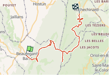
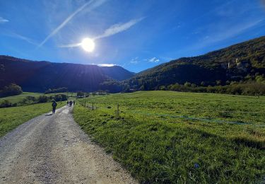
Trail Walking of 17.1 km to be discovered at Auvergne-Rhône-Alpes, Drôme, Beauregard-Baret. This trail is proposed by GuyVachet.

Description

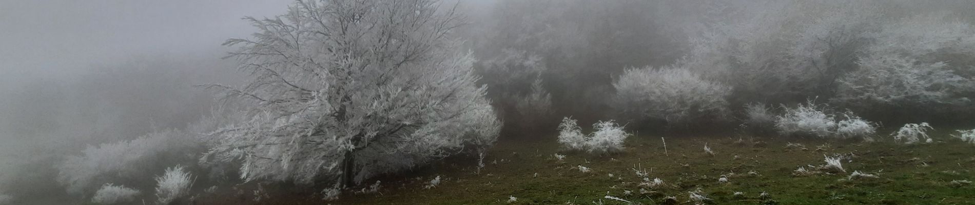
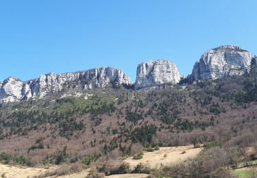
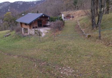
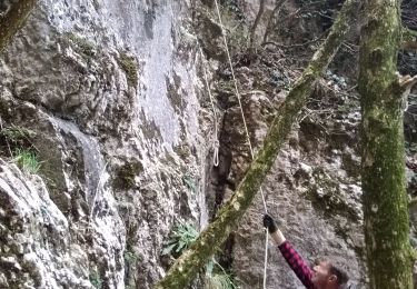
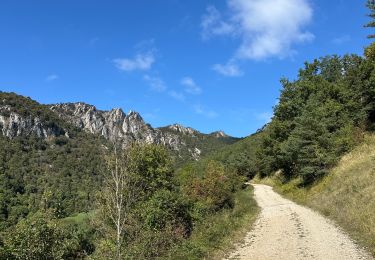
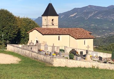
Traversée de Beauregard-Baret à Rochechinard. Paysage givré à partir du Col des Marchands et il fallait l'être pour s'engager sur les Crêtes de Musan car en fait de belvédère et gouffre, ça a été plutôt "point de vue" avec en prime une progression difficile en Aller/Retour. C'est bien dommage car il semble bien que cela valait le coup et en plus, la suite de la crête offre d'autres perspectives ce qui pourrait donner matière à une belle boucle. La descente s'est faite sans trop d'encombres et le ciel bleu a pu être aperçu à l'arrivée pour mettre quand même un peu du baume au cœur.

Elevation profile

Photos

Positioning

Country:
France
Region :
Auvergne-Rhône-Alpes
Department/Province :
Drôme
Municipality :
Beauregard-Baret
Location:
Unknown
Start:(UTM)
672178 ; 4984909 (31T) N.

Trails nearby

Trail Walking Beauregard-Baret - Pré de Cinq Sous - Beauregard Baret - Photo
Walking
tracegps

Walking

Medium
(1)
Beauregard-Baret, Auvergne-Rhône-Alpes, Drôme, France
11.6 km | 23 km-effort
5h 0min
Yes
Trail Walking Rochefort-Samson - Les Vachères - Combe d'oyans  - Photo
Walking
randochu

Walking

Difficult
(1)
Rochefort-Samson, Auvergne-Rhône-Alpes, Drôme, France
17.1 km | 28 km-effort
8h 26min
Yes
Trail Walking Beauregard-Baret - reco cx st Gervais b baret - Photo
Walking
GUIDE
randodyssée

Walking

Difficult
Beauregard-Baret, Auvergne-Rhône-Alpes, Drôme, France
9.4 km | 16.2 km-effort
4h 58min
No
Trail Walking Beauregard-Baret - croix st Gervais et Pas du loup - Photo
Walking
GUIDE
nadd73

Walking

Medium
Beauregard-Baret, Auvergne-Rhône-Alpes, Drôme, France
10 km | 16.9 km-effort
5h 4min
No
Trail Walking Chatuzange-le-Goubet - autour de Papelissier - Photo
Walking
ajd26

Walking

Very easy
(1)
Chatuzange-le-Goubet, Auvergne-Rhône-Alpes, Drôme, France
16.5 km | 21 km-effort
3h 20min
Yes
Trail sport Beauregard-Baret - Pierre rousse pas de pourceau l’eau basse - Photo
sport
alinetpierre

sport

Very easy
Beauregard-Baret, Auvergne-Rhône-Alpes, Drôme, France
14.7 km | 28 km-effort
Unknown
Yes
Trail Walking Barbières - Traversée Barbières Beauregard-Baret - Photo
Walking
GuyVachet

Walking

Very difficult
Barbières, Auvergne-Rhône-Alpes, Drôme, France
17 km | 28 km-effort
7h 9min
No
Trail Walking Rochechinard - Rochechinard la Ragnole les Berthonettes - Photo
Walking
alinetpierre

Walking

Easy
(1)
Rochechinard, Auvergne-Rhône-Alpes, Drôme, France
12.1 km | 18.9 km-effort
2h 55min
Yes
Trail Walking Rochechinard - Chateau de Rochechinard - Photo
Walking
crocau

Walking

Very easy
Rochechinard, Auvergne-Rhône-Alpes, Drôme, France
4.3 km | 6.7 km-effort
1h 57min
Yes


Close
My subscriptions