![](/images/other/stat-length.png)
![Trail Walking Couesmes - Couesmes Château-la-Vallière la Gare - PR GRP Castelvalérie Marcilly Braye Villiers - 27km 280m 6h05 (40mn) - 2024 11 13 - Photo](https://media.geolcdn.com/t/1900/400/a6ed14d6-cf1f-4346-965d-10cf16b9f80b.jpg&format=pjpeg&maxdim=2)
Couesmes Château-la-Vallière la Gare - PR GRP Castelvalérie Marcilly Braye Villiers - 27km 280m 6h05 (40mn) - 2024 11 13
Orcal37
User GUIDE
![Length](/images/other/stat-length.png)
Length
27 km
![Max alt](https://static1.geolcdn.com/siteimages/upload/files/1508320355ic_sort_altitude_max_24dp.png)
Max alt
121 m
![Uphill gradient](https://static1.geolcdn.com/siteimages/upload/files/1508320355ic_sort_den_pos_24dp.png)
Uphill gradient
278 m
![Km-Effort](/images/other/stat-length.png)
Km-Effort
31 km
![Min alt](https://static1.geolcdn.com/siteimages/upload/files/1508320355ic_sort_altitude_min_24dp.png)
Min alt
54 m
![Downhill gradient](https://static1.geolcdn.com/siteimages/upload/files/1508320355ic_sort_den_neg_24dp.png)
Downhill gradient
278 m
![Boucle](https://static1.geolcdn.com/siteimages/upload/files/16400158638029165_repeat_loop_refresh_sync_direction_icon.png)
Boucle
Yes
Creation date :
2024-11-13 08:58:14.182
Updated on :
2024-11-14 18:17:34.833
![Walking](https://static1.geolcdn.com/sitytour/trail-icons/101.png)
6h05
Difficulty : Medium
![Scan this QR Code to open this trail in the SityTrail application](https://capi.geolives.com/qq0zvz2zws4bq2lad0pu/sitytour/trails/4265283/qr.png?size=200)
FREE GPS app for hiking
About
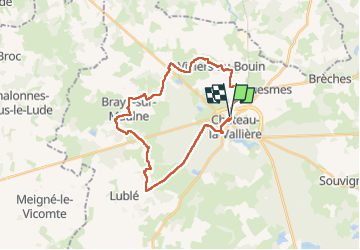
Trail Walking of 27 km to be discovered at Centre-Loire Valley, Indre-et-Loire, Couesmes. This trail is proposed by Orcal37.
Description
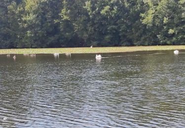
Couesmes Château-la-Vallière l'ancienne Gare - PR GRP Castelvalérie - Marcilly-sur-Maulne - Braye-sur-Maulne - Villiers-au-Bouin - 27km 280m 6h05 (40mn) - 2024 11 13
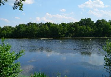
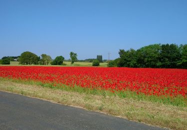
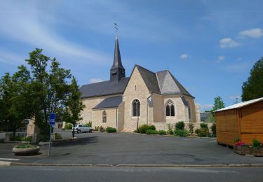
Positioning
Country:
France
Region :
Centre-Loire Valley
Department/Province :
Indre-et-Loire
Municipality :
Couesmes
Location:
Unknown
Start:(Dec)
Start:(UTM)
298344 ; 5269906 (31T) N.
Comments
Trails nearby
![Trail Walking Château-la-Vallière - Château-la-Vallière - Lac du Val Joyeux - 6.1km 70m 1h30 - 2023 06 07 - Photo](https://media.geolcdn.com/t/375/260/5ac883b9-c1e1-4571-ae83-aede517b82a5.jpg&format=jpg&maxdim=2)
![Walking Walking](https://static1.geolcdn.com/sitytour/trail-icons/101.png)
Château-la-Vallière - Lac du Val Joyeux - 6.1km 70m 1h30 - 2023 06 07
Walking
Easy
Château-la-Vallière,
Centre-Loire Valley,
Indre-et-Loire,
France
![](/images/other/stat-length.png)
6.1 km | 7 km-effort
1h 30min
![](https://static1.geolcdn.com/siteimages/upload/files/16400158638029165_repeat_loop_refresh_sync_direction_icon.png)
Yes
![Trail Walking Saint-Laurent-de-Lin - Saint-Laurent-de-Lin - GRP Castelvalérie Lublé - 13.3km 70m 3h00 (35mn) - 2023 05 27 - Photo](https://media.geolcdn.com/t/375/260/4d8dbac5-78d6-451e-9994-19b790aab408.jpg&format=jpg&maxdim=2)
![Walking Walking](https://static1.geolcdn.com/sitytour/trail-icons/101.png)
Saint-Laurent-de-Lin - GRP Castelvalérie Lublé - 13.3km 70m 3h00 (35mn) - 202...
Walking
Easy
Saint-Laurent-de-Lin,
Centre-Loire Valley,
Indre-et-Loire,
France
![](/images/other/stat-length.png)
13.3 km | 14.3 km-effort
3h 0min
![](https://static1.geolcdn.com/siteimages/upload/files/16400158638029165_repeat_loop_refresh_sync_direction_icon.png)
Yes
![Trail Walking Château-la-Vallière - Château-la-Vallière - GRP Castelvalérie Villiers-au-Bouin Couesmes - 22.7km 180m 5h15 (35mn) - 2023 05 18 - Photo](https://media.geolcdn.com/t/375/260/a3f39e88-89ba-4ca0-a948-b1b82e0807d3.jpg&format=jpg&maxdim=2)
![Walking Walking](https://static1.geolcdn.com/sitytour/trail-icons/101.png)
Château-la-Vallière - GRP Castelvalérie Villiers-au-Bouin Couesmes - 22.7km 1...
Walking
Easy
Château-la-Vallière,
Centre-Loire Valley,
Indre-et-Loire,
France
![](/images/other/stat-length.png)
22 km | 25 km-effort
5h 15min
![](https://static1.geolcdn.com/siteimages/upload/files/16400158638029165_repeat_loop_refresh_sync_direction_icon.png)
Yes
![Trail Walking Château-la-Vallière - Chateau la Vallières.11,4 Km.Le 29 Octobre 2015.Auteur tintin37 - Photo](https://media.geolcdn.com/t/375/260/ext.jpg?maxdim=2&url=https%3A%2F%2Fstatic1.geolcdn.com%2Fsiteimages%2Fupload%2Ffiles%2F1553511878bg_sport_marche.png)
![Walking Walking](https://static1.geolcdn.com/sitytour/trail-icons/101.png)
Chateau la Vallières.11,4 Km.Le 29 Octobre 2015.Auteur tintin37
Walking
Medium
(2)
Château-la-Vallière,
Centre-Loire Valley,
Indre-et-Loire,
France
![](/images/other/stat-length.png)
11.4 km | 13.1 km-effort
2h 44min
![](https://static1.geolcdn.com/siteimages/upload/files/16400158638029165_repeat_loop_refresh_sync_direction_icon.png)
Yes
![Trail Walking Château-la-Vallière - Château Lavalière - Photo](https://media.geolcdn.com/t/375/260/a7d0b3f7-9bff-4f79-abe1-0ef5d0a77e13.jpg&format=jpg&maxdim=2)
![Walking Walking](https://static1.geolcdn.com/sitytour/trail-icons/101.png)
Château Lavalière
Walking
Easy
Château-la-Vallière,
Centre-Loire Valley,
Indre-et-Loire,
France
![](/images/other/stat-length.png)
5.3 km | 5.9 km-effort
56min
![](https://static1.geolcdn.com/siteimages/upload/files/16400158638029165_repeat_loop_refresh_sync_direction_icon.png)
Yes
![Trail Walking Château-la-Vallière - Chateau la Vallières-11,6km-Le-Auteur tintin37 - Photo](https://media.geolcdn.com/t/375/260/ext.jpg?maxdim=2&url=https%3A%2F%2Fstatic1.geolcdn.com%2Fsiteimages%2Fupload%2Ffiles%2F1553511878bg_sport_marche.png)
![Walking Walking](https://static1.geolcdn.com/sitytour/trail-icons/101.png)
Chateau la Vallières-11,6km-Le-Auteur tintin37
Walking
Medium
Château-la-Vallière,
Centre-Loire Valley,
Indre-et-Loire,
France
![](/images/other/stat-length.png)
11.5 km | 13.1 km-effort
2h 53min
![](https://static1.geolcdn.com/siteimages/upload/files/16400158638029165_repeat_loop_refresh_sync_direction_icon.png)
Yes
![Trail Walking Château-la-Vallière - Château-la-Vallière - Photo](https://media.geolcdn.com/t/375/260/ext.jpg?maxdim=2&url=https%3A%2F%2Fstatic1.geolcdn.com%2Fsiteimages%2Fupload%2Ffiles%2F1553511878bg_sport_marche.png)
![Walking Walking](https://static1.geolcdn.com/sitytour/trail-icons/101.png)
Château-la-Vallière
Walking
Medium
Château-la-Vallière,
Centre-Loire Valley,
Indre-et-Loire,
France
![](/images/other/stat-length.png)
15.7 km | 18 km-effort
3h 28min
![](https://static1.geolcdn.com/siteimages/upload/files/16400158638029165_repeat_loop_refresh_sync_direction_icon.png)
Yes
![Trail Electric bike Couesmes - 2024-05-09 - Photo](https://media.geolcdn.com/t/375/260/ext.jpg?maxdim=2&url=https%3A%2F%2Fstatic1.geolcdn.com%2Fsiteimages%2Fupload%2Ffiles%2F1524743154velo.jpg)
![Electric bike Electric bike](https://static1.geolcdn.com/sitytour/trail-icons/205.png)
2024-05-09
Electric bike
Easy
Couesmes,
Centre-Loire Valley,
Indre-et-Loire,
France
![](/images/other/stat-length.png)
25 km | 28 km-effort
1h 30min
![](https://static1.geolcdn.com/siteimages/upload/files/16400158638029165_repeat_loop_refresh_sync_direction_icon.png)
Yes
![Trail Road bike Château-la-Vallière - 1nov 2019 - Photo](https://media.geolcdn.com/t/375/260/ext.jpg?maxdim=2&url=https%3A%2F%2Fstatic1.geolcdn.com%2Fsiteimages%2Fupload%2Ffiles%2F1524743154velo.jpg)
![Road bike Road bike](https://static1.geolcdn.com/sitytour/trail-icons/201.png)
1nov 2019
Road bike
Château-la-Vallière,
Centre-Loire Valley,
Indre-et-Loire,
France
![](/images/other/stat-length.png)
57 km | 66 km-effort
2h 20min
![](https://static1.geolcdn.com/siteimages/upload/files/16400158638029165_repeat_loop_refresh_sync_direction_icon.png)
No