![](/images/other/stat-length.png)
![Trail Walking Auray - 2024-10-03_15h31m36_Pluneret---Circuit---Les-deux-rivieres - Photo](https://media.geolcdn.com/t/1900/400/ext.pjpeg?maxdim=2&url=https%3A%2F%2Fstatic1.geolcdn.com%2Fsiteimages%2Fupload%2Ffiles%2F1553511878bg_sport_marche.png)
2024-10-03_15h31m36_Pluneret---Circuit---Les-deux-rivieres
dmj41
User
![Length](/images/other/stat-length.png)
Length
17.2 km
![Max alt](https://static1.geolcdn.com/siteimages/upload/files/1508320355ic_sort_altitude_max_24dp.png)
Max alt
36 m
![Uphill gradient](https://static1.geolcdn.com/siteimages/upload/files/1508320355ic_sort_den_pos_24dp.png)
Uphill gradient
175 m
![Km-Effort](/images/other/stat-length.png)
Km-Effort
19.5 km
![Min alt](https://static1.geolcdn.com/siteimages/upload/files/1508320355ic_sort_altitude_min_24dp.png)
Min alt
0 m
![Downhill gradient](https://static1.geolcdn.com/siteimages/upload/files/1508320355ic_sort_den_neg_24dp.png)
Downhill gradient
174 m
![Boucle](https://static1.geolcdn.com/siteimages/upload/files/16400158638029165_repeat_loop_refresh_sync_direction_icon.png)
Boucle
Yes
Creation date :
2024-11-05 12:51:53.002
Updated on :
2025-02-03 15:21:57.924
![Walking](https://static1.geolcdn.com/sitytour/trail-icons/101.png)
4h26
Difficulty : Very difficult
![Scan this QR Code to open this trail in the SityTrail application](https://capi.geolives.com/qq0zvz2zws4bq2lad0pu/sitytour/trails/4248953/qr.png?size=200)
FREE GPS app for hiking
About
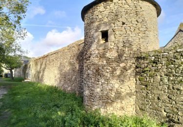
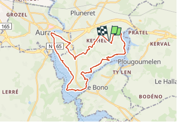
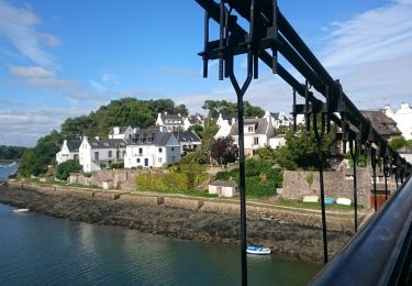
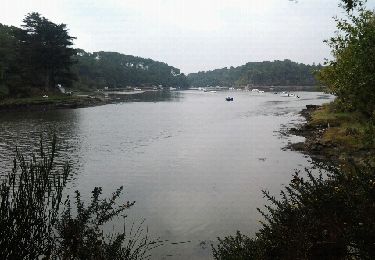
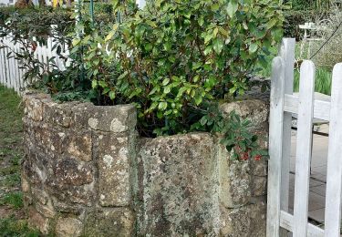
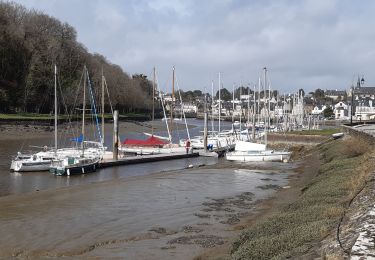
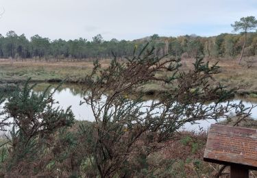
Trail Walking of 17.2 km to be discovered at Brittany, Morbihan, Auray. This trail is proposed by dmj41.
Description
Boucle des 2 rivières autour de Pluneret (56) en passant par la chapelle Ste Avoye
Départ/Arrivée : Parking Le Téno, 26-27 Rte de Kerchican, 56400 Pluneret
Positioning
Country:
France
Region :
Brittany
Department/Province :
Morbihan
Municipality :
Auray
Location:
Unknown
Start:(Dec)
Start:(UTM)
502005 ; 5278968 (30T) N.
Comments
Trails nearby
![Trail Walking Le Bono - Du Bono à la Chapelle de Saint-Avoye - Photo](https://media.geolcdn.com/t/375/260/ext.jpg?maxdim=2&url=https%3A%2F%2Fservices.sitytrail.com%2FGeolivesWS%2FDownloadMedia.ashx%3FTrailID%3D455675%26Media%3Dfix__20150807180035.jpg)
![Walking Walking](https://static1.geolcdn.com/sitytour/trail-icons/101.png)
Du Bono à la Chapelle de Saint-Avoye
Walking
Easy
(1)
Le Bono,
Brittany,
Morbihan,
France
![](/images/other/stat-length.png)
8 km | 9.3 km-effort
2h 47min
![](https://static1.geolcdn.com/siteimages/upload/files/16400158638029165_repeat_loop_refresh_sync_direction_icon.png)
Yes
![Trail Walking Pluneret - st Avoye - Photo](https://media.geolcdn.com/t/375/260/ext.jpg?maxdim=2&url=https%3A%2F%2Fservices.sitytrail.com%2FGeolivesWS%2FDownloadMedia.ashx%3FTrailID%3D159588%26Media%3D20121024110349.jpeg)
![Walking Walking](https://static1.geolcdn.com/sitytour/trail-icons/101.png)
![Trail Walking Sainte-Anne-d'Auray - PR_56_Ste-Anne-D-Auray_AA_01_Circuit1b_A-Deux-Pas-De-Chez-Nous_20340228 - Photo](https://media.geolcdn.com/t/375/260/9ca0d22d-7363-461d-90e6-7e573db31e48.jpg&format=jpg&maxdim=2)
![Walking Walking](https://static1.geolcdn.com/sitytour/trail-icons/101.png)
PR_56_Ste-Anne-D-Auray_AA_01_Circuit1b_A-Deux-Pas-De-Chez-Nous_20340228
Walking
Medium
Sainte-Anne-d'Auray,
Brittany,
Morbihan,
France
![](/images/other/stat-length.png)
10.6 km | 11.9 km-effort
2h 41min
![](https://static1.geolcdn.com/siteimages/upload/files/16400158638029165_repeat_loop_refresh_sync_direction_icon.png)
Yes
![Trail Walking Pluneret - PR_56_Pluneret_EA_06_Circuit1b_Tro-Ar-Vourch_20240227 - Photo](https://media.geolcdn.com/t/375/260/5d6bdb50-6a7c-4d72-8e80-1296b3e69841.jpg&format=jpg&maxdim=2)
![Walking Walking](https://static1.geolcdn.com/sitytour/trail-icons/101.png)
PR_56_Pluneret_EA_06_Circuit1b_Tro-Ar-Vourch_20240227
Walking
Very easy
Pluneret,
Brittany,
Morbihan,
France
![](/images/other/stat-length.png)
7.3 km | 8.2 km-effort
1h 51min
![](https://static1.geolcdn.com/siteimages/upload/files/16400158638029165_repeat_loop_refresh_sync_direction_icon.png)
Yes
![Trail Walking Plougoumelen - PR_56_Plougoumelen_CA_03_Circuit4a_Du-Boterff_20231011 - Photo](https://media.geolcdn.com/t/375/260/d3c418c5-7ec8-4dd5-81ed-a4f492fa39d3.jpg&format=jpg&maxdim=2)
![Walking Walking](https://static1.geolcdn.com/sitytour/trail-icons/101.png)
PR_56_Plougoumelen_CA_03_Circuit4a_Du-Boterff_20231011
Walking
Easy
Plougoumelen,
Brittany,
Morbihan,
France
![](/images/other/stat-length.png)
10 km | 11.8 km-effort
2h 40min
![](https://static1.geolcdn.com/siteimages/upload/files/16400158638029165_repeat_loop_refresh_sync_direction_icon.png)
Yes
![Trail Walking Auray - port saint goustan,port bono - Photo](https://media.geolcdn.com/t/375/260/12116764-6d8c-4e87-8742-90bc6f2c0827.jpg&format=jpg&maxdim=2)
![Walking Walking](https://static1.geolcdn.com/sitytour/trail-icons/101.png)
port saint goustan,port bono
Walking
Easy
Auray,
Brittany,
Morbihan,
France
![](/images/other/stat-length.png)
14.3 km | 16.5 km-effort
3h 17min
![](https://static1.geolcdn.com/siteimages/upload/files/16400158638029165_repeat_loop_refresh_sync_direction_icon.png)
Yes
![Trail Walking Pluneret - PR_56_Pluneret_AB_04_Circuit1b_Les-Deux-Rivieres_20230221 - Photo](https://media.geolcdn.com/t/375/260/93c0f218-ebed-477b-bd47-1f60865f1de6.jpg&format=jpg&maxdim=2)
![Walking Walking](https://static1.geolcdn.com/sitytour/trail-icons/101.png)
PR_56_Pluneret_AB_04_Circuit1b_Les-Deux-Rivieres_20230221
Walking
Easy
Pluneret,
Brittany,
Morbihan,
France
![](/images/other/stat-length.png)
12.2 km | 13.9 km-effort
2h 52min
![](https://static1.geolcdn.com/siteimages/upload/files/16400158638029165_repeat_loop_refresh_sync_direction_icon.png)
Yes
![Trail Walking Pluneret - PR_56_Pluneret_CA_03_Circuit1b_Anse-Du-Teno_20221120 - Photo](https://media.geolcdn.com/t/375/260/bd8d16df-d91c-4abb-9d2b-d13070c275ca.jpg&format=jpg&maxdim=2)
![Walking Walking](https://static1.geolcdn.com/sitytour/trail-icons/101.png)
PR_56_Pluneret_CA_03_Circuit1b_Anse-Du-Teno_20221120
Walking
Easy
Pluneret,
Brittany,
Morbihan,
France
![](/images/other/stat-length.png)
9.5 km | 10.8 km-effort
2h 19min
![](https://static1.geolcdn.com/siteimages/upload/files/16400158638029165_repeat_loop_refresh_sync_direction_icon.png)
Yes
![Trail Walking Le Bono - 56-Bono-9km - Photo](https://media.geolcdn.com/t/375/260/d693d4bc-73fd-4dca-9046-40ecea606032.jpg&format=jpg&maxdim=2)
![Walking Walking](https://static1.geolcdn.com/sitytour/trail-icons/101.png)