9 km | 17.7 km-effort
jas du Mathieu
saintclair04
User
Length
6 km
Max alt
1434 m
Uphill gradient
290 m
Km-Effort
9.9 km
Min alt
1143 m
Downhill gradient
295 m
Boucle
Yes
Creation date :
2024-10-30 09:29:28.484
Updated on :
2024-10-30 09:29:31.819
2h14
Difficulty : Medium
FREE GPS app for hiking
About
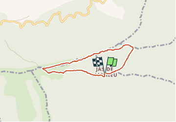
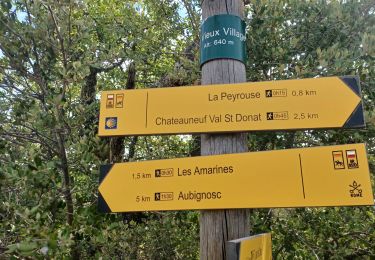
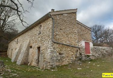
Trail Walking of 6 km to be discovered at Provence-Alpes-Côte d'Azur, Alpes-de-Haute-Provence, Aubignosc. This trail is proposed by saintclair04.
Positioning
Country:
France
Region :
Provence-Alpes-Côte d'Azur
Department/Province :
Alpes-de-Haute-Provence
Municipality :
Aubignosc
Location:
Unknown
Start:(Dec)
Start:(UTM)
732576 ; 4888436 (31T) N.
Comments
Trails nearby
PEIPIN . PAR LES CHEMINS ABANDONNÉS DE PEIPIN O L S
Walking
Medium
(1)
Peipin,
Provence-Alpes-Côte d'Azur,
Alpes-de-Haute-Provence,
France
2h 46min
Yes
AUBIGNOSC. Vieil Chateau Neuf , canyons o l m s
Walking
Easy
(1)
Aubignosc,
Provence-Alpes-Côte d'Azur,
Alpes-de-Haute-Provence,
France
12.6 km | 17.6 km-effort
3h 33min
Yes
AUBIGNOSC . LE PETIT COLORADO . O L S
Walking
Medium
(1)
Aubignosc,
Provence-Alpes-Côte d'Azur,
Alpes-de-Haute-Provence,
France
8.3 km | 11.3 km-effort
2h 36min
Yes
CHÂTEAU NEUF VAL SAINT DONAT. Circuit des bories o l s
Walking
Medium
(1)
Châteauneuf-Val-Saint-Donat,
Provence-Alpes-Côte d'Azur,
Alpes-de-Haute-Provence,
France
6.6 km | 9.6 km-effort
1h 57min
Yes
CHÂTEAU NEUF VAL SAINT DONAT . Vieux village , voie Romaine o l s o
Walking
Easy
(1)
Châteauneuf-Val-Saint-Donat,
Provence-Alpes-Côte d'Azur,
Alpes-de-Haute-Provence,
France
7.8 km | 10 km-effort
1h 57min
Yes
VALBELLE . Chemin de Sara o l s
Walking
Medium
(1)
Valbelle,
Provence-Alpes-Côte d'Azur,
Alpes-de-Haute-Provence,
France
13.2 km | 19.7 km-effort
4h 47min
Yes
Bergeries en pierres sèches - Châteauneuf Val Saint Donat
Walking
Medium
(2)
Châteauneuf-Val-Saint-Donat,
Provence-Alpes-Côte d'Azur,
Alpes-de-Haute-Provence,
France
7.6 km | 11.2 km-effort
2h 19min
Yes
PEIPIN . aubignosc. Le vieux village Château Neuf Val Saint Donnât par GR7 o...
Walking
Easy
(1)
Peipin,
Provence-Alpes-Côte d'Azur,
Alpes-de-Haute-Provence,
France
13.5 km | 18.3 km-effort
3h 44min
Yes
05 chap st Pons col sumiou zel
Walking
Difficult
Valbelle,
Provence-Alpes-Côte d'Azur,
Alpes-de-Haute-Provence,
France
11 km | 21 km-effort
5h 40min
Yes
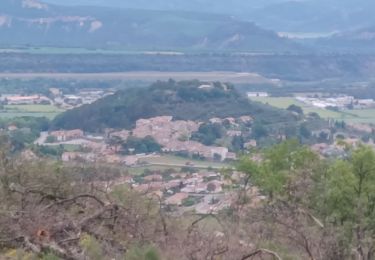
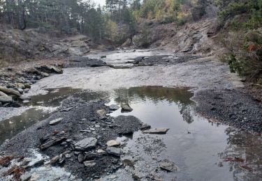
belle vue sur les Alpes. terrain un peu caillouteux