


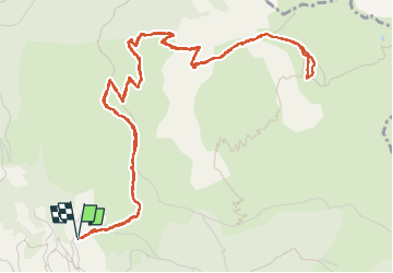

8.8 km | 14.3 km-effort

User


FREE GPS app for hiking
 SityTrail
IGN / Geographical institutes
SityTrail World
The world is yours!
Trail Walking of 8.3 km to be discovered at New Aquitaine, Pyrénées-Atlantiques, Bedous. This trail is proposed by bedous.
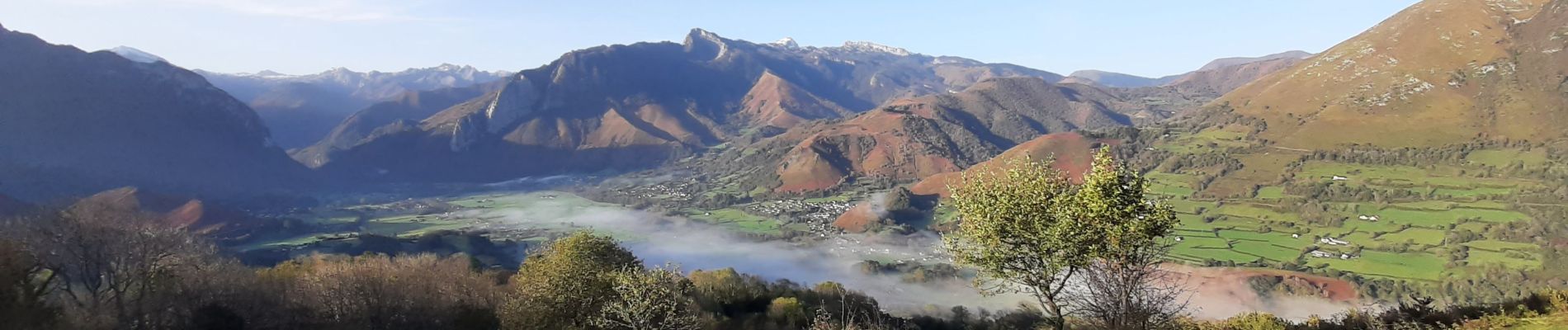
Randonnée de niveau IBP 90 mais magnifiques vues sur la vallée d'Aspe, sur Bedous....Puis du haut du plateau vue jusqu'à Oloron Sainte Marie et plus loin.....


Walking

Walking

Walking

On foot

On foot

On foot

On foot
On foot
On foot