Trail Walking Boigneville - De Boigneville à Boutigny (sens sud-nord) - Photo

De Boigneville à Boutigny (sens sud-nord)

 mmx007
mmx007

User

© OpenStreetMap contributors
Length
Length
22 km
Max alt
Max alt
139 m
Uphill gradient
Uphill gradient
271 m
Km-Effort
Km-Effort  
26 km
Min alt
Min alt
61 m
Downhill gradient
Downhill gradient
280 m
Boucle
Boucle
No
Creation date :
2015-06-01 00:00:00.0
Updated on :
2015-06-01 00:00:00.0

(0 Reviews)

Walking
Walking
5h32
Difficulty : Easy

Scan this QR Code to open this trail in the SityTrail application

FREE GPS app for hiking

Logo SityTrail SityTrail

IGN / Geographical institutes

Download SityTrail from the App Store Download SityTrail from Google Play

Logo SityTrail SityTrail World

The world is yours!

Download SityTrail from the App Store Download SityTrail from Google Play Download SityTrail on Huawei AppGallery

About

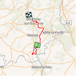
Trail Walking of 22 km to be discovered at Ile-de-France, Essonne, Boigneville. This trail is proposed by mmx007.

Description

Itinéraire de Boigneville à Boutigny par le GR 1 et les PR 8 et 53, en traversant les bois de Saint Eloy et de Malabri. RER D.
(On marche du sud vers le nord, en sens inverse vs le topo guide de la FFRP, avec le soleil dans le dos et la possibilité de déjeuner en forêt à l'ombre après 13 ou 15 kms de marche).
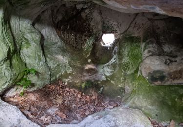
Voir POIs pour plus d'informations sur les "choses à voir" (dont 1 menhir), et les particularités du tracé.
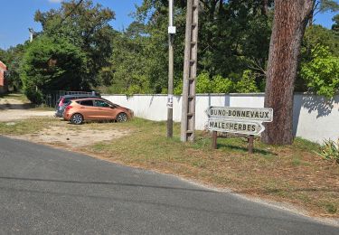
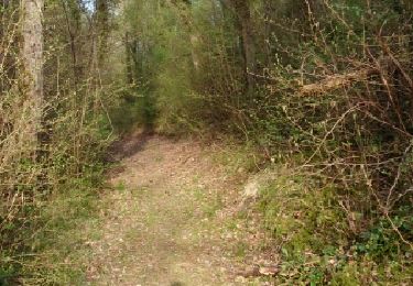
Cet itinéraire (suivi en mai 2015) privilégie les chemins et sentiers non goudronnés, mais on peut probablement faire encore mieux en évitant Buno Bonnevaux et en empruntant le GR 111 à droite après le moulin Paillard.

Elevation profile

Points of interest

Point of interest Buno-Bonnevaux - Le polissoir de Buno-Bonnevaux - Photo
mmx007
Point of interest Milly-la-Forêt - Le menhir de la Pierre Droite - Photo
mmx007
Point of interest Buno-Bonnevaux - Chemin de Grimery - Photo
mmx007
BUNO-BONNEVAUX 
Point of interest Buno-Bonnevaux - Attention - Photo
mmx007
BUNO-BONNEVAUX 
Point of interest Buno-Bonnevaux - Attention variante - Photo
mmx007
BUNO-BONNEVAUX 
Point of interest Buno-Bonnevaux - Planneurs - Aérodrome de Buno - Photo
mmx007
Point of interest Milly-la-Forêt - Attention variante vers les PR 8 et 53 - Photo
mmx007
Point of interest Milly-la-Forêt - Attention traversée dangeureuse - Photo
mmx007
Point of interest Milly-la-Forêt - Jonction entre le PR 8 et le PR 53 - Photo
mmx007
Point of interest Buno-Bonnevaux - Jonction avec le GR 111 - Photo
mmx007
BUNO-BONNEVAUX 
Point of interest Buno-Bonnevaux - Jonction avec le GR - Photo
mmx007
BUNO-BONNEVAUX 
Point of interest Boutigny-sur-Essonne - Km 18.2 - Photo
mmx007
BOUTIGNY-SUR-ESSONNE 
Point of interest Boutigny-sur-Essonne - Km 21  - Photo
mmx007
BOUTIGNY-SUR-ESSONNE 
Point of interest Boutigny-sur-Essonne - Attention marche le long d'une route - Photo
mmx007
BOUTIGNY-SUR-ESSONNE 

Positioning

Country:
France
Region :
Ile-de-France
Department/Province :
Essonne
Municipality :
Boigneville
Location:
Unknown
Start:(UTM)
453979 ; 5354524 (31U) N.

Trails nearby

Trail Walking Buno-Bonnevaux - Buno-Bonnevaux - Photo
Walking
guydu41

Walking

Medium
Buno-Bonnevaux, Ile-de-France, Essonne, France
7.7 km | 9.7 km-effort
2h 11min
Yes
Trail Walking Buno-Bonnevaux - Buneau-Bonnevaux Menhir de la pierre droite  - Photo
Walking
jll7513

Walking

Easy
Buno-Bonnevaux, Ile-de-France, Essonne, France
12.2 km | 13.9 km-effort
3h 9min
Yes
Trail Walking Buno-Bonnevaux - buno bonneveau - Photo
Walking
BrassensJC

Walking

Very easy
Buno-Bonnevaux, Ile-de-France, Essonne, France
3.4 km | 4.2 km-effort
58min
Yes
Trail Mountain bike Prunay-sur-Essonne - VTT 25 juin 2024 - Photo
Mountain bike
poozix

Mountain bike

Easy
Prunay-sur-Essonne, Ile-de-France, Essonne, France
13 km | 14.3 km-effort
1h 32min
Yes
Trail Canoe - kayak Prunay-sur-Essonne - 16 jun 2024 - Photo
Canoe - kayak
poozix

Canoe - kayak

Very easy
Prunay-sur-Essonne, Ile-de-France, Essonne, France
10.9 km | 12.1 km-effort
51min
Yes
Trail Mountain bike Prunay-sur-Essonne - 17 oct 2923  - Photo
Mountain bike
poozix

Mountain bike

Very easy
Prunay-sur-Essonne, Ile-de-France, Essonne, France
13.4 km | 15 km-effort
1h 31min
Yes
Trail Mountain bike Prunay-sur-Essonne - VTT 26 juin 2023 - Photo
Mountain bike
poozix

Mountain bike

Medium
Prunay-sur-Essonne, Ile-de-France, Essonne, France
18.9 km | 21 km-effort
2h 10min
Yes
Trail Walking Boigneville - Boigneville - Photo
Walking
JacquesMARQUET

Walking

Difficult
Boigneville, Ile-de-France, Essonne, France
12.9 km | 14.8 km-effort
3h 17min
Yes
Trail Walking Buno-Bonnevaux - buno bonneveau - Photo
Walking
Christophe Jarry

Walking

Difficult
Buno-Bonnevaux, Ile-de-France, Essonne, France
11.6 km | 12.9 km-effort
2h 51min
Yes


Close
My subscriptions