


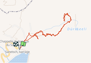

13.3 km | 20 km-effort


User


FREE GPS app for hiking
 SityTrail
IGN / Geographical institutes
SityTrail World
The world is yours!
Trail Walking of 3 km to be discovered at Valais/Wallis, Sion, Savièse. This trail is proposed by jeff2.
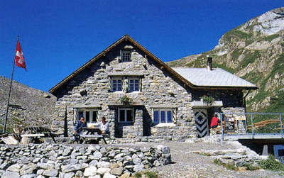
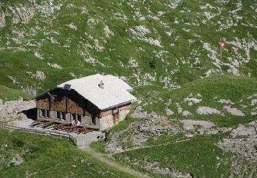
J'ai réussi, depuis le temps que je regarde les cartes, Google earth, etc... Je l'ai trouvé. Route assez longue jusqu'au lac, puis un petit aller retour au milieu de la montagne et dans les nuages. Au bout du chemin une découverte aérienne pour y accéder. Prochaine fois j'y passe la nuit.


Nordic walking
Walking
Walking

Walking
Walking
Walking
Walking
Walking
Walking