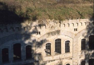
18 km | 22 km-effort
Le temps perdu
José800
User
Length
11.5 km
Max alt
168 m
Uphill gradient
198 m
Km-Effort
14.1 km
Min alt
54 m
Downhill gradient
198 m
Boucle
Yes
Creation date :
2024-10-22 13:41:45.394
Updated on :
2024-10-22 13:43:58.212
3h12
Difficulty : Difficult
FREE GPS app for hiking
About
Trail Walking of 11.5 km to be discovered at Hauts-de-France, Aisne, Chassemy. This trail is proposed by José800.
Positioning
Country:
France
Region :
Hauts-de-France
Department/Province :
Aisne
Municipality :
Chassemy
Location:
Unknown
Start:(Dec)
Start:(UTM)
536706 ; 5469979 (31U) N.
Comments
Trails nearby
Fort de condé - chivres
Walking
Very difficult
(1)
Chivres-Val,
Hauts-de-France,
Aisne,
France
4h 48min
Yes
11 la fontaine St ouen
Walking
Medium
Chivres-Val,
Hauts-de-France,
Aisne,
France
14.1 km | 17.5 km-effort
3h 53min
Yes
Autour du fort de Condé
Walking
Very easy
Chivres-Val,
Hauts-de-France,
Aisne,
France
939 m | 999 m-effort
Unknown
Yes
Chivres Val - La Fontaine de St Ouen
Walking
Medium
Chivres-Val,
Hauts-de-France,
Aisne,
France
12 km | 15.1 km-effort
4h 0min
No
Chassemy - Le temps perdu
Walking
Medium
Chassemy,
Hauts-de-France,
Aisne,
France
14.3 km | 17.5 km-effort
3h 45min
Yes
La Folie
Walking
Very difficult
(1)
Braine,
Hauts-de-France,
Aisne,
France
8.4 km | 10.6 km-effort
3h 0min
Yes
Les échauguettes
Walking
Very difficult
Couvrelles,
Hauts-de-France,
Aisne,
France
9.4 km | 12 km-effort
3h 0min
Yes
Les roches de l'Abondin
Walking
Very difficult
(1)
Vailly-sur-Aisne,
Hauts-de-France,
Aisne,
France
9.8 km | 13.2 km-effort
3h 0min
Yes
Le fort de Condé
Walking
Very difficult
Missy-sur-Aisne,
Hauts-de-France,
Aisne,
France
10.7 km | 13.5 km-effort
3h 0min
Yes