plateau de blu SityTrail > Trails > Outdoor > France > Grand Est > Aube > Saint-Usage SityTrail > Trails > Outdoor > France > Grand Est > Aube > Saint-Usage plateau de blu Novomarquiens User 3D © OpenStreetMap contributors Length 6.5 km Max alt 350 m Uphill gradient 97 m Km-Effort 7.8 km Min alt 269 m Downhill gradient 96 m Boucle Yes Creation date : 2024-10-14 08:26:05.222 Updated on : 2024-10-14 11:50:24.42 (0 Reviews) Walking 3h23 Difficulty : Medium FREE GPS app for hiking SityTrail IGN / Geographical institutes SityTrail World The world is yours! About 
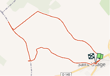
Trail Walking of 6.5 km to be discovered at Grand Est, Aube, Saint-Usage. This trail is proposed by Novomarquiens. Description randonnée pédestre dans les vignes Legends | More details (PDF) Elevation profile Legends > 15% 15% - 10% 10% - 5% flat 5% - 10% 10% - 15% 15% - 30% > 30% Positioning Country: France Region : Grand Est Department/Province : Aube Municipality : Saint-Usage Location: Unknown Start:(Dec) 48.1000299 / 4.6086181 Start:(UTM) 619762 ; 5328670 (31U) N. Comments Please log in to post a review or rate the element Trails nearby heb Essoyes Walking Easy Noé-les-Mallets, Grand Est, Aube, France 24 km | 30 km-effort 6h 32min Yes iznogud Essoye Châtillon sur Seine Walking Very difficult Essoyes, Grand Est, Aube, France 31 km | 38 km-effort 9h 58min No