


jylbalans Kyrgyzstan

kenleggat
User
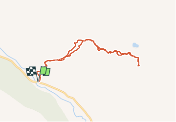

Length
10.3 km

Max alt
2657 m

Uphill gradient
553 m
Km-Effort
17.6 km

Min alt
2112 m

Downhill gradient
552 m
Boucle
Yes
Creation date :
2024-10-04 03:32:50.863
Updated on :
2024-10-05 09:06:36.216
5h03
Difficulty : Medium

FREE GPS app for hiking
 SityTrail
IGN / Geographical institutes
SityTrail World
The world is yours!
About
Trail Walking of 10.3 km to be discovered at Issyk-Kul Region. This trail is proposed by kenleggat.
Positioning
Country:
Kyrgyzstan
Region :
Issyk-Kul Region
Department/Province :
Unknown
Municipality :
Unknown
Location:
Unknown
Start:(Dec)
Start:(UTM)
333743 ; 4721962 (44T) N.
Comments
Trails nearby