Trail Walking Bonac-Irazein - Pic de Courbayran et cabane de Roques - Photo

Pic de Courbayran et cabane de Roques

 chrisgps
chrisgps

User

© OpenStreetMap contributors
Length
Length
15.9 km
Max alt
Max alt
1644 m
Uphill gradient
Uphill gradient
998 m
Km-Effort
Km-Effort  
29 km
Min alt
Min alt
705 m
Downhill gradient
Downhill gradient
998 m
Boucle
Boucle
Yes
Creation date :
2024-10-03 06:53:14.324
Updated on :
2024-10-04 21:07:14.788

(0 Reviews)

Walking
Walking
6h37
Difficulty : Very difficult

Scan this QR Code to open this trail in the SityTrail application

FREE GPS app for hiking

Logo SityTrail SityTrail

IGN / Geographical institutes

Download SityTrail from the App Store Download SityTrail from Google Play

Logo SityTrail SityTrail World

The world is yours!

Download SityTrail from the App Store Download SityTrail from Google Play Download SityTrail on Huawei AppGallery

About

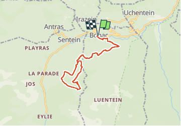
Trail Walking of 15.9 km to be discovered at Occitania, Ariège, Bonac-Irazein. This trail is proposed by chrisgps.

Description

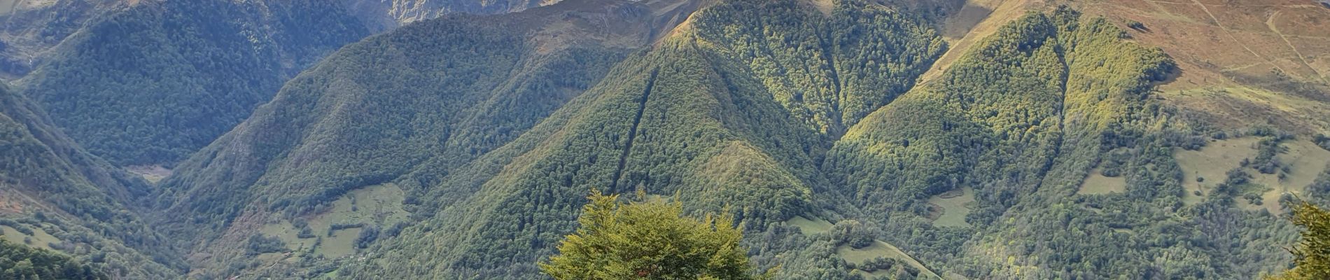
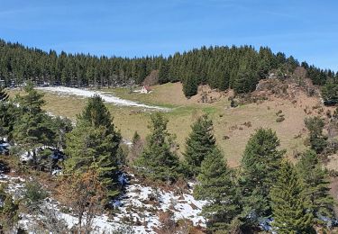
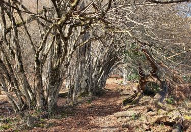
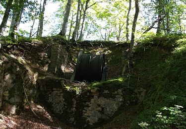
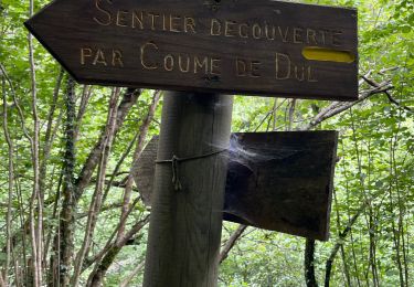
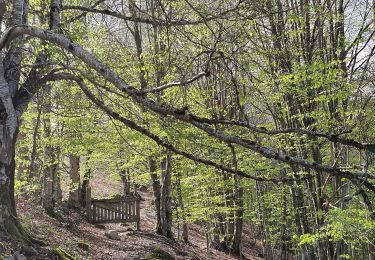
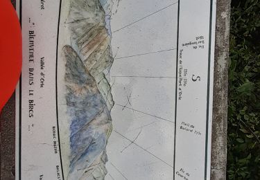
au départ de Bonac, (aire du camping-car) en suivant la variante GR10 qui déroule "les versants Nord et ouest du Pic", par un chemin agréable, long et à couvert. Un peu après la sortie de la foret, nous avons opté pour une montée directe pleine pente pour retrouver la sente menant à la cabane de Roques. Les uns sont allés, en A/R au Pic de Courbayan, et du  sommet, la descente s'est faite en suivant le chemin passant par les 2 fontaines et en longeant la foret en plongeant au point 1500 tout droit, sur pente raide parfois, pour aboutir à une ancienne piste qui nous ramène sur le chemin de la montée (variante gr10).

Elevation profile

Photos

Positioning

Country:
France
Region :
Occitania
Department/Province :
Ariège
Municipality :
Bonac-Irazein
Location:
Unknown
Start:(UTM)
334535 ; 4749096 (31T) N.

Trails nearby

Trail Walking Arrien-en-Bethmale - Les granges de la Serre depuis Tournac-La Bouche. - Photo
Walking
chrisgps

Walking

Medium
(1)
Arrien-en-Bethmale, Occitania, Ariège, France
15 km | 26 km-effort
6h 39min
Yes
Trail Walking Sentein - M008-Frechendech à Etang ARAING - Photo
Walking
Polo-31

Walking

Difficult
(1)
Sentein, Occitania, Ariège, France
24 km | 44 km-effort
10h 0min
Yes
Trail Walking Sentein - Araing Crabère - Photo
Walking
Gepeto_22

Walking

Difficult
(2)
Sentein, Occitania, Ariège, France
32 km | 63 km-effort
9h 49min
No
Trail Walking Salsein - Cabane et pic de l'Arraing depuis Salsein - Photo
Walking
chrisgps

Walking

Medium
Salsein, Occitania, Ariège, France
11.7 km | 21 km-effort
4h 43min
Yes
Trail Walking Bonac-Irazein - tunnels du Biros ou sentier Decauville - Photo
Walking
chrisgps

Walking

Very difficult
Bonac-Irazein, Occitania, Ariège, France
17.8 km | 29 km-effort
6h 35min
Yes
Trail Walking Bonac-Irazein - Sentier du port d’Orle - col du Tuc - Photo
Walking
altaya

Walking

Easy
Bonac-Irazein, Occitania, Ariège, France
13.7 km | 27 km-effort
6h 20min
Yes
Trail Walking Arrien-en-Bethmale - Les granges de la Serre depuis Tournac-Bouche. - Photo
Walking
chrisgps

Walking

Medium
Arrien-en-Bethmale, Occitania, Ariège, France
14.6 km | 25 km-effort
7h 33min
Yes
Trail On foot Bordes-Uchentein - Étangs Long et Rond - Photo
On foot
GUIDE+

On foot

Difficult
Bordes-Uchentein, Occitania, Ariège, France
15.8 km | 36 km-effort
8h 7min
No
Trail Walking Balacet - Pic de l'Arraing - Photo
Walking
counoise

Walking

Medium
Balacet, Occitania, Ariège, France
11.9 km | 24 km-effort
4h 7min
Yes


Close
My subscriptions