![](/images/other/stat-length.png)
![Trail Walking Coteaux-sur-Loire - Saint-Patrice les Prés Bédoué - GRP Étang Chêne Meunier Ingrandes-de-Touraine - 20.4km 315m 4h35 (1h10) - 2024 10 03 - Photo](https://media.geolcdn.com/t/1900/400/3d1e0486-a9fa-4b9a-9781-086219041449.jpg&format=pjpeg&maxdim=2)
Saint-Patrice les Prés Bédoué - GRP Étang Chêne Meunier Ingrandes-de-Touraine - 20.4km 315m 4h35 (1h10) - 2024 10 03
Orcal37
User GUIDE
![Length](/images/other/stat-length.png)
Length
20 km
![Max alt](https://static1.geolcdn.com/siteimages/upload/files/1508320355ic_sort_altitude_max_24dp.png)
Max alt
119 m
![Uphill gradient](https://static1.geolcdn.com/siteimages/upload/files/1508320355ic_sort_den_pos_24dp.png)
Uphill gradient
318 m
![Km-Effort](/images/other/stat-length.png)
Km-Effort
25 km
![Min alt](https://static1.geolcdn.com/siteimages/upload/files/1508320355ic_sort_altitude_min_24dp.png)
Min alt
31 m
![Downhill gradient](https://static1.geolcdn.com/siteimages/upload/files/1508320355ic_sort_den_neg_24dp.png)
Downhill gradient
319 m
![Boucle](https://static1.geolcdn.com/siteimages/upload/files/16400158638029165_repeat_loop_refresh_sync_direction_icon.png)
Boucle
Yes
Creation date :
2024-10-03 09:02:27.377
Updated on :
2024-10-03 18:39:50.371
![Walking](https://static1.geolcdn.com/sitytour/trail-icons/101.png)
4h35
Difficulty : Easy
![Scan this QR Code to open this trail in the SityTrail application](https://capi.geolives.com/qq0zvz2zws4bq2lad0pu/sitytour/trails/4214954/qr.png?size=200)
FREE GPS app for hiking
About
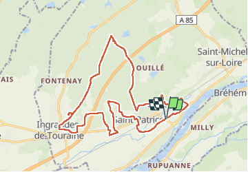
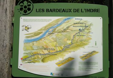
Trail Walking of 20 km to be discovered at Centre-Loire Valley, Indre-et-Loire, Coteaux-sur-Loire. This trail is proposed by Orcal37.
Description
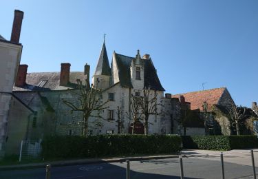
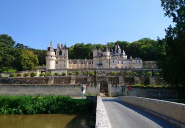
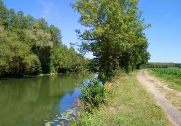
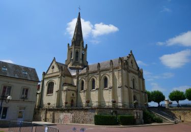
Saint-Patrice les Prés Bédoué - Étang du Chêne de Meunier - Ingrandes-de-Touraine - via GRP Coteaux de Bourgueil - 20.4km 315m 4h35 (1h10) - 2024 10 03
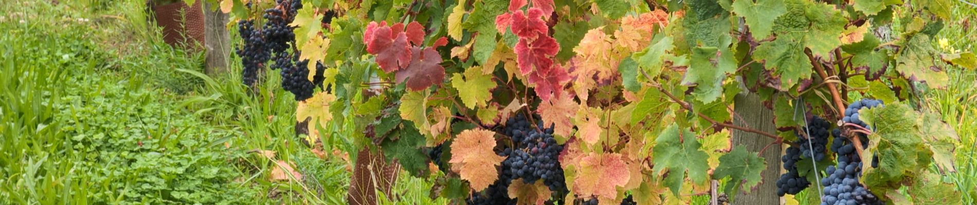
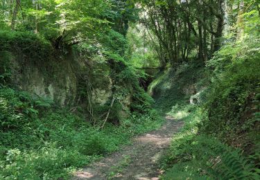
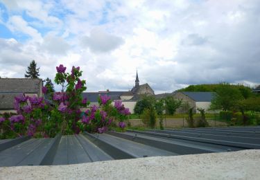
Positioning
Country:
France
Region :
Centre-Loire Valley
Department/Province :
Indre-et-Loire
Municipality :
Coteaux-sur-Loire
Location:
Saint-Patrice
Start:(Dec)
Start:(UTM)
297370 ; 5240463 (31T) N.
Comments
Trails nearby
![Trail Walking Rivarennes - Rivarennes - Zig zag GR3 Cheillé - 23.4km 405m 5h05 (50mn) - 2024 06 09 - Photo](https://media.geolcdn.com/t/375/260/a700836a-a1be-4ab5-8f09-42ab101fa387.jpg&format=jpg&maxdim=2)
![Walking Walking](https://static1.geolcdn.com/sitytour/trail-icons/101.png)
Rivarennes - Zig zag GR3 Cheillé - 23.4km 405m 5h05 (50mn) - 2024 06 09
Walking
Medium
Rivarennes,
Centre-Loire Valley,
Indre-et-Loire,
France
![](/images/other/stat-length.png)
23 km | 29 km-effort
5h 5min
![](https://static1.geolcdn.com/siteimages/upload/files/16400158638029165_repeat_loop_refresh_sync_direction_icon.png)
Yes
![Trail Walking Coteaux-sur-Loire - Saint-Patrice - GRP Coteaux de Bourgueil - 24.7km 300m 5h45 (45mn) - 2023 04 26 - Photo](https://media.geolcdn.com/t/375/260/9c145635-efa6-434e-8c31-c2ea338ba684.jpg&format=jpg&maxdim=2)
![Walking Walking](https://static1.geolcdn.com/sitytour/trail-icons/101.png)
Saint-Patrice - GRP Coteaux de Bourgueil - 24.7km 300m 5h45 (45mn) - 2023 04 26
Walking
Medium
Coteaux-sur-Loire,
Centre-Loire Valley,
Indre-et-Loire,
France
![](/images/other/stat-length.png)
25 km | 29 km-effort
5h 45min
![](https://static1.geolcdn.com/siteimages/upload/files/16400158638029165_repeat_loop_refresh_sync_direction_icon.png)
Yes
![Trail Walking Coteaux-sur-Loire - Saint-Michel-sur-Loire - GRP Coteaux de Bourgueil Saint-Patrice - 21.7km 240m 4h45 (35mn) - 2023 04 19 - Photo](https://media.geolcdn.com/t/375/260/4b4cc327-71a6-4b30-a490-6a61de68d6cc.jpg&format=jpg&maxdim=2)
![Walking Walking](https://static1.geolcdn.com/sitytour/trail-icons/101.png)
Saint-Michel-sur-Loire - GRP Coteaux de Bourgueil Saint-Patrice - 21.7km 240m...
Walking
Easy
Coteaux-sur-Loire,
Centre-Loire Valley,
Indre-et-Loire,
France
![](/images/other/stat-length.png)
22 km | 25 km-effort
4h 45min
![](https://static1.geolcdn.com/siteimages/upload/files/16400158638029165_repeat_loop_refresh_sync_direction_icon.png)
Yes
![Trail Walking Rigny-Ussé - Rigny-Ussé - Bréhémont - 25.7km 110m 5h30 (40mn) - 2021 07 17 - Photo](https://media.geolcdn.com/t/375/260/604f5918-63d0-4ab7-b7d3-aeff46e7ba5a.jpg&format=jpg&maxdim=2)
![Walking Walking](https://static1.geolcdn.com/sitytour/trail-icons/101.png)
Rigny-Ussé - Bréhémont - 25.7km 110m 5h30 (40mn) - 2021 07 17
Walking
Easy
Rigny-Ussé,
Centre-Loire Valley,
Indre-et-Loire,
France
![](/images/other/stat-length.png)
26 km | 27 km-effort
5h 30min
![](https://static1.geolcdn.com/siteimages/upload/files/16400158638029165_repeat_loop_refresh_sync_direction_icon.png)
Yes
![Trail Walking Rivarennes - Rivarennes - Circuit 1 - 18.2km 225m 3h55 - 2020 07 13 - Photo](https://media.geolcdn.com/t/375/260/787eacec-2808-4b7a-b7e4-990b0e9f64fa.jpg&format=jpg&maxdim=2)
![Walking Walking](https://static1.geolcdn.com/sitytour/trail-icons/101.png)
Rivarennes - Circuit 1 - 18.2km 225m 3h55 - 2020 07 13
Walking
Easy
Rivarennes,
Centre-Loire Valley,
Indre-et-Loire,
France
![](/images/other/stat-length.png)
18.2 km | 21 km-effort
3h 55min
![](https://static1.geolcdn.com/siteimages/upload/files/16400158638029165_repeat_loop_refresh_sync_direction_icon.png)
Yes
![Trail Walking Bréhémont - Brehemont - 3.9km 15m 50mn - 2018 02 18 - Photo](https://media.geolcdn.com/t/375/260/3def90f7-e92f-4d79-87ce-f67f5770efe5.jpg&format=jpg&maxdim=2)
![Walking Walking](https://static1.geolcdn.com/sitytour/trail-icons/101.png)
Brehemont - 3.9km 15m 50mn - 2018 02 18
Walking
Very easy
Bréhémont,
Centre-Loire Valley,
Indre-et-Loire,
France
![](/images/other/stat-length.png)
3.9 km | 4.2 km-effort
50min
![](https://static1.geolcdn.com/siteimages/upload/files/16400158638029165_repeat_loop_refresh_sync_direction_icon.png)
Yes
![Trail Walking Bréhémont - brehemont 2 - Photo](https://media.geolcdn.com/t/375/260/c2cbb755-5753-4089-b2b2-4bfee1188a86.jpg&format=jpg&maxdim=2)
![Walking Walking](https://static1.geolcdn.com/sitytour/trail-icons/101.png)
brehemont 2
Walking
Very easy
Bréhémont,
Centre-Loire Valley,
Indre-et-Loire,
France
![](/images/other/stat-length.png)
22 km | 24 km-effort
5h 24min
![](https://static1.geolcdn.com/siteimages/upload/files/16400158638029165_repeat_loop_refresh_sync_direction_icon.png)
Yes
![Trail Horseback riding Coteaux-sur-Loire - 8 septembre 2024. Galop de langeais - Photo](https://media.geolcdn.com/t/375/260/ext.jpg?maxdim=2&url=https%3A%2F%2Fstatic1.geolcdn.com%2Fsiteimages%2Fupload%2Ffiles%2F1524743154cheval.jpg)
![Horseback riding Horseback riding](https://static1.geolcdn.com/sitytour/trail-icons/301.png)
8 septembre 2024. Galop de langeais
Horseback riding
Easy
Coteaux-sur-Loire,
Centre-Loire Valley,
Indre-et-Loire,
France
![](/images/other/stat-length.png)
9.2 km | 10.4 km-effort
1h 56min
![](https://static1.geolcdn.com/siteimages/upload/files/16400158638029165_repeat_loop_refresh_sync_direction_icon.png)
No
![Trail Road bike Bréhémont - Deuxième étape Brehemont Beaulieu les Loches - Photo](https://media.geolcdn.com/t/375/260/ext.jpg?maxdim=2&url=https%3A%2F%2Fstatic1.geolcdn.com%2Fsiteimages%2Fupload%2Ffiles%2F1524743154velo.jpg)
![Road bike Road bike](https://static1.geolcdn.com/sitytour/trail-icons/201.png)
Deuxième étape Brehemont Beaulieu les Loches
Road bike
Easy
Bréhémont,
Centre-Loire Valley,
Indre-et-Loire,
France
![](/images/other/stat-length.png)
74 km | 83 km-effort
6h 47min
![](https://static1.geolcdn.com/siteimages/upload/files/16400158638029165_repeat_loop_refresh_sync_direction_icon.png)
No