Trail Walking Cros - Le pont du diable, en p1rtant du gîte aux milles fleurs - Photo

Le pont du diable, en p1rtant du gîte aux milles fleurs

© OpenStreetMap contributors
Length
Length
9.4 km
Max alt
Max alt
858 m
Uphill gradient
Uphill gradient
207 m
Km-Effort
Km-Effort  
12.2 km
Min alt
Min alt
725 m
Downhill gradient
Downhill gradient
213 m
Boucle
Boucle
Yes
Creation date :
2024-09-30 12:03:59.632
Updated on :
2024-10-02 09:45:34.852

(0 Reviews)

Walking
Walking
2h18
Difficulty : Medium

Scan this QR Code to open this trail in the SityTrail application

FREE GPS app for hiking

Logo SityTrail SityTrail

IGN / Geographical institutes

Download SityTrail from the App Store Download SityTrail from Google Play

Logo SityTrail SityTrail World

The world is yours!

Download SityTrail from the App Store Download SityTrail from Google Play Download SityTrail on Huawei AppGallery

About

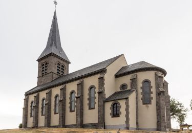
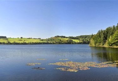
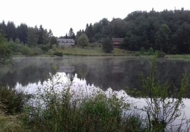
Trail Walking of 9.4 km to be discovered at Auvergne-Rhône-Alpes, Puy-de-Dôme, Cros. This trail is proposed by Thierry0032.

Description

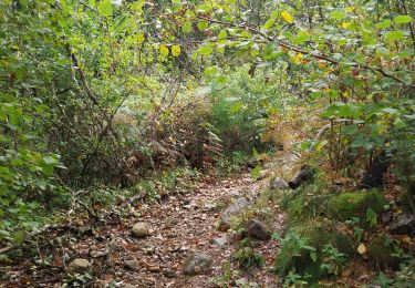
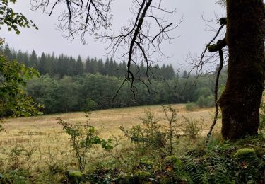
E partant du gîte et en suivant la rivière, il faut prévoir l'équipement adéquat surtout en période pluvieuse. Magnifique promenade où on voit la rivière se déchaîner.

Elevation profile

Photos

Positioning

Country:
France
Region :
Auvergne-Rhône-Alpes
Department/Province :
Puy-de-Dôme
Municipality :
Cros
Location:
Unknown
Start:(UTM)
472417 ; 5032678 (31T) N.

Trails nearby

Trail On foot Saint-Genès-Champespe - Le Lac de la Crégut - Photo
On foot
GUIDE+

On foot

Easy
Saint-Genès-Champespe, Auvergne-Rhône-Alpes, Puy-de-Dôme, France
14 km | 17.7 km-effort
4h 1min
Yes
Trail Walking Trémouille - Cregut_St_Genes_Champespe - Photo
Walking
GUIDE
jagarnier

Walking

Medium
Trémouille, Auvergne-Rhône-Alpes, Cantal, France
15.7 km | 19.8 km-effort
4h 45min
Yes
Trail Walking Cros - Pont du diable 3 - Photo
Walking
Thierry0032

Walking

Difficult
Cros, Auvergne-Rhône-Alpes, Puy-de-Dôme, France
9.5 km | 12.4 km-effort
2h 10min
Yes
Trail Walking Cros - Promenade du gite des milles fleurs, au fil de l'eau. - Photo
Walking
Thierry0032

Walking

Easy
Cros, Auvergne-Rhône-Alpes, Puy-de-Dôme, France
3.7 km | 5 km-effort
1h 24min
Yes
Trail On foot Saint-Donat - Le Bois de Caux - Photo
On foot
GUIDE+

On foot

Easy
Saint-Donat, Auvergne-Rhône-Alpes, Puy-de-Dôme, France
6.7 km | 9.1 km-effort
2h 3min
Yes
Trail On foot Cros - Le Bois de Rochemave - Photo
On foot
GUIDE+

On foot

Easy
Cros, Auvergne-Rhône-Alpes, Puy-de-Dôme, France
5.6 km | 7.5 km-effort
1h 41min
Yes
Trail On foot Bagnols - Ponchet - Photo
On foot
GUIDE+

On foot

Easy
Bagnols, Auvergne-Rhône-Alpes, Puy-de-Dôme, France
8.3 km | 10.7 km-effort
2h 26min
Yes
Trail Walking Lanobre - esparzeloux - Photo
Walking
François Bouvelot

Walking

Very easy
Lanobre, Auvergne-Rhône-Alpes, Cantal, France
7.8 km | 10.7 km-effort
2h 2min
Yes
Trail Walking Saint-Genès-Champespe - lacs - Photo
Walking
trailer.nono

Walking

Very easy
Saint-Genès-Champespe, Auvergne-Rhône-Alpes, Puy-de-Dôme, France
12.3 km | 15.5 km-effort
3h 8min
Yes


Close
My subscriptions