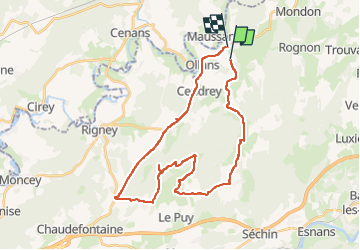
23 km | 28 km-effort
La tour du bois
berruyer
User
Length
32 km
Max alt
503 m
Uphill gradient
632 m
Km-Effort
41 km
Min alt
238 m
Downhill gradient
659 m
Boucle
No
Creation date :
2024-09-29 11:05:41.0
Updated on :
2024-09-29 14:16:52.188
FREE GPS app for hiking
About
Trail of 32 km to be discovered at Bourgogne-Franche-Comté, Doubs, Avilley. This trail is proposed by berruyer.
Description
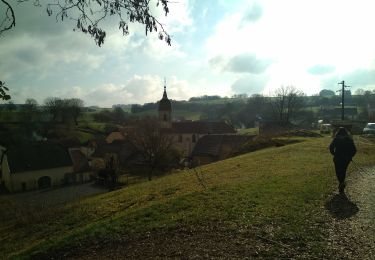
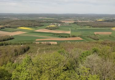
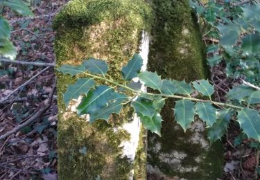
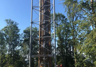
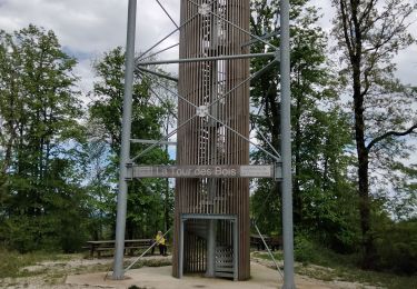
Voir aussi le lavoir. Peu de monde. Route goudronnée et forestière faciles. Belles vues
Positioning
Country:
France
Region :
Bourgogne-Franche-Comté
Department/Province :
Doubs
Municipality :
Avilley
Location:
Unknown
Start:(Dec)
Start:(UTM)
293704 ; 5255429 (32T) N.
Comments
Trails nearby
Montbozon 18 mars 2021 IBP 61
Walking
Medium
Montbozon,
Bourgogne-Franche-Comté,
Haute-Saône,
France
5h 57min
Yes
tour de scay stade du moireau
Walking
Medium
La Tour-de-Sçay,
Bourgogne-Franche-Comté,
Doubs,
France
12.6 km | 17.5 km-effort
3h 37min
Yes
tour de scey stade
Walking
Medium
La Tour-de-Sçay,
Bourgogne-Franche-Comté,
Doubs,
France
13.9 km | 19.9 km-effort
4h 41min
Yes
Le Verjoulot 6 fév 2020 CAF
Walking
Very easy
La Tour-de-Sçay,
Bourgogne-Franche-Comté,
Doubs,
France
19.4 km | 27 km-effort
6h 45min
No
rando tour de scey
Walking
Difficult
La Tour-de-Sçay,
Bourgogne-Franche-Comté,
Doubs,
France
12.9 km | 18.8 km-effort
5h 4min
Yes
La tour des bois par le chemin des éolienne
Walking
La Tour-de-Sçay,
Bourgogne-Franche-Comté,
Doubs,
France
9.9 km | 14.7 km-effort
3h 29min
No
39 Besançon entre Saône & Doubs J 4/6
Bicycle tourism
Medium
Montbozon,
Bourgogne-Franche-Comté,
Haute-Saône,
France
55 km | 64 km-effort
6h 10min
No
tour de scay stade du moireau
Walking
Medium
La Tour-de-Sçay,
Bourgogne-Franche-Comté,
Doubs,
France
12.4 km | 17.7 km-effort
4h 6min
Yes