43 km | 48 km-effort
beb
sylvieschmidt
User
Length
2.7 km
Max alt
14 m
Uphill gradient
24 m
Km-Effort
3 km
Min alt
0 m
Downhill gradient
25 m
Boucle
Yes
Creation date :
2024-09-29 05:56:27.361
Updated on :
2024-09-29 06:23:20.517
25m
Difficulty : Easy
FREE GPS app for hiking
About
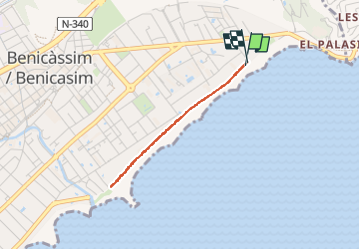
Trail Walking of 2.7 km to be discovered at Valencian Community, Castelló / Castellón, Benicàssim / Benicasim. This trail is proposed by sylvieschmidt.
Description
Benicasim
Positioning
Country:
Spain
Region :
Valencian Community
Department/Province :
Castelló / Castellón
Municipality :
Benicàssim / Benicasim
Location:
Unknown
Start:(Dec)
Start:(UTM)
251043 ; 4438008 (31T) N.
Comments
Trails nearby
Oropesa Burriananova.
Hybrid bike
Easy
Orpesa / Oropesa del Mar,
Valencian Community,
Castelló / Castellón,
Spain
4h 43min
No
huit avril les tours
Walking
Difficult
Benicàssim / Benicasim,
Valencian Community,
Castelló / Castellón,
Spain
14 km | 17 km-effort
6h 32min
Yes
sept avril plage
Walking
Medium
Orpesa / Oropesa del Mar,
Valencian Community,
Castelló / Castellón,
Spain
17.9 km | 21 km-effort
5h 30min
Yes
5 avril tour
Walking
Very easy
Benicàssim / Benicasim,
Valencian Community,
Castelló / Castellón,
Spain
7.8 km | 13.4 km-effort
5h 21min
Yes
erreur 4 avril el bartolo
Walking
Medium
Benicàssim / Benicasim,
Valencian Community,
Castelló / Castellón,
Spain
20 km | 33 km-effort
8h 31min
No
bernicassin Espagne
Walking
Medium
Benicàssim / Benicasim,
Valencian Community,
Castelló / Castellón,
Spain
5.6 km | 10.5 km-effort
2h 23min
Yes