


10.1 km | 13.3 km-effort


Randonnez sur et autour des GR ® wallons (Sentiers de Grande Randonnée). PRO


FREE GPS app for hiking
 SityTrail
IGN / Geographical institutes
SityTrail World
The world is yours!
Trail Walking of 9.3 km to be discovered at Wallonia, Liège, Jalhay. This trail is proposed by GR Rando.
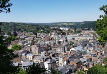
RF-Lg-09 - Dans le bois de Staneu au nord de Spa
Dans quel type de paysage randonnons-nous?
Les deux tiers de la balade vont se dérouler dans la belle forêt ancienne de Staneu qui englobe la petite réserve naturelle du ru de Chawion, constituée d’anciennes prairies de fauche abandonnées. Sa flore, typique des fonds de vallées ardennaises, est très diversifiée.
Quelle difficulté ?
Aucune.
Combien de kilomètres ?
8,5 km.
Sur quel GR randonnons-nous ?
Nous empruntons un tronçon du GR 15 «Monschau – Martelange – Arlon».
Où démarrons-nous ?
À la chapelle N.D. de l’Épine, à Tiège (Ardespine).
Comment y arriver ?
Tiège (carte Michelin n° 534, pli U/19) est à deux pas de l’autoroute E42 (tronçon Battice – Prüm, sortie 8) sur la route Spa – Verviers. Au rond-point principal du village, prendre la direction «Eupen – Jalhay». Au carrefour suivant, au lieu de poursuivre vers la droite dans cette direction (Eupen – Jalhay), tourner à gauche. Au premier embranchement, prendre à droite. Au suivant également. Au carrefour qui suit, virer encore à droite, dépasser une éolienne privée et continuer jusqu’à une petite chapelle blanche à droite. Garer sur le bas-côté (assez large) de la route.
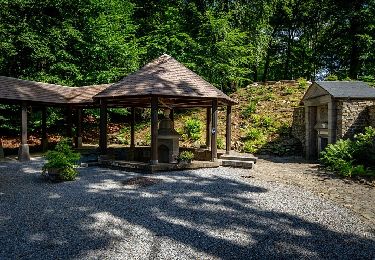
Que découvrons-nous aujourd’hui ?
Nous vous proposons d’aller au musée de la Lessive de Spa (eh oui, de tels musées existent !) à la découverte d’une époque que votre (arrière-) grand-mère a peut-être encore connue !
Quelles sont les cartes IGN de référence ?
Cartes IGN au 1 : 20 000 : «Aywaille – Spa», 49/3-4 et «Sart –Xhoffraix», 50/1-2.
Transports en commun ?
Trois lignes de bus TEC desservent les arrêts «Tiège – Route de Jalhay» et «Tiège –Village», assurant de nombreux services, tant en semaine que le week-end, mais ils sont situés à environ 1,5 km du départ de la randonnée. Il s’agit des lignes : 395 Verviers – Stavelot – Trois-Ponts ; 295 Verviers – Tiège – Spa et 395 Verviers Malmedy – Reuland.

Walking

Walking

Walking

Walking
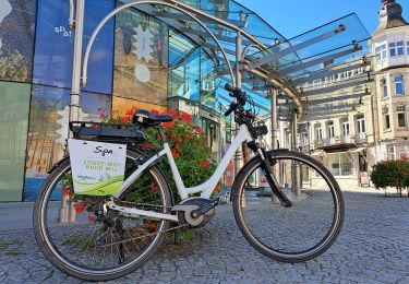
Cycle

Electric bike

Walking
Walking
On foot