Trail Walking Saint-Cyr-des-Gâts - Le Défend St Cyr des Gats - Fontenay Le.Comte - Photo

Le Défend St Cyr des Gats - Fontenay Le.Comte

© OpenStreetMap contributors
Length
Length
18.9 km
Max alt
Max alt
109 m
Uphill gradient
Uphill gradient
220 m
Km-Effort
Km-Effort  
22 km
Min alt
Min alt
6 m
Downhill gradient
Downhill gradient
285 m
Boucle
Boucle
No
Creation date :
2024-09-19 06:46:27.992
Updated on :
2024-09-19 12:08:05.389

(0 Reviews)

Walking
Walking
4h15
Difficulty : Very difficult

Scan this QR Code to open this trail in the SityTrail application

FREE GPS app for hiking

Logo SityTrail SityTrail

IGN / Geographical institutes

Download SityTrail from the App Store Download SityTrail from Google Play

Logo SityTrail SityTrail World

The world is yours!

Download SityTrail from the App Store Download SityTrail from Google Play Download SityTrail on Huawei AppGallery

About

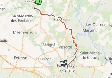
Trail Walking of 18.9 km to be discovered at Pays de la Loire, Vendée, Saint-Cyr-des-Gâts. This trail is proposed by yves le sommer.

Elevation profile

Photos

Positioning

Country:
France
Region :
Pays de la Loire
Department/Province :
Vendée
Municipality :
Saint-Cyr-des-Gâts
Location:
Unknown
Start:(UTM)
662750 ; 5158059 (30T) N.

Trails nearby

Trail sport Cezais - Dimanche 10 mars  - Photo
sport
bobineau

sport

Very easy
Cezais, Pays de la Loire, Vendée, France
26 km | 30 km-effort
Unknown
Yes
Trail Walking Saint-Laurent-de-la-Salle - 5 6 7 8 St Laurent-St Jean d'Y - Photo
Walking
bessonpaul

Walking

Very difficult
Saint-Laurent-de-la-Salle, Pays de la Loire, Vendée, France
121 km | 133 km-effort
8h 43min
No
Trail Mountain bike Cezais - option  - Photo
Mountain bike
petorin

Mountain bike

Easy
Cezais, Pays de la Loire, Vendée, France
474 m | 577 m-effort
18min
No


Close
My subscriptions