Trail Walking Lelin-Lapujolle - Compostelle 2 étapes Lelin Miramont Pomps - Photo

Compostelle 2 étapes Lelin Miramont Pomps

 Nono55
Nono55

User

© OpenStreetMap contributors
Length
Length
78 km
Max alt
Max alt
247 m
Uphill gradient
Uphill gradient
1050 m
Km-Effort
Km-Effort  
92 km
Min alt
Min alt
78 m
Downhill gradient
Downhill gradient
1056 m
Boucle
Boucle
No
Creation date :
2024-09-17 06:05:48.0
Updated on :
2024-09-18 16:35:13.33

(0 Reviews)

Walking
Walking
15h17
Difficulty : Medium

Scan this QR Code to open this trail in the SityTrail application

FREE GPS app for hiking

Logo SityTrail SityTrail

IGN / Geographical institutes

Download SityTrail from the App Store Download SityTrail from Google Play

Logo SityTrail SityTrail World

The world is yours!

Download SityTrail from the App Store Download SityTrail from Google Play Download SityTrail on Huawei AppGallery

About

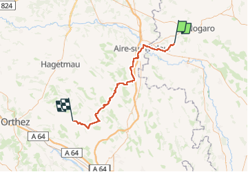
Trail Walking of 78 km to be discovered at Occitania, Gers, Lelin-Lapujolle. This trail is proposed by Nono55.

Description

Début d étape super chemin de sous bois très vallonné puis route route et route heureusement super paysage et beau village

Elevation profile

Positioning

Country:
France
Region :
Occitania
Department/Province :
Gers
Municipality :
Lelin-Lapujolle
Location:
Unknown
Start:(UTM)
730629 ; 4844141 (30T) N.

Trails nearby

Trail Walking Lanne-Soubiran - CC_Velay_FA_24_Lanne-Soubiran_Aire-Adour_20081109 - Photo
Walking
patrickdanilo

Walking

Easy
Lanne-Soubiran, Occitania, Gers, France
25 km | 29 km-effort
6h 15min
No
Trail Walking Lanne-Soubiran - Compostelle 22 1er Etape - Photo
Walking
Anne-Marie Duret

Walking

Easy
Lanne-Soubiran, Occitania, Gers, France
18.8 km | 21 km-effort
4h 51min
No
Trail Walking Lanne-Soubiran - Aire sur l'Adour  - Photo
Walking
cutter

Walking

Easy
Lanne-Soubiran, Occitania, Gers, France
22 km | 25 km-effort
9h 40min
No
Trail Walking Arblade-le-Bas - OR-6947886--Arblade-le-Bas:Airblade le bas-mirmont-sensacq-8 - Photo
Walking
Compostel61

Walking

Very easy
Arblade-le-Bas, Occitania, Gers, France
26 km | 30 km-effort
6h 34min
No
Trail Walking Lelin-Lapujolle - St Jacques Étape 29 réalisée  - Photo
Walking
Jean-MarieFaux

Walking

Very easy
Lelin-Lapujolle, Occitania, Gers, France
24 km | 27 km-effort
6h 9min
No
Trail Nordic walking Lanne-Soubiran - De Miramont-Sensac à Aire-sur-Adour - Photo
Nordic walking
BOUMA

Nordic walking

Medium
Lanne-Soubiran, Occitania, Gers, France
23 km | 26 km-effort
7h 24min
No
Trail Walking Lanne-Soubiran - compostelle lanne Soubiran aire sur Adour  - Photo
Walking
guariso

Walking

Very difficult
Lanne-Soubiran, Occitania, Gers, France
20 km | 23 km-effort
5h 0min
No
Trail Walking Lanne-Soubiran - presbytère-Aire sur l'Adour  - Photo
Walking
bernard.bonafous@free.fr

Walking

Very difficult
Lanne-Soubiran, Occitania, Gers, France
21 km | 23 km-effort
4h 46min
No
Trail Walking Lanne-Soubiran - 70_19_02 Lanne-Soubiran Aire Sur  - Photo
Walking
jeanlucien

Walking

Easy
Lanne-Soubiran, Occitania, Gers, France
19.8 km | 23 km-effort
5h 7min
No


Close
My subscriptions