Trail  Rolampont - 52  LANNES sept 2024 - Photo

52 LANNES sept 2024

© OpenStreetMap contributors
Length
Length
20 km
Max alt
Max alt
445 m
Uphill gradient
Uphill gradient
346 m
Km-Effort
Km-Effort  
25 km
Min alt
Min alt
314 m
Downhill gradient
Downhill gradient
349 m
Boucle
Boucle
Yes
Creation date :
2024-09-18 07:01:00.0
Updated on :
2024-09-18 14:38:09.35

(0 Reviews)


Scan this QR Code to open this trail in the SityTrail application

FREE GPS app for hiking

Logo SityTrail SityTrail

IGN / Geographical institutes

Download SityTrail from the App Store Download SityTrail from Google Play

Logo SityTrail SityTrail World

The world is yours!

Download SityTrail from the App Store Download SityTrail from Google Play Download SityTrail on Huawei AppGallery

About

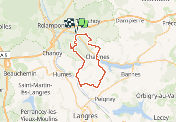
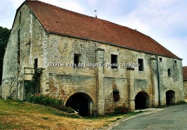
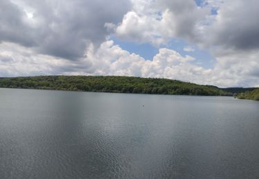
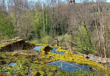
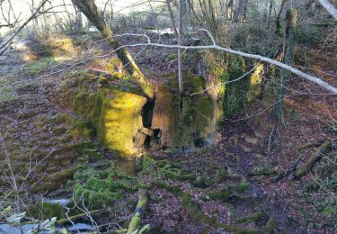
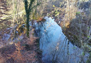
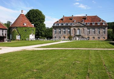
Trail of 20 km to be discovered at Grand Est, Haute-Marne, Rolampont. This trail is proposed by Lucienfilippi.

Description

Mairie Lannes/ charmes/jorquenay/st Menge/mairie Lannes

Elevation profile

Positioning

Country:
France
Region :
Grand Est
Department/Province :
Haute-Marne
Municipality :
Rolampont
Location:
Unknown
Start:(UTM)
673338 ; 5312415 (31T) N.

Trails nearby

Trail Walking Humes-Jorquenay - Boucle 26 km autour de Humes - Photo
Walking
GUIDE
chessyca

Walking

Very difficult
Humes-Jorquenay, Grand Est, Haute-Marne, France
26 km | 33 km-effort
5h 56min
Yes
Trail Mountain bike Rolampont - Rolampont Thivet - Photo
Mountain bike
indianalou

Mountain bike

Medium
Rolampont, Grand Est, Haute-Marne, France
15.7 km | 18.4 km-effort
1h 13min
Yes
Trail Mountain bike Rolampont - Rolampont - Lac de la Liez - Photo
Mountain bike
indianalou

Mountain bike

Easy
Rolampont, Grand Est, Haute-Marne, France
42 km | 46 km-effort
3h 20min
Yes
Trail Cycle Rolampont - De la Suize à l'Aujon - Rolampont - Photo
Cycle
tracegps

Cycle

Difficult
(1)
Rolampont, Grand Est, Haute-Marne, France
53 km | 62 km-effort
4h 30min
Yes
Trail Walking Humes-Jorquenay - Humes saint ciergues - Photo
Walking
Nicole SIMONNET

Walking

Medium
Humes-Jorquenay, Grand Est, Haute-Marne, France
15.8 km | 19.1 km-effort
4h 29min
Yes
Trail Electric bike Rolampont - Vallée des Caivottes, Trimeule et Tufiere  - Photo
Electric bike
zombie52

Electric bike

Medium
Rolampont, Grand Est, Haute-Marne, France
34 km | 42 km-effort
3h 0min
Yes
Trail Mountain bike Rolampont - Source de la Tuffiere - Photo
Mountain bike
delestrai

Mountain bike

Very easy
Rolampont, Grand Est, Haute-Marne, France
21 km | 25 km-effort
3h 15min
Yes
Trail Mountain bike Rolampont - SityTrail - Autour de la Tuffière - Photo
Mountain bike
delestrai

Mountain bike

Medium
Rolampont, Grand Est, Haute-Marne, France
20 km | 25 km-effort
1h 38min
Yes
Trail Mountain bike Humes-Jorquenay - Le Val de Mouche - Humes - Photo
Mountain bike
tracegps

Mountain bike

Very difficult
Humes-Jorquenay, Grand Est, Haute-Marne, France
18.7 km | 23 km-effort
2h 30min
Yes


Close
My subscriptions