Trail Mountain bike Bassillac et Auberoche - boucles change blis et born et eyliac - Photo

boucles change blis et born et eyliac

© OpenStreetMap contributors
Length
Length
44 km
Max alt
Max alt
235 m
Uphill gradient
Uphill gradient
1029 m
Km-Effort
Km-Effort  
57 km
Min alt
Min alt
98 m
Downhill gradient
Downhill gradient
1027 m
Boucle
Boucle
Yes
Creation date :
2015-05-10 00:00:00.0
Updated on :
2015-05-10 00:00:00.0

(0 Reviews)

Mountain bike
Mountain bike
2h05
Difficulty : Medium

Scan this QR Code to open this trail in the SityTrail application

FREE GPS app for hiking

Logo SityTrail SityTrail

IGN / Geographical institutes

Download SityTrail from the App Store Download SityTrail from Google Play

Logo SityTrail SityTrail World

The world is yours!

Download SityTrail from the App Store Download SityTrail from Google Play Download SityTrail on Huawei AppGallery

About

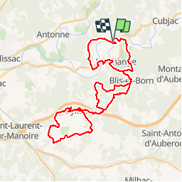
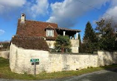
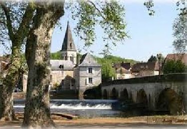
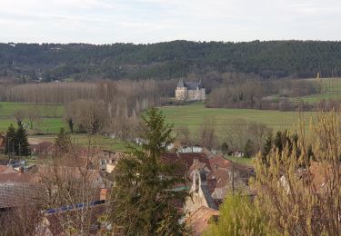
Trail Mountain bike of 44 km to be discovered at New Aquitaine, Dordogne, Bassillac et Auberoche. This trail is proposed by kayakiste15.

Description

1/2 boucle pommiers boucles fonbrejades et eyliac puis 1/2 boucles du roc

Elevation profile

Positioning

Country:
France
Region :
New Aquitaine
Department/Province :
Dordogne
Municipality :
Bassillac et Auberoche
Location:
Le Change
Start:(UTM)
334305 ; 5008254 (31T) N.

Trails nearby

Trail Walking Bassillac et Auberoche - Le Change Roc 9km - Photo
Walking
YV24

Walking

Very easy
(1)
Bassillac et Auberoche, New Aquitaine, Dordogne, France
9.3 km | 12.2 km-effort
2h 43min
Yes
Trail Walking Bassillac et Auberoche - Le Change Pommiers 9km - Photo
Walking
YV24

Walking

Easy
(1)
Bassillac et Auberoche, New Aquitaine, Dordogne, France
9 km | 11.3 km-effort
2h 32min
Yes
Trail On foot Bassillac et Auberoche - Les chabannes - Photo
On foot
Claire Maya

On foot

Easy
Bassillac et Auberoche, New Aquitaine, Dordogne, France
6.3 km | 8.2 km-effort
1h 52min
Yes
Trail Walking Cubjac-Auvézère-Val d'Ans - Le chemin du Causse - Cubjac - Photo
Walking
tracegps

Walking

Medium
Cubjac-Auvézère-Val d'Ans, New Aquitaine, Dordogne, France
7.9 km | 10 km-effort
2h 0min
Yes
Trail Walking Cubjac-Auvézère-Val d'Ans - track - Photo
Walking
houbart

Walking

Very difficult
Cubjac-Auvézère-Val d'Ans, New Aquitaine, Dordogne, France
15.4 km | 19.7 km-effort
4h 28min
Yes
Trail Nordic walking Saint-Vincent-sur-l'Isle - Saint Vincent sur l'Isle MN - Photo
Nordic walking
CC.RIDER

Nordic walking

Medium
Saint-Vincent-sur-l'Isle, New Aquitaine, Dordogne, France
10.3 km | 12.6 km-effort
Unknown
Yes
Trail Nordic walking Saint-Vincent-sur-l'Isle - Saint Vincent sur l'Isle MN - Photo
Nordic walking
CC.RIDER

Nordic walking

Medium
Saint-Vincent-sur-l'Isle, New Aquitaine, Dordogne, France
10.3 km | 12.6 km-effort
Unknown
Yes
Trail Walking Cubjac-Auvézère-Val d'Ans - Boucle des Quatre Paroisses - Photo
Walking
CC.RIDER

Walking

Difficult
Cubjac-Auvézère-Val d'Ans, New Aquitaine, Dordogne, France
12.3 km | 15.9 km-effort
3h 36min
Yes
Trail Walking Escoire - Boucle Escoire, départ de château. - Photo
Walking
swp648

Walking

Easy
Escoire, New Aquitaine, Dordogne, France
12 km | 15.7 km-effort
3h 1min
Yes


Close
My subscriptions