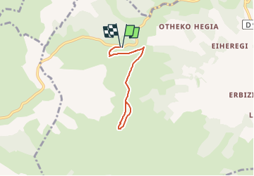
Trail On foot Musculdy - MUSCULDY col d'Osquich journée des presidents et animateurs du 9/11/2024

MUSCULDY col d'Osquich journée des presidents et animateurs du 9/11/2024 "4188158"

 marmotte65
marmotte65

User GUIDE

© OpenStreetMap contributors
Length
Length
5.9 km
Max alt
Max alt
701 m
Uphill gradient
Uphill gradient
229 m
Km-Effort
Km-Effort  
8.9 km
Min alt
Min alt
491 m
Downhill gradient
Downhill gradient
229 m
Boucle
Boucle
Yes
Creation date :
2024-09-13 09:33:49.722
Updated on :
2024-09-13 16:00:53.387

(0 Reviews)

On foot
On foot
2h45
Difficulty : Easy

Scan this QR Code to open this trail in the SityTrail application

FREE GPS app for hiking

Logo SityTrail SityTrail

IGN / Geographical institutes

Download SityTrail from the App Store Download SityTrail from Google Play

Logo SityTrail SityTrail World

The world is yours!

Download SityTrail from the App Store Download SityTrail from Google Play Download SityTrail on Huawei AppGallery

About

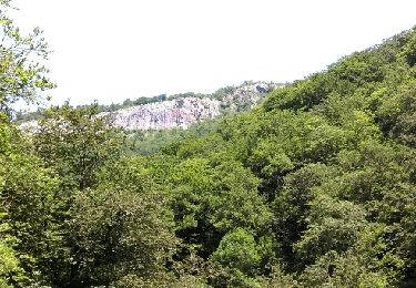
Trail On foot of 5.9 km to be discovered at New Aquitaine, Pyrénées-Atlantiques, Musculdy. This trail is proposed by marmotte65.

Description

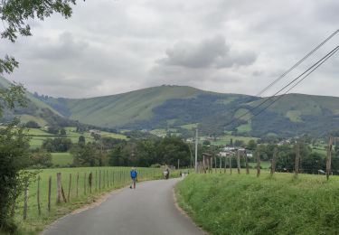
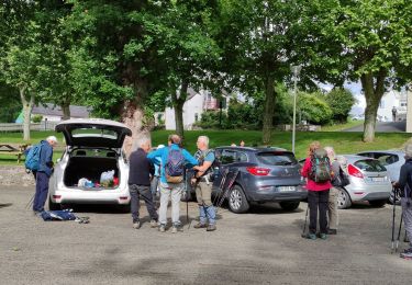
Une courte balade très agréable nous laissera plus de temps pour échanger, et attirera peux être plus de monde....
D'apres les chiffres de ma reco: départ col d'Osquich à 10h arrivée à la chapelle à 11h45.
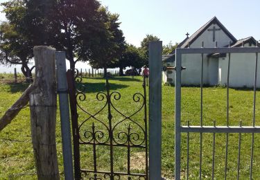
2h45 maxi a la chapelle
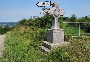
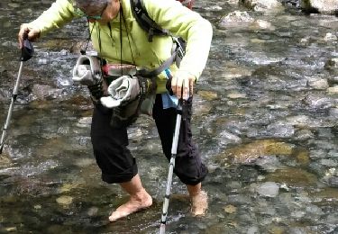
14h30 on redescend  et à 15h30 15h45 on est de retour au voiture

Elevation profile

Positioning

Country:
France
Region :
New Aquitaine
Department/Province :
Pyrénées-Atlantiques
Municipality :
Musculdy
Location:
Unknown
Start:(UTM)
662170 ; 4784895 (30T) N.

Trails nearby

Trail Walking Musculdy - MUSCULUDY  du col d'Osquich à la chapelle Saint-Antoine
Walking
GUIDE
marmotte65

Walking

Difficult
Musculdy, New Aquitaine, Pyrénées-Atlantiques, France
9.3 km | 13.4 km-effort
2h 51min
No
Trail Walking Ordiarp - ORDIARP la chapelle st Gregoire G3  4082977 - Photo
Walking
GUIDE
marmotte65

Walking

Difficult
Ordiarp, New Aquitaine, Pyrénées-Atlantiques, France
11.9 km | 17 km-effort
3h 28min
Yes
Trail Walking Pagolle - PAGOLLE et la chapelle St gregoire G3
Walking
GUIDE
marmotte65

Walking

Difficult
Pagolle, New Aquitaine, Pyrénées-Atlantiques, France
10.3 km | 15.3 km-effort
3h 28min
Yes
Trail Walking Ordiarp - ORDIARP   le Kaskaborro G4  4079186 - Photo
Walking
GUIDE
marmotte65

Walking

Difficult
Ordiarp, New Aquitaine, Pyrénées-Atlantiques, France
10.1 km | 13.4 km-effort
3h 6min
Yes
Trail Walking Pagolle - G4 pagolle  Gastelusare 2023 - Photo
Walking
LouisROGER

Walking

Difficult
Pagolle, New Aquitaine, Pyrénées-Atlantiques, France
9.6 km | 14.6 km-effort
3h 19min
Yes
Trail Walking Saint-Just-Ibarre - Sources de la Bidouze - Photo
Walking
so.duchateau

Walking

Easy
(1)
Saint-Just-Ibarre, New Aquitaine, Pyrénées-Atlantiques, France
8.8 km | 14 km-effort
3h 2min
Yes
Trail Walking Saint-Just-Ibarre - sources de la Bidouze fait et trace nettoyee - Photo
Walking
LouisROGER

Walking

Very easy
Saint-Just-Ibarre, New Aquitaine, Pyrénées-Atlantiques, France
9.5 km | 14.4 km-effort
2h 59min
Yes
Trail Walking Saint-Just-Ibarre - Pic d'Etchecortia en boucle par le hameau d'Arla et la source de la Bidouze - Photo
Walking
tracegps

Walking

Difficult
Saint-Just-Ibarre, New Aquitaine, Pyrénées-Atlantiques, France
15.3 km | 29 km-effort
6h 0min
Yes
Trail Walking Musculdy - chapelle st Antoine  - Photo
Walking
ChristopheLefauconnier

Walking

Medium
Musculdy, New Aquitaine, Pyrénées-Atlantiques, France
11.8 km | 21 km-effort
3h 58min
Yes


Close
My subscriptions