


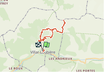

8.8 km | 13.6 km-effort


User GUIDE


FREE GPS app for hiking
 SityTrail
IGN / Geographical institutes
SityTrail World
The world is yours!
Trail Walking of 19.8 km to be discovered at Provence-Alpes-Côte d'Azur, Hautes-Alpes, Villar-Loubière. This trail is proposed by Marco05.
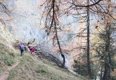
Cette randonnée à la limite de l'alpinisme est réservée à des montagnards confirmés.
Elle est hors sentier après le lac Lauzon et il faut mettre les mains dans des passages très exposés. Les personnes ayant le vertige doivent s'abstenir.
Il faut faire étape la veille au refuge des Souffles.
Le lendemain après le sommet la descente sur 2000m est très physique et interminable.
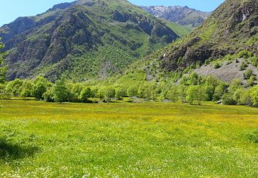
Au sommet la vue sur la face nord de l'Olan est époustouflante.


Walking

Walking

Walking

Walking

Walking

Walking

Walking
Walking
Walking