Trail Walking Westport-Belmullet Municipal District - Falaise de Keem - Photo
 Morelli
Morelli

User

© OpenStreetMap contributors
Length
Length
5.9 km
Max alt
Max alt
301 m
Uphill gradient
Uphill gradient
428 m
Km-Effort
Km-Effort  
11.6 km
Min alt
Min alt
10 m
Downhill gradient
Downhill gradient
430 m
Boucle
Boucle
Yes
Creation date :
2024-09-09 07:59:53.126
Updated on :
2024-09-09 11:51:36.041

(0 Reviews)

Walking
Walking
3h00
Difficulty : Easy

Scan this QR Code to open this trail in the SityTrail application

FREE GPS app for hiking

Logo SityTrail SityTrail

IGN / Geographical institutes

Download SityTrail from the App Store Download SityTrail from Google Play

Logo SityTrail SityTrail World

The world is yours!

Download SityTrail from the App Store Download SityTrail from Google Play Download SityTrail on Huawei AppGallery

About

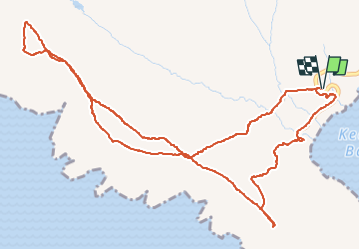
Trail Walking of 5.9 km to be discovered at Unknown, County Mayo, Westport-Belmullet Municipal District. This trail is proposed by Morelli.

Elevation profile

Positioning

Country:
Ireland
Region :
Unknown
Department/Province :
County Mayo
Municipality :
Westport-Belmullet Municipal District
Location:
Slievemore ED
Start:(UTM)
421721 ; 5980811 (29U) N.

Trails nearby

Trail Walking Westport-Belmullet Municipal District - Mon parcours - Photo
Walking
BureauChris

Walking

Medium
Westport-Belmullet Municipal District, Unknown, County Mayo, Ireland
7.2 km | 13.5 km-effort
2h 38min
Yes
Trail Car Westport-Belmullet Municipal District - Achill Island - Easkey  WAW part 9 - Photo
Car
Bernard Lejeune

Car

Very easy
Westport-Belmullet Municipal District, Unknown, County Mayo, Ireland
363 km | 404 km-effort
Unknown
No
Trail Walking Westport-Belmullet Municipal District - Achill Croaghaun - Photo
Walking
heb

Walking

Very easy
Westport-Belmullet Municipal District, Unknown, County Mayo, Ireland
12.2 km | 26 km-effort
5h 23min
Yes


Close
My subscriptions