Trail Walking Les Houches - J4 - Les Chavants - Charousse - Vaudagne  - Photo

J4 - Les Chavants - Charousse - Vaudagne

© OpenStreetMap contributors
Length
Length
7.3 km
Max alt
Max alt
1215 m
Uphill gradient
Uphill gradient
308 m
Km-Effort
Km-Effort  
11.4 km
Min alt
Min alt
943 m
Downhill gradient
Downhill gradient
313 m
Boucle
Boucle
Yes
Creation date :
2024-09-04 08:06:55.857
Updated on :
2024-10-01 12:28:30.13

(1 Reviews)

Walking
Walking
2h10
Difficulty : Medium

Scan this QR Code to open this trail in the SityTrail application

FREE GPS app for hiking

Logo SityTrail SityTrail

IGN / Geographical institutes

Download SityTrail from the App Store Download SityTrail from Google Play

Logo SityTrail SityTrail World

The world is yours!

Download SityTrail from the App Store Download SityTrail from Google Play Download SityTrail on Huawei AppGallery

About

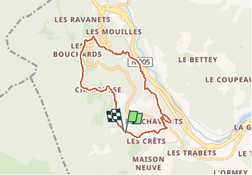
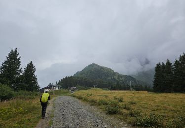
Trail Walking of 7.3 km to be discovered at Auvergne-Rhône-Alpes, Upper Savoy, Les Houches. This trail is proposed by Je vous emmène sur mes chemins .

Description

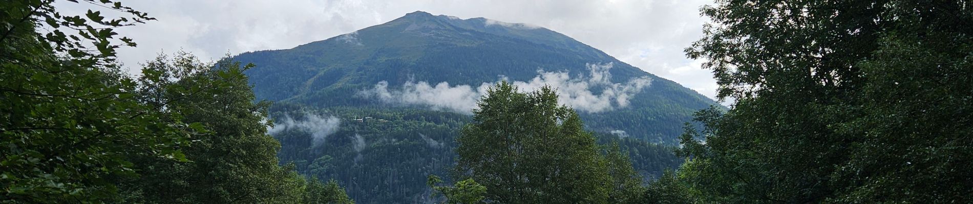
L'alpage de Charousse est un endroit magnifique qui bénéficie d’une vue exceptionnelle sur le massif du Mont-Blanc.

Retour par le lac des Chavants et sa buvette.

Elevation profile

Photos

Positioning

Country:
France
Region :
Auvergne-Rhône-Alpes
Department/Province :
Upper Savoy
Municipality :
Les Houches
Location:
Unknown
Start:(UTM)
327155 ; 5084661 (32T) N.

Comments

Please log in to post a review or rate the element


J23 - R23 - Super rando refaite avec les filles. 🌧☔️


Trails nearby

Trail Walking Les Houches - 2024-05-29_17h11m02_christ-roi - Photo
Walking
GUIDE
mumu.larandonneuse

Walking

Easy
(1)
Les Houches, Auvergne-Rhône-Alpes, Upper Savoy, France
1.8 km | 4.2 km-effort
56min
No
Trail Walking Chamonix-Mont-Blanc - Glacier des Bossons Les Houches Chamonix - Photo
Walking
tracegps

Walking

Difficult
(2)
Chamonix-Mont-Blanc, Auvergne-Rhône-Alpes, Upper Savoy, France
13.1 km | 28 km-effort
5h 0min
Yes
Trail Running Passy - grimpe de chedde ayeres - Photo
Running
winbat11

Running

Very easy
(1)
Passy, Auvergne-Rhône-Alpes, Upper Savoy, France
15 km | 28 km-effort
2h 46min
No
Trail Walking Les Houches - Chalets de Charlousse - Photo
Walking
YannPro81

Walking

Easy
(2)
Les Houches, Auvergne-Rhône-Alpes, Upper Savoy, France
9.2 km | 14.1 km-effort
2h 28min
Yes
Trail Walking Saint-Gervais-les-Bains - Descente au Glacier de Bionnassay depuis le Nid d''Aigle - Photo
Walking
GUIDE
pscheven

Walking

Very easy
(1)
Saint-Gervais-les-Bains, Auvergne-Rhône-Alpes, Upper Savoy, France
839 m | 1.9 km-effort
28min
No
Trail Walking Les Houches - J21 - R20 - La Fontaine - La Tour St Michel - Photo
Walking

Walking

Medium
Les Houches, Auvergne-Rhône-Alpes, Upper Savoy, France
5 km | 6.3 km-effort
1h 22min
Yes
Trail Walking Saint-Gervais-les-Bains - J17 - R16 - Le Plan de la Croix - Bettex - Photo
Walking

Walking

Easy
Saint-Gervais-les-Bains, Auvergne-Rhône-Alpes, Upper Savoy, France
5.8 km | 7.9 km-effort
1h 35min
No
Trail Walking Saint-Gervais-les-Bains - J15 - R14 - Bellevue - Col de Voza - Bionnassay - Le Planet - L'Are - Photo
Walking

Walking

Difficult
Saint-Gervais-les-Bains, Auvergne-Rhône-Alpes, Upper Savoy, France
8.2 km | 14.5 km-effort
2h 32min
Yes
Trail Walking Saint-Gervais-les-Bains - J8 - Grand Balcon Nord : Prarion - Bellevue - Photo
Walking

Walking

Medium
Saint-Gervais-les-Bains, Auvergne-Rhône-Alpes, Upper Savoy, France
3.5 km | 5.8 km-effort
1h 23min
No


Close
My subscriptions