Trail Walking Roche-Saint-Secret-Béconne - Rachas par Roche Saint-Secret - Photo
 parastat
parastat

User

© OpenStreetMap contributors
Length
Length
12.8 km
Max alt
Max alt
894 m
Uphill gradient
Uphill gradient
615 m
Km-Effort
Km-Effort  
21 km
Min alt
Min alt
381 m
Downhill gradient
Downhill gradient
612 m
Boucle
Boucle
Yes
Creation date :
2024-08-28 14:22:21.758
Updated on :
2024-08-28 15:13:36.692

(0 Reviews)

Walking
Walking
4h46
Difficulty : Very difficult

Scan this QR Code to open this trail in the SityTrail application

FREE GPS app for hiking

Logo SityTrail SityTrail

IGN / Geographical institutes

Download SityTrail from the App Store Download SityTrail from Google Play

Logo SityTrail SityTrail World

The world is yours!

Download SityTrail from the App Store Download SityTrail from Google Play Download SityTrail on Huawei AppGallery

About

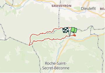
Trail Walking of 12.8 km to be discovered at Auvergne-Rhône-Alpes, Drôme, Roche-Saint-Secret-Béconne. This trail is proposed by parastat.

Description

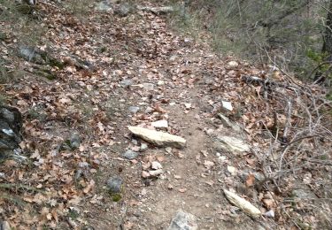
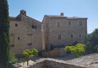
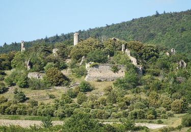
Jusqu'à la tour d'Alençon (photo) suite de raidillons montants et descendants.
Depuis l'adret large piste parfois caillouteuse, en particulier la montée au Rachas ( et au soleil, rando le 27/08/2024). J'ai joint trois photos depuis le mont.
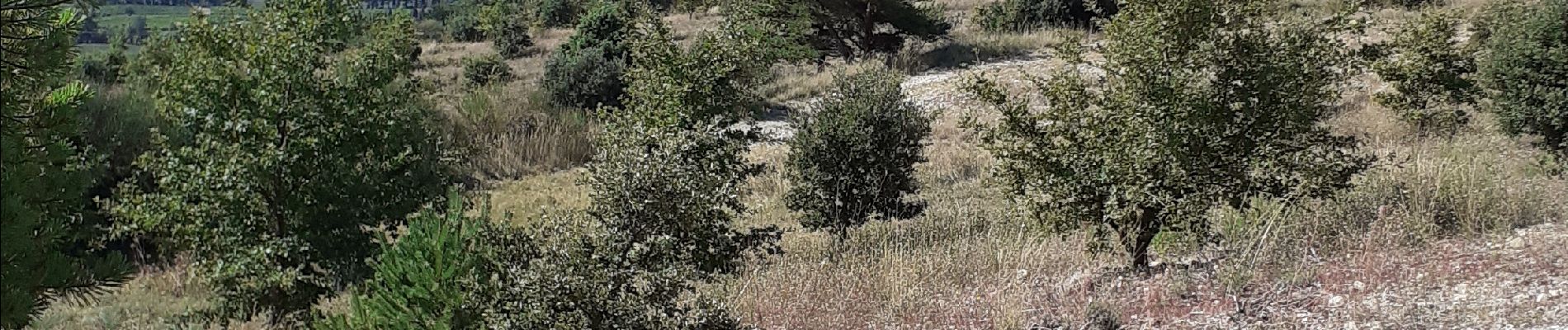
Après le mont Rachas suite de sentes en sous-bois et pistes.
Pour la descente, après le col de dieu-grace, j'ai choisi la piste en zigzag plutôt que le GR9: plus long mais plus reposant pour mes vieux genoux.
Arrêts compris ( 3/4 heures environ: casse-croute et photos) il m'a fallu 6h.
On peut garer son véhicule au domaine des Caminottes en demandant l'autorisation.

Elevation profile

Photos

Positioning

Country:
France
Region :
Auvergne-Rhône-Alpes
Department/Province :
Drôme
Municipality :
Roche-Saint-Secret-Béconne
Location:
Unknown
Start:(UTM)
662520 ; 4929451 (31T) N.

Trails nearby

Trail Walking Montjoux - Le Devès - Montjoux - Photo
Walking
tracegps

Walking

Easy
(1)
Montjoux, Auvergne-Rhône-Alpes, Drôme, France
5.3 km | 7 km-effort
1h 19min
Yes
Trail Walking Dieulefit - 26 dieulefit chap st Maurice vitrouilleres - Photo
Walking
GUIDE
randodyssée

Walking

Easy
Dieulefit, Auvergne-Rhône-Alpes, Drôme, France
13.8 km | 23 km-effort
6h 17min
Yes
Trail Walking Roche-Saint-Secret-Béconne - 26montjoux - Photo
Walking
GUIDE
randodyssée

Walking

Medium
Roche-Saint-Secret-Béconne, Auvergne-Rhône-Alpes, Drôme, France
13.6 km | 22 km-effort
6h 6min
No
Trail Walking Le Poët-Laval - Le poët laval - Photo
Walking
orlandiniluc

Walking

Medium
(1)
Le Poët-Laval, Auvergne-Rhône-Alpes, Drôme, France
9.8 km | 17.8 km-effort
4h 21min
Yes
Trail Walking Le Poët-Laval - le Poët-Laval et le trou du furet - Photo
Walking
GUIDE
amiral13

Walking

Very easy
Le Poët-Laval, Auvergne-Rhône-Alpes, Drôme, France
7.5 km | 14.3 km-effort
4h 3min
Yes
Trail Walking Dieulefit - Chapelle saint Maurice par le sentier du cochon - Photo
Walking
parastat

Walking

Difficult
Dieulefit, Auvergne-Rhône-Alpes, Drôme, France
10.9 km | 17.9 km-effort
4h 40min
Yes
Trail Walking Roche-Saint-Secret-Béconne - Béconne Roche - Photo
Walking
parastat

Walking

Difficult
Roche-Saint-Secret-Béconne, Auvergne-Rhône-Alpes, Drôme, France
8.6 km | 12.1 km-effort
2h 59min
Yes
Trail Walking Le Poët-Laval - Poët-Laval Les vitrouilléres (La Dame Blanche) 9km. - Photo
Walking
chancha

Walking

Medium
Le Poët-Laval, Auvergne-Rhône-Alpes, Drôme, France
8.7 km | 11.5 km-effort
2h 37min
Yes
Trail Walking Le Poët-Laval - Le poet Laval le trou du furet - Photo
Walking
Vero7684

Walking

Medium
Le Poët-Laval, Auvergne-Rhône-Alpes, Drôme, France
10.8 km | 19.4 km-effort
4h 12min
Yes


Close
My subscriptions