9.4 km | 12 km-effort
Burren, Yellow, Pink and Brown Walk
Jopnert
User
Length
5.7 km
Max alt
186 m
Uphill gradient
94 m
Km-Effort
6.9 km
Min alt
90 m
Downhill gradient
94 m
Boucle
Yes
Creation date :
2024-08-21 10:39:48.25
Updated on :
2024-08-22 10:31:04.959
1h39
Difficulty : Medium
FREE GPS app for hiking
About
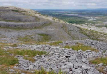
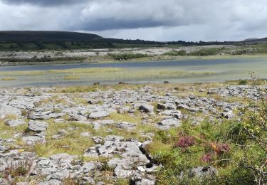
Trail Walking of 5.7 km to be discovered at Unknown, County Clare, West Clare Municipal District. This trail is proposed by Jopnert.
Positioning
Country:
Ireland
Region :
Unknown
Department/Province :
County Clare
Municipality :
West Clare Municipal District
Location:
Carran Electoral Division
Start:(Dec)
Start:(UTM)
500081 ; 5880754 (29U) N.
Comments
Trails nearby
Burren - the blue and white trains
Walking
Medium
West Clare Municipal District,
Unknown,
County Clare,
Ireland
2h 43min
Yes
190705BurrenNationalPark
Walking
Very easy
West Clare Municipal District,
Unknown,
County Clare,
Ireland
13.3 km | 16 km-effort
4h 48min
No
Rando Black head Loop 18km
Walking
Very difficult
West Clare Municipal District,
Unknown,
County Clare,
Ireland
18.1 km | 24 km-effort
4h 45min
Yes
J-27/06- CARRAN LOOP WALK - 9,5 KM
Walking
Medium
West Clare Municipal District,
Unknown,
County Clare,
Ireland
9.6 km | 11.7 km-effort
2h 39min
Yes
LOUGH AVALLA
Walking
Medium
West Clare Municipal District,
Unknown,
County Clare,
Ireland
8.2 km | 10.2 km-effort
2h 18min
Yes
BLACK HEAD INTEGRAL
Walking
Very difficult
West Clare Municipal District,
Unknown,
County Clare,
Ireland
19.4 km | 25 km-effort
5h 43min
Yes
BLACK HEAD INTEGRAL
Walking
Very difficult
West Clare Municipal District,
Unknown,
County Clare,
Ireland
24 km | 32 km-effort
7h 23min
Yes
Mon parcours
Walking
Medium
(1)
West Clare Municipal District,
Unknown,
County Clare,
Ireland
7.5 km | 9.8 km-effort
2h 5min
Yes
bac transbordeur
Car
Very easy
West Clare Municipal District,
Unknown,
County Clare,
Ireland
190 km | 222 km-effort
6h 34min
No