


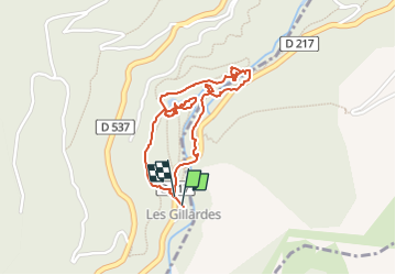

11 km | 19.6 km-effort


User


FREE GPS app for hiking
 SityTrail
IGN / Geographical institutes
SityTrail World
The world is yours!
Trail Walking of 1.9 km to be discovered at Auvergne-Rhône-Alpes, Isère, Pellafol. This trail is proposed by Thierry.T.
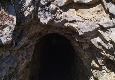
Site magnifique mais très fréquenté. Parking en auto tres compliqué. A découvrir

Walking
Walking

Touring skiing

Touring skiing

Touring skiing

Walking

Walking

Walking

Walking